Gatesville elevation
Gatesville (Texas, Coryell County), United States elevation is 252 meters and Gatesville elevation in feet is 827 ft above sea level [src 1]. Gatesville is a seat of a second-order administrative division (feature code) with elevation that is 27 meters (89 ft) smaller than average city elevation in United States.
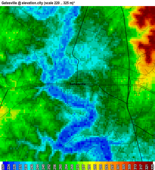
Below is the Elevation map of Gatesville, which displays elevation range with different colors. Scale of the first map is from 220 to 325 m (722 to 1066 ft) with average elevation of 254.4 meters (=835 ft) [note 1]
These maps also provides idea of topography and contour of this city, they are displayed at different zoom levels. More info about maps, scale and edge coordinates you can find below images.
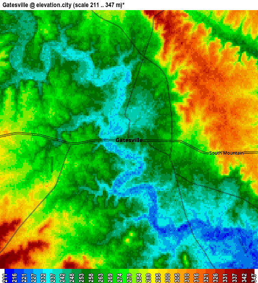
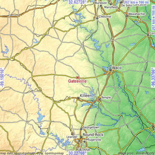
| \ | Map #1 | Map #2 | Topo.Map |
| Scale [m] | 220..325 m | 211..347 m | × |
| Scale [ft] | 722..1066 ft | 692..1138 ft | × |
| Average | 254.4 m = 835 ft | 268.6 m = 881 ft | × |
| Width | 8.34 km = 5.2 mi | 16.68 km = 10.4 mi | 266.8 km = 165.8 mi |
| Height | 8.34 km = 5.2 mi | 16.68 km = 10.4 mi | 266.8 km = 165.8 mi |
| ↑Max Latitude | 31.472648° | 31.510121° | 32.62728° |
| Latitude at center | 31.43516° | 31.43516° | 31.43516° |
| ↓Min Latitude | 31.397657° | 31.360139° | 30.22768° |
| ← Min Longitude | -97.787855° | -97.831801° | -99.15016° |
| Longitude center | -97.74391° | -97.74391° | -97.74391° |
| →Max Longitude | -97.699965° | -97.656019° | -96.33766° |
Nearby cities:
Cities around Gatesville sort by population:
• Killeen elevation 254 m
35.4 km,  177°
177°
• Copperas Cove 333 m
37.8 km,  203°
203°
• Fort Hood 276 m
33.5 km,  185°
185°
• Harker Heights 236 m
39.9 km,  168°
168°
• McGregor 218 m
31.8 km,  88°
88°
• Nolanville 221 m
41.7 km,  161°
161°
• Morgans Point Resort 215 m
41.6 km,  140°
140°
• Clifton 209 m
41.7 km,  22°
22°
• Moody 243 m
39 km,  111°
111°
• Valley Mills 185 m
35.8 km,  45°
45°
• Ames 287 m
10.1 km,  340°
340°
• Kempner 269 m
46.4 km,  211°
211°
Multilingual:
 En español:
Gatesville elevación 252 m.
 En France:
Gatesville élévation 252 m.
 Auf Deutsch:
Gatesville höhe über dem Meeresspiegel ist 252 m.

Sources and notes:
- [note 1] Map square and city borders are not equal. Map elevation data is calculated only from area inside that square.
- [src 1] Elevation data from geonames database provided with same terms of usage.
- [src 2] The elevation map of Gatesville is generated using elevation data from NASA's 3 arcsec (90m) resolution SRTM data.
- [src 3] Base (background) map © OpenStreetMap contributors tiles are generated by Geofabrik and OpenTopoMap.
Copyright & License:
This Gatesville Elevation Map is licensed under CC BY-SA. You may reuse any part from this page, if you give a proper credit by linking to this URL:
 More info on terms of use page.