Nolanville elevation
Nolanville (Texas, Bell County), United States elevation is 221 meters and Nolanville elevation in feet is 725 ft above sea level [src 1]. Nolanville is a populated place (feature code) with elevation that is 58 meters (190 ft) smaller than average city elevation in United States.
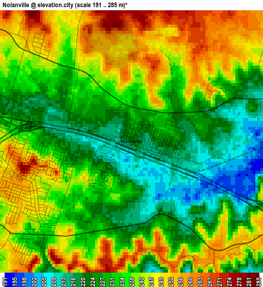
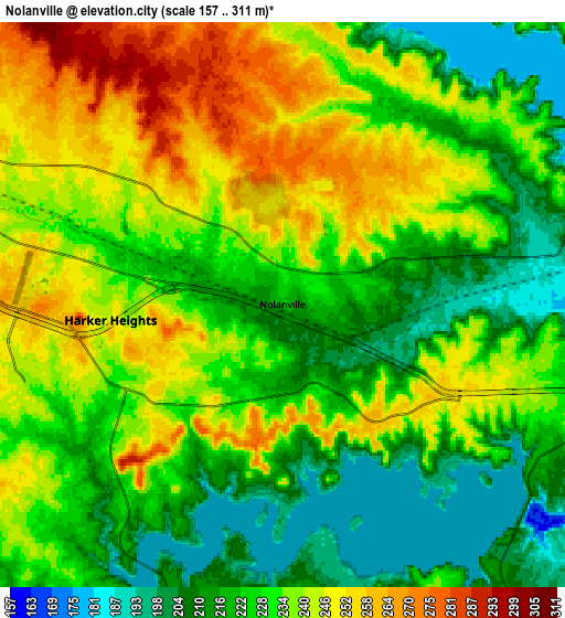
Below is the Elevation map of Nolanville, which displays elevation range with different colors. Scale of the first map is from 191 to 285 m (627 to 935 ft) with average elevation of 235.6 meters (=773 ft) [note 1]
These maps also provides idea of topography and contour of this city, they are displayed at different zoom levels. More info about maps, scale and edge coordinates you can find below images.
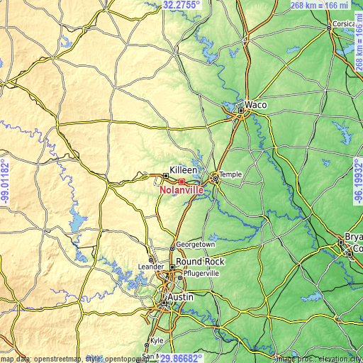
| \ | Map #1 | Map #2 | Topo.Map |
| Scale [m] | 191..285 m | 157..311 m | × |
| Scale [ft] | 627..935 ft | 515..1020 ft | × |
| Average | 235.6 m = 773 ft | 231.1 m = 758 ft | × |
| Width | 8.37 km = 5.2 mi | 16.74 km = 10.4 mi | 267.8 km = 166.4 mi |
| Height | 8.37 km = 5.2 mi | 16.74 km = 10.4 mi | 267.8 km = 166.4 mi |
| ↑Max Latitude | 31.11642° | 31.154035° | 32.2755° |
| Latitude at center | 31.07879° | 31.07879° | 31.07879° |
| ↓Min Latitude | 31.041145° | 31.003486° | 29.86682° |
| ← Min Longitude | -97.649515° | -97.693461° | -99.01182° |
| Longitude center | -97.60557° | -97.60557° | -97.60557° |
| →Max Longitude | -97.561625° | -97.517679° | -96.19932° |
Nearby cities:
Cities around Nolanville sort by population:
• Killeen elevation 254 m
12.4 km,  290°
290°
• Temple 223 m
25.1 km,  85°
85°
• Copperas Cove 333 m
28.8 km,  280°
280°
• Fort Hood 276 m
17.3 km, 291°
• Harker Heights 236 m
5.2 km, 275°
• Belton 165 m
13.7 km,  100°
100°
• Sparks 147 m
28.8 km,  125°
125°
• Morgans Point Resort 215 m
15.6 km,  60°
60°
• Salado 193 m
16 km,  156°
156°
• Little River-Academy 149 m
25.7 km,  113°
113°
• Jarrell 267 m
28.2 km,  179°
179°
• Holland 163 m
29.6 km,  138°
138°
Multilingual:
 En español:
Nolanville elevación 221 m.
 En France:
Nolanville élévation 221 m.
 Auf Deutsch:
Nolanville höhe über dem Meeresspiegel ist 221 m.

Sources and notes:
- [note 1] Map square and city borders are not equal. Map elevation data is calculated only from area inside that square.
- [src 1] Elevation data from geonames database provided with same terms of usage.
- [src 2] The elevation map of Nolanville is generated using elevation data from NASA's 3 arcsec (90m) resolution SRTM data.
- [src 3] Base (background) map © OpenStreetMap contributors tiles are generated by Geofabrik and OpenTopoMap.
Copyright & License:
This Nolanville Elevation Map is licensed under CC BY-SA. You may reuse any part from this page, if you give a proper credit by linking to this URL:
 More info on terms of use page.