Temple elevation
Temple (Texas, Bell County), United States elevation is 223 meters and Temple elevation in feet is 732 ft above sea level [src 1]. Temple is a populated place (feature code) with elevation that is 56 meters (184 ft) smaller than average city elevation in United States.
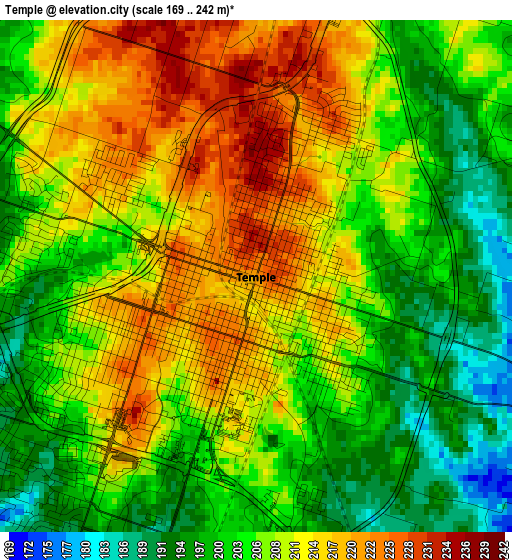
Below is the Elevation map of Temple, which displays elevation range with different colors. Scale of the first map is from 169 to 242 m (554 to 794 ft) with average elevation of 207.3 meters (=680 ft) [note 1]
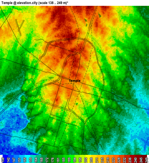
These maps also provides idea of topography and contour of this city, they are displayed at different zoom levels. More info about maps, scale and edge coordinates you can find below images.
| \ | Map #1 | Map #2 | Topo.Map |
| Scale [m] | 169..242 m | 138..249 m | × |
| Scale [ft] | 554..794 ft | 453..817 ft | × |
| Average | 207.3 m = 680 ft | 190.6 m = 625 ft | × |
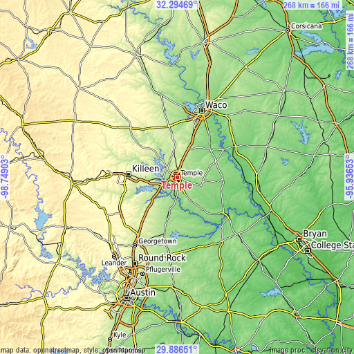
| Width | 8.37 km = 5.2 mi | 16.74 km = 10.4 mi | 267.8 km = 166.4 mi |
| Height | 8.37 km = 5.2 mi | 16.74 km = 10.4 mi | 267.8 km = 166.4 mi |
| ↑Max Latitude | 31.135852° | 31.173459° | 32.29469° |
| Latitude at center | 31.09823° | 31.09823° | 31.09823° |
| ↓Min Latitude | 31.060593° | 31.022941° | 29.88651° |
| ← Min Longitude | -97.386725° | -97.430671° | -98.74903° |
| Longitude center | -97.34278° | -97.34278° | -97.34278° |
| →Max Longitude | -97.298835° | -97.254889° | -95.93653° |
Nearby cities:
Cities around Temple sort by population:
• Harker Heights elevation 236 m
30.2 km,  266°
266°
• Belton 165 m
12.5 km,  247°
247°
• Nolanville 221 m
25.1 km, 265°
• Sparks 147 m
18.9 km,  184°
184°
• Morgans Point Resort 215 m
12.8 km,  295°
295°
• Salado 193 m
25.1 km,  228°
228°
• Little River-Academy 149 m
12.5 km,  186°
186°
• Troy 209 m
12.7 km,  17°
17°
• Bruceville-Eddy 213 m
24.6 km, 20°
• Moody 243 m
23.4 km,  355°
355°
• Rogers 169 m
21.6 km,  149°
149°
• Holland 163 m
25.1 km, 192°
Multilingual:
 En español:
Temple elevación 223 m.
 En France:
Temple élévation 223 m.


Sources and notes:
- [note 1] Map square and city borders are not equal. Map elevation data is calculated only from area inside that square.
- [src 1] Elevation data from geonames database provided with same terms of usage.
- [src 2] The elevation map of Temple is generated using elevation data from NASA's 3 arcsec (90m) resolution SRTM data.
- [src 3] Base (background) map © OpenStreetMap contributors tiles are generated by Geofabrik and OpenTopoMap.
Copyright & License:
This Temple Elevation Map is licensed under CC BY-SA. You may reuse any part from this page, if you give a proper credit by linking to this URL:
 More info on terms of use page.