Lawrenceburg elevation
Lawrenceburg (Tennessee, Lawrence County), United States elevation is 274 meters and Lawrenceburg elevation in feet is 899 ft above sea level [src 1]. Lawrenceburg is a seat of a second-order administrative division (feature code) with elevation that is 5 meters (16 ft) smaller than average city elevation in United States.
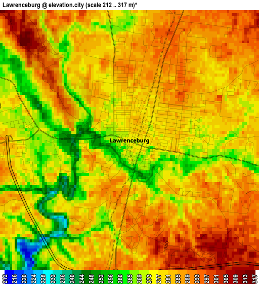
Below is the Elevation map of Lawrenceburg, which displays elevation range with different colors. Scale of the first map is from 212 to 317 m (696 to 1040 ft) with average elevation of 279.3 meters (=916 ft) [note 1]
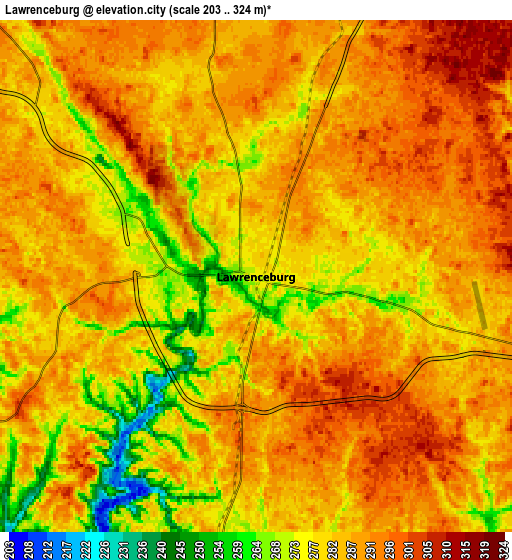
These maps also provides idea of topography and contour of this city, they are displayed at different zoom levels. More info about maps, scale and edge coordinates you can find below images.
| \ | Map #1 | Map #2 | Topo.Map |
| Scale [m] | 212..317 m | 203..324 m | × |
| Scale [ft] | 696..1040 ft | 666..1063 ft | × |
| Average | 279.3 m = 916 ft | 284.3 m = 933 ft | × |
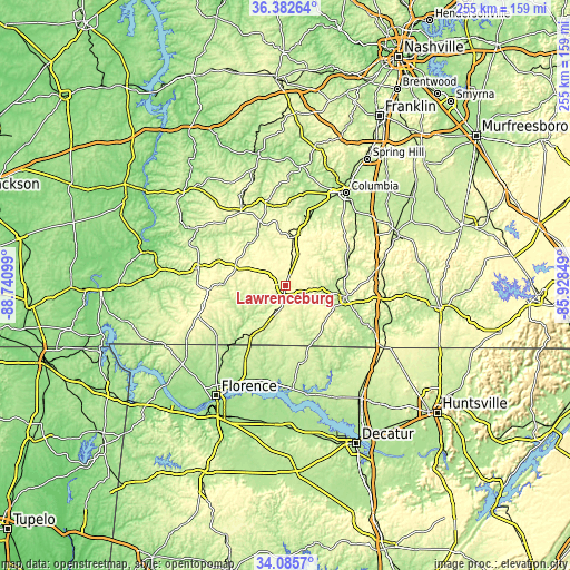
| Width | 7.98 km = 5 mi | 15.96 km = 9.9 mi | 255.4 km = 158.7 mi |
| Height | 7.98 km = 5 mi | 15.96 km = 9.9 mi | 255.4 km = 158.7 mi |
| ↑Max Latitude | 35.278183° | 35.31405° | 36.38264° |
| Latitude at center | 35.2423° | 35.2423° | 35.2423° |
| ↓Min Latitude | 35.206401° | 35.170486° | 34.0857° |
| ← Min Longitude | -87.378685° | -87.422631° | -88.74099° |
| Longitude center | -87.33474° | -87.33474° | -87.33474° |
| →Max Longitude | -87.290795° | -87.246849° | -85.92849° |
Nearby cities:
Cities around Lawrenceburg sort by population:
• Columbia elevation 199 m
49.5 km,  33°
33°
• East Florence 171 m
56 km,  210°
210°
• Lewisburg 226 m
54.6 km,  65°
65°
• Pulaski 222 m
28 km,  99°
99°
• Mount Pleasant 205 m
34.5 km,  19°
19°
• Hohenwald 299 m
39.3 km,  329°
329°
• Underwood-Petersville 196 m
52.3 km,  219°
219°
• Waynesboro 231 m
39.7 km,  282°
282°
• Loretto 250 m
20.6 km, 207°
• Rogersville 194 m
46.4 km,  175°
175°
• Cornersville 271 m
46.8 km, 73°
• Ardmore 271 m
52.4 km,  122°
122°
Multilingual:
 En español:
Lawrenceburg elevación 274 m.
 En France:
Lawrenceburg élévation 274 m.
 Auf Deutsch:
Lawrenceburg höhe über dem Meeresspiegel ist 274 m.

Sources and notes:
- [note 1] Map square and city borders are not equal. Map elevation data is calculated only from area inside that square.
- [src 1] Elevation data from geonames database provided with same terms of usage.
- [src 2] The elevation map of Lawrenceburg is generated using elevation data from NASA's 3 arcsec (90m) resolution SRTM data.
- [src 3] Base (background) map © OpenStreetMap contributors tiles are generated by Geofabrik and OpenTopoMap.
Copyright & License:
This Lawrenceburg Elevation Map is licensed under CC BY-SA. You may reuse any part from this page, if you give a proper credit by linking to this URL:
 More info on terms of use page.