Lewisburg elevation
Lewisburg (Tennessee, Marshall County), United States elevation is 226 meters and Lewisburg elevation in feet is 741 ft above sea level [src 1]. Lewisburg is a seat of a second-order administrative division (feature code) with elevation that is 53 meters (174 ft) smaller than average city elevation in United States.
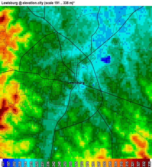
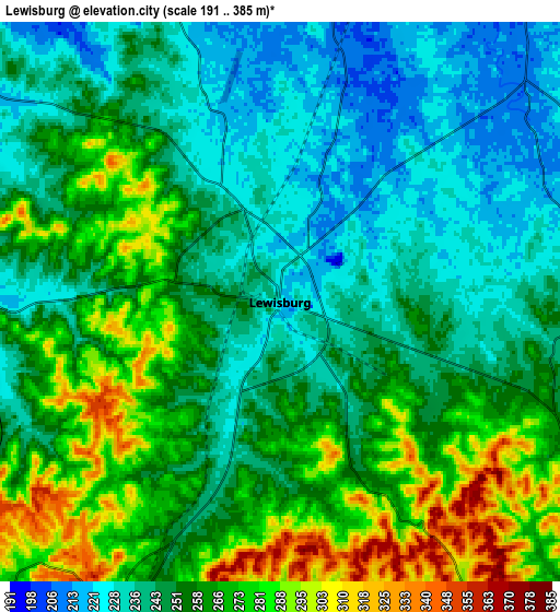
Below is the Elevation map of Lewisburg, which displays elevation range with different colors. Scale of the first map is from 191 to 338 m (627 to 1109 ft) with average elevation of 243.1 meters (=798 ft) [note 1]
These maps also provides idea of topography and contour of this city, they are displayed at different zoom levels. More info about maps, scale and edge coordinates you can find below images.
| \ | Map #1 | Map #2 | Topo.Map |
| Scale [m] | 191..338 m | 191..385 m | × |
| Scale [ft] | 627..1109 ft | 627..1263 ft | × |
| Average | 243.1 m = 798 ft | 254.6 m = 835 ft | × |
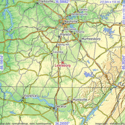
| Width | 7.96 km = 4.9 mi | 15.92 km = 9.9 mi | 254.7 km = 158.3 mi |
| Height | 7.96 km = 4.9 mi | 15.92 km = 9.9 mi | 254.7 km = 158.3 mi |
| ↑Max Latitude | 35.485031° | 35.520806° | 36.58662° |
| Latitude at center | 35.44924° | 35.44924° | 35.44924° |
| ↓Min Latitude | 35.413433° | 35.37761° | 34.29555° |
| ← Min Longitude | -86.832835° | -86.876781° | -88.19514° |
| Longitude center | -86.78889° | -86.78889° | -86.78889° |
| →Max Longitude | -86.744945° | -86.700999° | -85.38264° |
Nearby cities:
Cities around Lewisburg sort by population:
• Columbia elevation 199 m
28.9 km,  309°
309°
• Spring Hill 231 m
35.9 km,  339°
339°
• Shelbyville 237 m
30 km,  82°
82°
• Pulaski 222 m
35.4 km,  218°
218°
• Fayetteville 216 m
38.5 km,  149°
149°
• Lynchburg 245 m
41.9 km,  116°
116°
• Mount Pleasant 205 m
39 km,  284°
284°
• Thompson's Station 249 m
40.8 km, 344°
• Park City 305 m
45.4 km, 154°
• Chapel Hill 211 m
21.5 km,  23°
23°
• Unionville 221 m
26.1 km,  42°
42°
• Cornersville 271 m
10.8 km,  205°
205°
Multilingual:
 En español:
Lewisburg elevación 226 m.
 En France:
Lewisburg élévation 226 m.
 Auf Deutsch:
Lewisburg höhe über dem Meeresspiegel ist 226 m.

Sources and notes:
- [note 1] Map square and city borders are not equal. Map elevation data is calculated only from area inside that square.
- [src 1] Elevation data from geonames database provided with same terms of usage.
- [src 2] The elevation map of Lewisburg is generated using elevation data from NASA's 3 arcsec (90m) resolution SRTM data.
- [src 3] Base (background) map © OpenStreetMap contributors tiles are generated by Geofabrik and OpenTopoMap.
Copyright & License:
This Lewisburg Elevation Map is licensed under CC BY-SA. You may reuse any part from this page, if you give a proper credit by linking to this URL:
 More info on terms of use page.