Lathrop elevation
Lathrop (Missouri, Clinton County), United States elevation is 327 meters and Lathrop elevation in feet is 1073 ft above sea level [src 1]. Lathrop is a populated place (feature code) with elevation that is 48 meters (157 ft) bigger than average city elevation in United States.
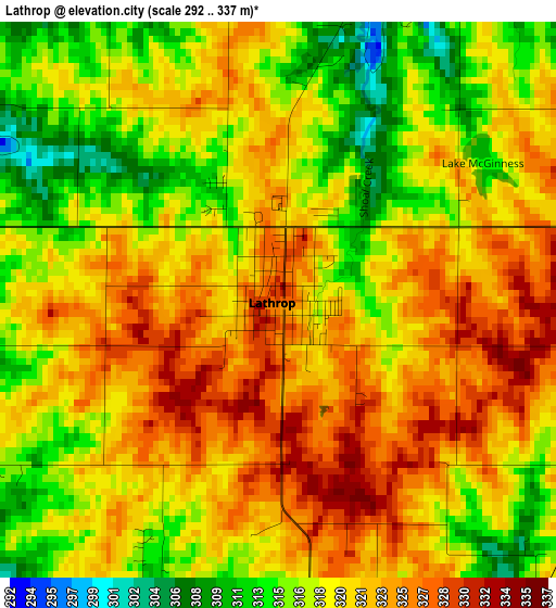
Below is the Elevation map of Lathrop, which displays elevation range with different colors. Scale of the first map is from 292 to 337 m (958 to 1106 ft) with average elevation of 319.9 meters (=1050 ft) [note 1]
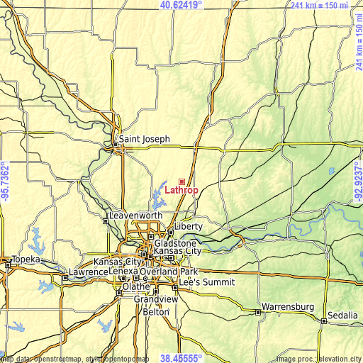
These maps also provides idea of topography and contour of this city, they are displayed at different zoom levels. More info about maps, scale and edge coordinates you can find below images.
| \ | Map #1 | Topo.Map |
| Scale [m] | 292..337 m | × |
| Scale [ft] | 958..1106 ft | × |
| Average | 319.9 m = 1050 ft | × |
| Width | 7.54 km = 4.7 mi | 241.1 km = 149.8 mi |
| Height | 7.54 km = 4.7 mi | 241.1 km = 149.8 mi |
| ↑Max Latitude | 39.582217° | 40.62419° |
| Latitude at center | 39.54834° | 39.54834° |
| ↓Min Latitude | 39.514446° | 38.45555° |
| ← Min Longitude | -94.373895° | -95.7362° |
| Longitude center | -94.32995° | -94.32995° |
| →Max Longitude | -94.286005° | -92.9237° |
Nearby cities:
Cities around Lathrop sort by population:
• Liberty elevation 274 m
34.5 km,  192°
192°
• Excelsior Springs 242 m
24.9 km,  159°
159°
• Cameron 317 m
22.7 km,  19°
19°
• Kearney 264 m
20.3 km, 187°
• Smithville 251 m
28 km,  230°
230°
• Pleasant Valley 244 m
39.2 km,  199°
199°
• Lawson 328 m
16.3 km,  138°
138°
• Plattsburg 290 m
10.3 km,  280°
280°
• Hamilton 306 m
35.7 km,  52°
52°
• Gower 292 m
24.1 km,  286°
286°
• Maysville 297 m
38 km,  355°
355°
• Kingston 276 m
27.1 km,  66°
66°
Multilingual:
 En español:
Lathrop elevación 327 m.
 En France:
Lathrop élévation 327 m.


Sources and notes:
- [note 1] Map square and city borders are not equal. Map elevation data is calculated only from area inside that square.
- [src 1] Elevation data from geonames database provided with same terms of usage.
- [src 2] The elevation map of Lathrop is generated using elevation data from NASA's 3 arcsec (90m) resolution SRTM data.
- [src 3] Base (background) map © OpenStreetMap contributors tiles are generated by Geofabrik and OpenTopoMap.
Copyright & License:
This Lathrop Elevation Map is licensed under CC BY-SA. You may reuse any part from this page, if you give a proper credit by linking to this URL:
 More info on terms of use page.