Chester elevation
Chester (Illinois, Randolph County), United States elevation is 201 meters and Chester elevation in feet is 659 ft above sea level [src 1]. Chester is a seat of a second-order administrative division (feature code) with elevation that is 78 meters (256 ft) smaller than average city elevation in United States.
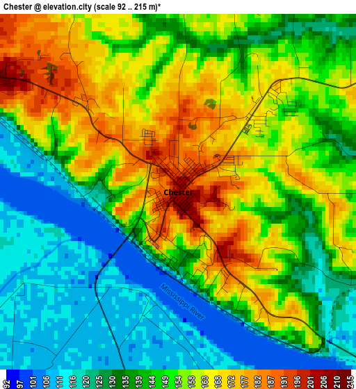
Below is the Elevation map of Chester, which displays elevation range with different colors. Scale of the first map is from 92 to 215 m (302 to 705 ft) with average elevation of 146.3 meters (=480 ft) [note 1]
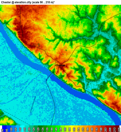
These maps also provides idea of topography and contour of this city, they are displayed at different zoom levels. More info about maps, scale and edge coordinates you can find below images.
| \ | Map #1 | Map #2 | Topo.Map |
| Scale [m] | 92..215 m | 90..218 m | × |
| Scale [ft] | 302..705 ft | 295..715 ft | × |
| Average | 146.3 m = 480 ft | 138.3 m = 454 ft | × |
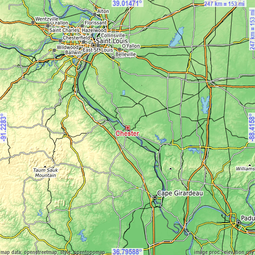
| Width | 7.71 km = 4.8 mi | 15.42 km = 9.6 mi | 246.7 km = 153.3 mi |
| Height | 7.71 km = 4.8 mi | 15.42 km = 9.6 mi | 246.7 km = 153.3 mi |
| ↑Max Latitude | 37.948322° | 37.982968° | 39.01471° |
| Latitude at center | 37.91366° | 37.91366° | 37.91366° |
| ↓Min Latitude | 37.878982° | 37.844287° | 36.79588° |
| ← Min Longitude | -89.865995° | -89.909941° | -91.2283° |
| Longitude center | -89.82205° | -89.82205° | -89.82205° |
| →Max Longitude | -89.778105° | -89.734159° | -88.4158° |
Nearby cities:
Cities around Chester sort by population:
• Farmington elevation 284 m
54.7 km,  254°
254°
• Perryville 177 m
21.3 km,  189°
189°
• Murphysboro 126 m
45.9 km,  111°
111°
• Du Quoin 139 m
52.5 km,  78°
78°
• Pinckneyville 133 m
42.8 km,  64°
64°
• Sparta 160 m
25.6 km,  24°
24°
• Sainte Genevieve 117 m
20.7 km,  291°
291°
• Red Bud 143 m
36.4 km,  335°
335°
• Steeleville 126 m
17.7 km,  54°
54°
• New Athens 123 m
46.1 km,  354°
354°
• Marissa 140 m
37.9 km,  9°
9°
• De Soto 122 m
53.2 km,  101°
101°
Multilingual:
 En español:
Chester elevación 201 m.
 En France:
Chester élévation 201 m.


Sources and notes:
- [note 1] Map square and city borders are not equal. Map elevation data is calculated only from area inside that square.
- [src 1] Elevation data from geonames database provided with same terms of usage.
- [src 2] The elevation map of Chester is generated using elevation data from NASA's 3 arcsec (90m) resolution SRTM data.
- [src 3] Base (background) map © OpenStreetMap contributors tiles are generated by Geofabrik and OpenTopoMap.
Copyright & License:
This Chester Elevation Map is licensed under CC BY-SA. You may reuse any part from this page, if you give a proper credit by linking to this URL:
 More info on terms of use page.