Pinckneyville elevation
Pinckneyville (Illinois, Perry County), United States elevation is 133 meters and Pinckneyville elevation in feet is 436 ft above sea level [src 1]. Pinckneyville is a seat of a second-order administrative division (feature code) with elevation that is 146 meters (479 ft) smaller than average city elevation in United States.
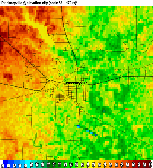
Below is the Elevation map of Pinckneyville, which displays elevation range with different colors. Scale of the first map is from 86 to 170 m (282 to 558 ft) with average elevation of 134.6 meters (=442 ft) [note 1]
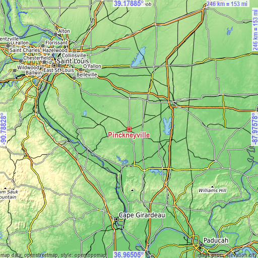
These maps also provides idea of topography and contour of this city, they are displayed at different zoom levels. More info about maps, scale and edge coordinates you can find below images.
| \ | Map #1 | Map #2 | Topo.Map |
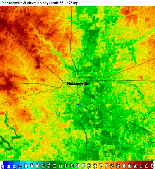
| Scale [m] | 86..170 m | 86..178 m | × |
| Scale [ft] | 282..558 ft | 282..584 ft | × |
| Average | 134.6 m = 442 ft | 139.7 m = 458 ft | × |
| Width | 7.69 km = 4.8 mi | 15.38 km = 9.6 mi | 246.2 km = 153 mi |
| Height | 7.69 km = 4.8 mi | 15.38 km = 9.6 mi | 246.1 km = 152.9 mi |
| ↑Max Latitude | 38.114913° | 38.14948° | 39.17885° |
| Latitude at center | 38.08033° | 38.08033° | 38.08033° |
| ↓Min Latitude | 38.04573° | 38.011114° | 36.96505° |
| ← Min Longitude | -89.425975° | -89.469921° | -90.78828° |
| Longitude center | -89.38203° | -89.38203° | -89.38203° |
| →Max Longitude | -89.338085° | -89.294139° | -87.97578° |
Nearby cities:
Cities around Pinckneyville sort by population:
• Murphysboro elevation 126 m
35.4 km,  173°
173°
• Du Quoin 139 m
14.9 km,  120°
120°
• Sparta 160 m
28.4 km,  279°
279°
• Nashville 158 m
29.3 km,  0°
0°
• Christopher 131 m
31.2 km,  112°
112°
• Steeleville 126 m
25.5 km,  251°
251°
• Sesser 147 m
29.1 km,  87°
87°
• Marissa 140 m
37.3 km,  300°
300°
• Zeigler 128 m
35.2 km, 124°
• De Soto 122 m
32.2 km,  155°
155°
• Cambria 129 m
40.4 km,  145°
145°
• Royalton 120 m
32.6 km,  133°
133°
Multilingual:
 En español:
Pinckneyville elevación 133 m.
 En France:
Pinckneyville élévation 133 m.
 Auf Deutsch:
Pinckneyville höhe über dem Meeresspiegel ist 133 m.

Sources and notes:
- [note 1] Map square and city borders are not equal. Map elevation data is calculated only from area inside that square.
- [src 1] Elevation data from geonames database provided with same terms of usage.
- [src 2] The elevation map of Pinckneyville is generated using elevation data from NASA's 3 arcsec (90m) resolution SRTM data.
- [src 3] Base (background) map © OpenStreetMap contributors tiles are generated by Geofabrik and OpenTopoMap.
Copyright & License:
This Pinckneyville Elevation Map is licensed under CC BY-SA. You may reuse any part from this page, if you give a proper credit by linking to this URL:
 More info on terms of use page.