Marissa elevation
Marissa (Illinois, Saint Clair County), United States elevation is 140 meters and Marissa elevation in feet is 459 ft above sea level [src 1]. Marissa is a populated place (feature code) with elevation that is 139 meters (456 ft) smaller than average city elevation in United States.
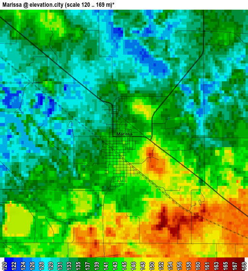
Below is the Elevation map of Marissa, which displays elevation range with different colors. Scale of the first map is from 120 to 169 m (394 to 554 ft) with average elevation of 138.8 meters (=455 ft) [note 1]
These maps also provides idea of topography and contour of this city, they are displayed at different zoom levels. More info about maps, scale and edge coordinates you can find below images.
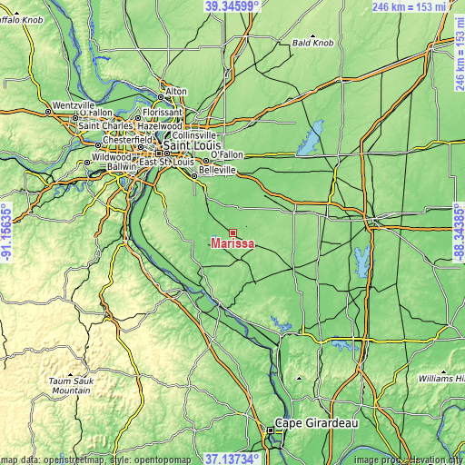
| \ | Map #1 | Topo.Map |
| Scale [m] | 120..169 m | × |
| Scale [ft] | 394..554 ft | × |
| Average | 138.8 m = 455 ft | × |
| Width | 7.67 km = 4.8 mi | 245.6 km = 152.6 mi |
| Height | 7.67 km = 4.8 mi | 245.6 km = 152.6 mi |
| ↑Max Latitude | 38.284553° | 39.34599° |
| Latitude at center | 38.25005° | 38.25005° |
| ↓Min Latitude | 38.215531° | 37.13734° |
| ← Min Longitude | -89.794045° | -91.15635° |
| Longitude center | -89.7501° | -89.7501° |
| →Max Longitude | -89.706155° | -88.34385° |
Nearby cities:
Cities around Marissa sort by population:
• Mascoutah elevation 131 m
27 km,  352°
352°
• Sparta 160 m
14.7 km,  163°
163°
• Freeburg 159 m
24.4 km,  324°
324°
• Smithton 145 m
27.5 km,  309°
309°
• Scott Air Force Base 127 m
33.7 km,  344°
344°
• Red Bud 143 m
21.7 km,  258°
258°
• New Baden 141 m
32 km,  7°
7°
• Nashville 158 m
33.9 km,  72°
72°
• Steeleville 126 m
28.2 km, 163°
• New Athens 123 m
14 km, 307°
• Okawville 137 m
26.9 km,  40°
40°
• Albers 135 m
34.8 km,  20°
20°
Multilingual:
 En español:
Marissa elevación 140 m.
 En France:
Marissa élévation 140 m.


Sources and notes:
- [note 1] Map square and city borders are not equal. Map elevation data is calculated only from area inside that square.
- [src 1] Elevation data from geonames database provided with same terms of usage.
- [src 2] The elevation map of Marissa is generated using elevation data from NASA's 3 arcsec (90m) resolution SRTM data.
- [src 3] Base (background) map © OpenStreetMap contributors tiles are generated by Geofabrik and OpenTopoMap.
Copyright & License:
This Marissa Elevation Map is licensed under CC BY-SA. You may reuse any part from this page, if you give a proper credit by linking to this URL:
 More info on terms of use page.