Mascoutah elevation
Mascoutah (Illinois, Saint Clair County), United States elevation is 131 meters and Mascoutah elevation in feet is 430 ft above sea level [src 1]. Mascoutah is a populated place (feature code) with elevation that is 148 meters (486 ft) smaller than average city elevation in United States.
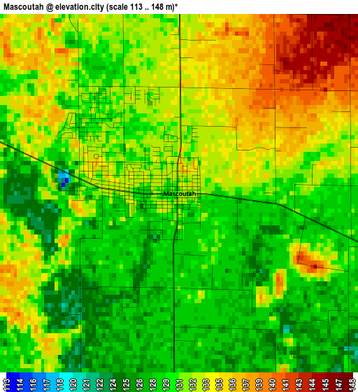
Below is the Elevation map of Mascoutah, which displays elevation range with different colors. Scale of the first map is from 113 to 148 m (371 to 486 ft) with average elevation of 131.2 meters (=430 ft) [note 1]
These maps also provides idea of topography and contour of this city, they are displayed at different zoom levels. More info about maps, scale and edge coordinates you can find below images.
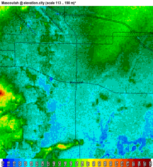
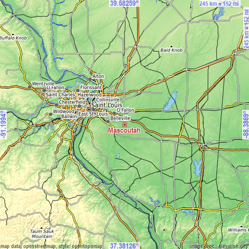
| \ | Map #1 | Map #2 | Topo.Map |
| Scale [m] | 113..148 m | 113..190 m | × |
| Scale [ft] | 371..486 ft | 371..623 ft | × |
| Average | 131.2 m = 430 ft | 133.6 m = 438 ft | × |
| Width | 7.65 km = 4.8 mi | 15.3 km = 9.5 mi | 244.8 km = 152.1 mi |
| Height | 7.65 km = 4.8 mi | 15.3 km = 9.5 mi | 244.8 km = 152.1 mi |
| ↑Max Latitude | 38.524718° | 38.55909° | 39.58259° |
| Latitude at center | 38.49033° | 38.49033° | 38.49033° |
| ↓Min Latitude | 38.455925° | 38.421504° | 37.38126° |
| ← Min Longitude | -89.837095° | -89.881041° | -91.1994° |
| Longitude center | -89.79315° | -89.79315° | -89.79315° |
| →Max Longitude | -89.749205° | -89.705259° | -88.3869° |
Nearby cities:
Cities around Mascoutah sort by population:
• Belleville elevation 157 m
16.9 km,  281°
281°
• O'Fallon 168 m
15.3 km,  317°
317°
• Swansea 165 m
17.7 km,  285°
285°
• Shiloh 201 m
12 km,  311°
311°
• Lebanon 159 m
12.7 km,  354°
354°
• Freeburg 159 m
12.6 km,  236°
236°
• Smithton 145 m
19.6 km, 242°
• Scott Air Force Base 127 m
7.7 km, 319°
• New Baden 141 m
9.5 km,  58°
58°
• Trenton 152 m
16.1 km,  37°
37°
• New Athens 123 m
19.6 km,  201°
201°
• Albers 135 m
16.8 km,  69°
69°
Multilingual:
 En español:
Mascoutah elevación 131 m.
 En France:
Mascoutah élévation 131 m.
 Auf Deutsch:
Mascoutah höhe über dem Meeresspiegel ist 131 m.

Sources and notes:
- [note 1] Map square and city borders are not equal. Map elevation data is calculated only from area inside that square.
- [src 1] Elevation data from geonames database provided with same terms of usage.
- [src 2] The elevation map of Mascoutah is generated using elevation data from NASA's 3 arcsec (90m) resolution SRTM data.
- [src 3] Base (background) map © OpenStreetMap contributors tiles are generated by Geofabrik and OpenTopoMap.
Copyright & License:
This Mascoutah Elevation Map is licensed under CC BY-SA. You may reuse any part from this page, if you give a proper credit by linking to this URL:
 More info on terms of use page.