Red Bud elevation
Red Bud (Illinois, Randolph County), United States elevation is 143 meters and Red Bud elevation in feet is 469 ft above sea level [src 1]. Red Bud is a populated place (feature code) with elevation that is 136 meters (446 ft) smaller than average city elevation in United States.
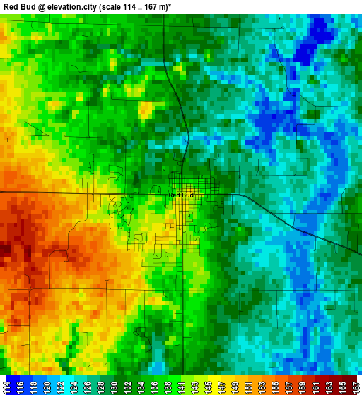
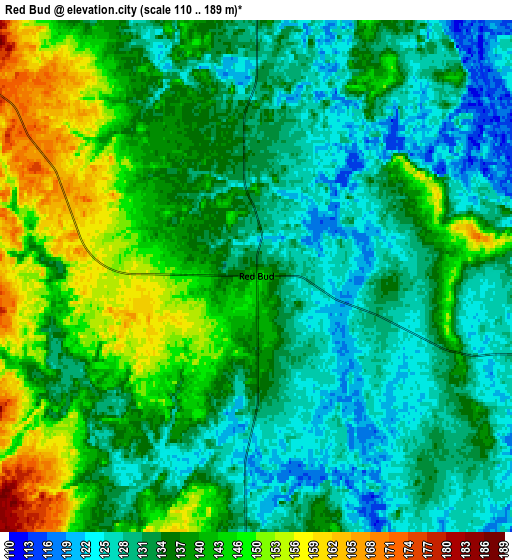
Below is the Elevation map of Red Bud, which displays elevation range with different colors. Scale of the first map is from 114 to 167 m (374 to 548 ft) with average elevation of 134.9 meters (=443 ft) [note 1]
These maps also provides idea of topography and contour of this city, they are displayed at different zoom levels. More info about maps, scale and edge coordinates you can find below images.
| \ | Map #1 | Map #2 | Topo.Map |
| Scale [m] | 114..167 m | 110..189 m | × |
| Scale [ft] | 374..548 ft | 361..620 ft | × |
| Average | 134.9 m = 443 ft | 136.9 m = 449 ft | × |
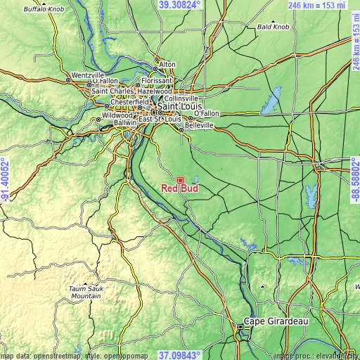
| Width | 7.68 km = 4.8 mi | 15.36 km = 9.5 mi | 245.7 km = 152.7 mi |
| Height | 7.68 km = 4.8 mi | 15.36 km = 9.5 mi | 245.7 km = 152.7 mi |
| ↑Max Latitude | 38.246241° | 38.280746° | 39.30824° |
| Latitude at center | 38.21172° | 38.21172° | 38.21172° |
| ↓Min Latitude | 38.177183° | 38.142629° | 37.09843° |
| ← Min Longitude | -90.038215° | -90.082161° | -91.40052° |
| Longitude center | -89.99427° | -89.99427° | -89.99427° |
| →Max Longitude | -89.950325° | -89.906379° | -88.58802° |
Nearby cities:
Cities around Red Bud sort by population:
• Belleville elevation 157 m
34.3 km,  1°
1°
• Waterloo 216 m
19.4 km,  315°
315°
• Columbia 154 m
31.5 km,  325°
325°
• Crystal City 134 m
33.6 km,  271°
271°
• Sparta 160 m
27.4 km,  111°
111°
• Sainte Genevieve 117 m
25.9 km,  189°
189°
• Freeburg 159 m
25 km,  16°
16°
• Millstadt 188 m
29 km,  342°
342°
• Smithton 145 m
21.9 km, 0°
• New Athens 123 m
16.4 km,  38°
38°
• Marissa 140 m
21.7 km,  78°
78°
• Valmeyer 225 m
26.8 km,  292°
292°
Multilingual:
 En español:
Red Bud elevación 143 m.
 En France:
Red Bud élévation 143 m.


Sources and notes:
- [note 1] Map square and city borders are not equal. Map elevation data is calculated only from area inside that square.
- [src 1] Elevation data from geonames database provided with same terms of usage.
- [src 2] The elevation map of Red Bud is generated using elevation data from NASA's 3 arcsec (90m) resolution SRTM data.
- [src 3] Base (background) map © OpenStreetMap contributors tiles are generated by Geofabrik and OpenTopoMap.
Copyright & License:
This Red Bud Elevation Map is licensed under CC BY-SA. You may reuse any part from this page, if you give a proper credit by linking to this URL:
 More info on terms of use page.