Columbia elevation
Columbia (Illinois, Monroe County), United States elevation is 154 meters and Columbia elevation in feet is 505 ft above sea level [src 1]. Columbia is a populated place (feature code) with elevation that is 125 meters (410 ft) smaller than average city elevation in United States.
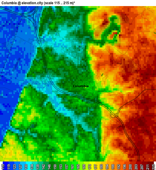
Below is the Elevation map of Columbia, which displays elevation range with different colors. Scale of the first map is from 115 to 215 m (377 to 705 ft) with average elevation of 162 meters (=531 ft) [note 1]
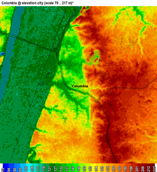
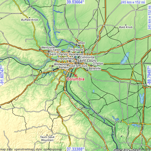
These maps also provides idea of topography and contour of this city, they are displayed at different zoom levels. More info about maps, scale and edge coordinates you can find below images.
| \ | Map #1 | Map #2 | Topo.Map |
| Scale [m] | 115..215 m | 79..217 m | × |
| Scale [ft] | 377..705 ft | 259..712 ft | × |
| Average | 162 m = 531 ft | 159.8 m = 524 ft | × |
| Width | 7.65 km = 4.8 mi | 15.31 km = 9.5 mi | 244.9 km = 152.2 mi |
| Height | 7.65 km = 4.8 mi | 15.31 km = 9.5 mi | 244.9 km = 152.2 mi |
| ↑Max Latitude | 38.478071° | 38.512465° | 39.53664° |
| Latitude at center | 38.44366° | 38.44366° | 38.44366° |
| ↓Min Latitude | 38.409233° | 38.374789° | 37.33388° |
| ← Min Longitude | -90.245165° | -90.289111° | -91.60747° |
| Longitude center | -90.20122° | -90.20122° | -90.20122° |
| →Max Longitude | -90.157275° | -90.113329° | -88.79497° |
Nearby cities:
Cities around Columbia sort by population:
• Oakville elevation 181 m
9.5 km,  288°
288°
• Mehlville 182 m
12.8 km,  304°
304°
• Arnold 178 m
15.4 km,  265°
265°
• Lemay 145 m
12.1 km,  325°
325°
• Concord 190 m
16.3 km, 303°
• Cahokia 124 m
14.2 km,  3°
3°
• Waterloo 216 m
12.8 km,  159°
159°
• Dupo 129 m
8.1 km,  354°
354°
• Millstadt 188 m
9.7 km,  78°
78°
• Green Park 170 m
14.9 km,  306°
306°
• Lakeshire 178 m
15.7 km, 312°
• Saint George 165 m
14.3 km,  316°
316°
Multilingual:
 En español:
Columbia elevación 154 m.
 En France:
Columbia élévation 154 m.
 Auf Deutsch:
Columbia höhe über dem Meeresspiegel ist 154 m.

Sources and notes:
- [note 1] Map square and city borders are not equal. Map elevation data is calculated only from area inside that square.
- [src 1] Elevation data from geonames database provided with same terms of usage.
- [src 2] The elevation map of Columbia is generated using elevation data from NASA's 3 arcsec (90m) resolution SRTM data.
- [src 3] Base (background) map © OpenStreetMap contributors tiles are generated by Geofabrik and OpenTopoMap.
Copyright & License:
This Columbia Elevation Map is licensed under CC BY-SA. You may reuse any part from this page, if you give a proper credit by linking to this URL:
 More info on terms of use page.