Russell elevation
Russell (Georgia, Barrow County), United States elevation is 299 meters and Russell elevation in feet is 981 ft above sea level [src 1]. Russell is a populated place (feature code) with elevation that is 20 meters (66 ft) bigger than average city elevation in United States.
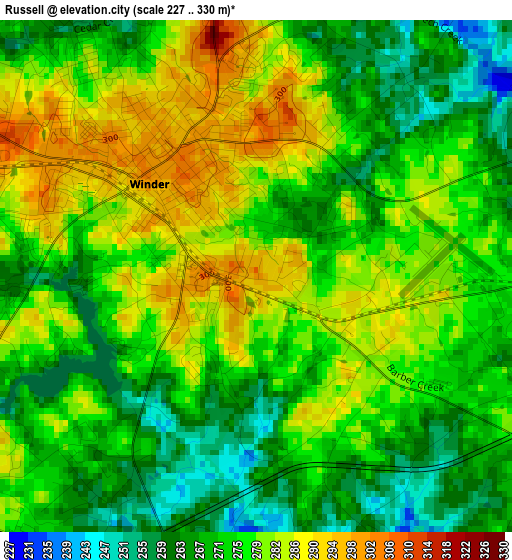
Below is the Elevation map of Russell, which displays elevation range with different colors. Scale of the first map is from 227 to 330 m (745 to 1083 ft) with average elevation of 275 meters (=902 ft) [note 1]
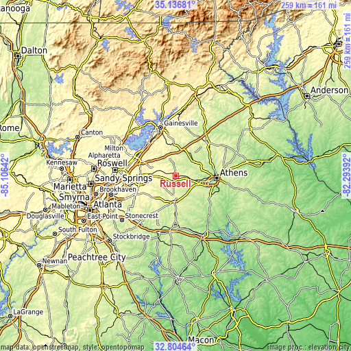
These maps also provides idea of topography and contour of this city, they are displayed at different zoom levels. More info about maps, scale and edge coordinates you can find below images.
| \ | Map #1 | Topo.Map |
| Scale [m] | 227..330 m | × |
| Scale [ft] | 745..1083 ft | × |
| Average | 275 m = 902 ft | × |
| Width | 8.1 km = 5 mi | 259.3 km = 161.1 mi |
| Height | 8.1 km = 5 mi | 259.3 km = 161.1 mi |
| ↑Max Latitude | 34.015154° | 35.13681° |
| Latitude at center | 33.97872° | 33.97872° |
| ↓Min Latitude | 33.942271° | 32.80464° |
| ← Min Longitude | -83.744115° | -85.10642° |
| Longitude center | -83.70017° | -83.70017° |
| →Max Longitude | -83.656225° | -82.29392° |
Nearby cities:
Cities around Russell sort by population:
• Winder elevation 303 m
2.4 km,  309°
309°
• Monroe 282 m
20.5 km,  183°
183°
• Loganville 308 m
24.2 km,  229°
229°
• Jefferson 228 m
19.4 km,  37°
37°
• Braselton 282 m
15.6 km,  338°
338°
• Auburn 321 m
12.4 km,  288°
288°
• Dacula 320 m
18.3 km,  273°
273°
• Grayson 334 m
25.4 km,  248°
248°
• Statham 273 m
9.7 km,  98°
98°
• Arcade 272 m
16.9 km,  49°
49°
• Hoschton 282 m
14.3 km, 336°
• Bogart 255 m
15.6 km, 102°
Multilingual:
 En español:
Russell elevación 299 m.
 En France:
Russell élévation 299 m.


Sources and notes:
- [note 1] Map square and city borders are not equal. Map elevation data is calculated only from area inside that square.
- [src 1] Elevation data from geonames database provided with same terms of usage.
- [src 2] The elevation map of Russell is generated using elevation data from NASA's 3 arcsec (90m) resolution SRTM data.
- [src 3] Base (background) map © OpenStreetMap contributors tiles are generated by Geofabrik and OpenTopoMap.
Copyright & License:
This Russell Elevation Map is licensed under CC BY-SA. You may reuse any part from this page, if you give a proper credit by linking to this URL:
 More info on terms of use page.