Jefferson elevation
Jefferson (Georgia, Jackson County), United States elevation is 228 meters and Jefferson elevation in feet is 748 ft above sea level [src 1]. Jefferson is a seat of a second-order administrative division (feature code) with elevation that is 51 meters (167 ft) smaller than average city elevation in United States.
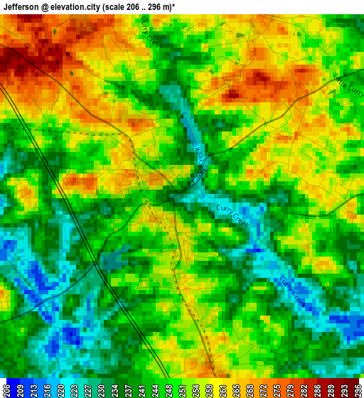
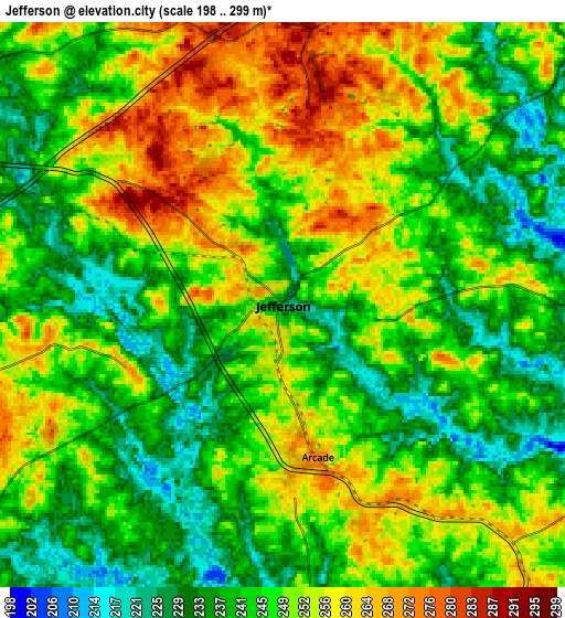
Below is the Elevation map of Jefferson, which displays elevation range with different colors. Scale of the first map is from 206 to 296 m (676 to 971 ft) with average elevation of 248.1 meters (=814 ft) [note 1]
These maps also provides idea of topography and contour of this city, they are displayed at different zoom levels. More info about maps, scale and edge coordinates you can find below images.
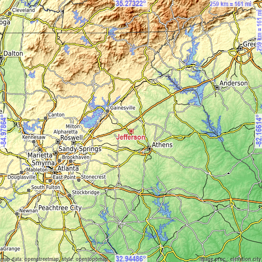
| \ | Map #1 | Map #2 | Topo.Map |
| Scale [m] | 206..296 m | 198..299 m | × |
| Scale [ft] | 676..971 ft | 650..981 ft | × |
| Average | 248.1 m = 814 ft | 246.8 m = 810 ft | × |
| Width | 8.09 km = 5 mi | 16.18 km = 10.1 mi | 258.9 km = 160.9 mi |
| Height | 8.09 km = 5 mi | 16.18 km = 10.1 mi | 258.9 km = 160.9 mi |
| ↑Max Latitude | 34.153424° | 34.189783° | 35.27322° |
| Latitude at center | 34.11705° | 34.11705° | 34.11705° |
| ↓Min Latitude | 34.08066° | 34.044255° | 32.94486° |
| ← Min Longitude | -83.616335° | -83.660281° | -84.97864° |
| Longitude center | -83.57239° | -83.57239° | -83.57239° |
| →Max Longitude | -83.528445° | -83.484499° | -82.16614° |
Nearby cities:
Cities around Jefferson sort by population:
• Athens elevation 232 m
24.9 km,  134°
134°
• Winder 303 m
19.4 km,  224°
224°
• Braselton 282 m
17.5 km,  267°
267°
• Country Club Estates 232 m
20.7 km, 133°
• Commerce 277 m
14.4 km,  47°
47°
• Statham 273 m
17 km,  187°
187°
• Maysville 274 m
15.1 km,  3°
3°
• Arcade 272 m
4.5 km,  167°
167°
• Nicholson 260 m
13 km,  91°
91°
• Hoschton 282 m
17.5 km,  262°
262°
• Russell 299 m
19.4 km, 217°
• Bogart 255 m
19 km, 169°
Multilingual:
 En español:
Jefferson elevación 228 m.
 En France:
Jefferson élévation 228 m.
 Auf Deutsch:
Jefferson höhe über dem Meeresspiegel ist 228 m.

Sources and notes:
- [note 1] Map square and city borders are not equal. Map elevation data is calculated only from area inside that square.
- [src 1] Elevation data from geonames database provided with same terms of usage.
- [src 2] The elevation map of Jefferson is generated using elevation data from NASA's 3 arcsec (90m) resolution SRTM data.
- [src 3] Base (background) map © OpenStreetMap contributors tiles are generated by Geofabrik and OpenTopoMap.
Copyright & License:
This Jefferson Elevation Map is licensed under CC BY-SA. You may reuse any part from this page, if you give a proper credit by linking to this URL:
 More info on terms of use page.