Bogart elevation
Bogart (Georgia, Oconee County), United States elevation is 255 meters and Bogart elevation in feet is 837 ft above sea level [src 1]. Bogart is a populated place (feature code) with elevation that is 24 meters (79 ft) smaller than average city elevation in United States.
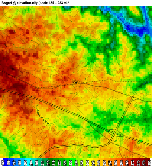
Below is the Elevation map of Bogart, which displays elevation range with different colors. Scale of the first map is from 185 to 283 m (607 to 928 ft) with average elevation of 245 meters (=804 ft) [note 1]
These maps also provides idea of topography and contour of this city, they are displayed at different zoom levels. More info about maps, scale and edge coordinates you can find below images.
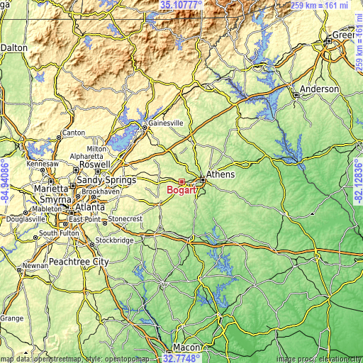
| \ | Map #1 | Topo.Map |
| Scale [m] | 185..283 m | × |
| Scale [ft] | 607..928 ft | × |
| Average | 245 m = 804 ft | × |
| Width | 8.11 km = 5 mi | 259.4 km = 161.2 mi |
| Height | 8.11 km = 5 mi | 259.4 km = 161.2 mi |
| ↑Max Latitude | 33.985726° | 35.10777° |
| Latitude at center | 33.94928° | 33.94928° |
| ↓Min Latitude | 33.912818° | 32.7748° |
| ← Min Longitude | -83.578555° | -84.94086° |
| Longitude center | -83.53461° | -83.53461° |
| →Max Longitude | -83.490665° | -82.12836° |
Nearby cities:
Cities around Bogart sort by population:
• Athens elevation 232 m
14.5 km,  84°
84°
• Winder 303 m
17.8 km,  285°
285°
• Monroe 282 m
23.8 km,  223°
223°
• Jefferson 228 m
19 km,  349°
349°
• Country Club Estates 232 m
12.4 km,  68°
68°
• Watkinsville 224 m
15.1 km,  129°
129°
• Statham 273 m
6 km, 287°
• Arcade 272 m
14.5 km, 350°
• Nicholson 260 m
20.6 km,  27°
27°
• Hoschton 282 m
26.5 km,  308°
308°
• Russell 299 m
15.6 km,  282°
282°
• Winterville 252 m
23.7 km,  85°
85°
Multilingual:
 En español:
Bogart elevación 255 m.
 En France:
Bogart élévation 255 m.


Sources and notes:
- [note 1] Map square and city borders are not equal. Map elevation data is calculated only from area inside that square.
- [src 1] Elevation data from geonames database provided with same terms of usage.
- [src 2] The elevation map of Bogart is generated using elevation data from NASA's 3 arcsec (90m) resolution SRTM data.
- [src 3] Base (background) map © OpenStreetMap contributors tiles are generated by Geofabrik and OpenTopoMap.
Copyright & License:
This Bogart Elevation Map is licensed under CC BY-SA. You may reuse any part from this page, if you give a proper credit by linking to this URL:
 More info on terms of use page.