Loganville elevation
Loganville (Georgia, Walton County), United States elevation is 308 meters and Loganville elevation in feet is 1010 ft above sea level [src 1]. Loganville is a populated place (feature code) with elevation that is 29 meters (95 ft) bigger than average city elevation in United States.
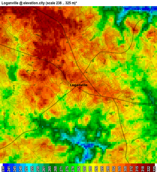
Below is the Elevation map of Loganville, which displays elevation range with different colors. Scale of the first map is from 238 to 325 m (781 to 1066 ft) with average elevation of 291.9 meters (=958 ft) [note 1]
These maps also provides idea of topography and contour of this city, they are displayed at different zoom levels. More info about maps, scale and edge coordinates you can find below images.
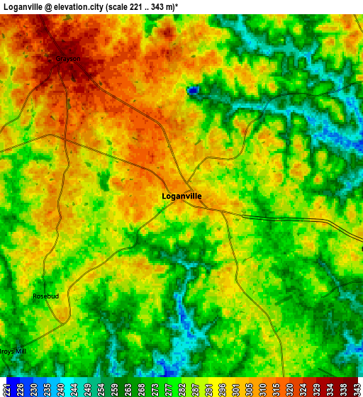
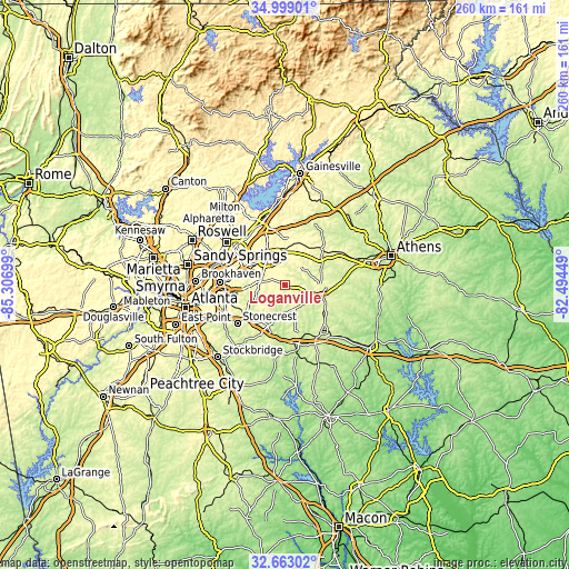
| \ | Map #1 | Map #2 | Topo.Map |
| Scale [m] | 238..325 m | 221..343 m | × |
| Scale [ft] | 781..1066 ft | 725..1125 ft | × |
| Average | 291.9 m = 958 ft | 285.7 m = 937 ft | × |
| Width | 8.12 km = 5 mi | 16.23 km = 10.1 mi | 259.7 km = 161.4 mi |
| Height | 8.12 km = 5 mi | 16.23 km = 10.1 mi | 259.7 km = 161.4 mi |
| ↑Max Latitude | 33.875493° | 33.911971° | 34.99901° |
| Latitude at center | 33.839° | 33.839° | 33.839° |
| ↓Min Latitude | 33.802491° | 33.765966° | 32.66302° |
| ← Min Longitude | -83.944685° | -83.988631° | -85.30699° |
| Longitude center | -83.90074° | -83.90074° | -83.90074° |
| →Max Longitude | -83.856795° | -83.812849° | -82.49449° |
Nearby cities:
Cities around Loganville sort by population:
• Lawrenceville elevation 326 m
15.3 km,  328°
328°
• Snellville 324 m
11.2 km,  280°
280°
• Conyers 279 m
21.9 km,  209°
209°
• Monroe 282 m
18 km,  105°
105°
• Lilburn 290 m
23.1 km, 284°
• Mountain Park 315 m
21.1 km,  271°
271°
• Auburn 321 m
20.6 km,  19°
19°
• Dacula 320 m
16.6 km,  0°
0°
• Grayson 334 m
8 km,  320°
320°
• Lakeview Estates 240 m
19 km,  219°
219°
• Lithonia 286 m
23.6 km,  233°
233°
• Walnut Grove 283 m
11.6 km,  157°
157°
Multilingual:
 En español:
Loganville elevación 308 m.
 En France:
Loganville élévation 308 m.
 Auf Deutsch:
Loganville höhe über dem Meeresspiegel ist 308 m.

Sources and notes:
- [note 1] Map square and city borders are not equal. Map elevation data is calculated only from area inside that square.
- [src 1] Elevation data from geonames database provided with same terms of usage.
- [src 2] The elevation map of Loganville is generated using elevation data from NASA's 3 arcsec (90m) resolution SRTM data.
- [src 3] Base (background) map © OpenStreetMap contributors tiles are generated by Geofabrik and OpenTopoMap.
Copyright & License:
This Loganville Elevation Map is licensed under CC BY-SA. You may reuse any part from this page, if you give a proper credit by linking to this URL:
 More info on terms of use page.