Auburn elevation
Auburn (Georgia, Barrow County), United States elevation is 321 meters and Auburn elevation in feet is 1053 ft above sea level [src 1]. Auburn is a populated place (feature code) with elevation that is 42 meters (138 ft) bigger than average city elevation in United States.
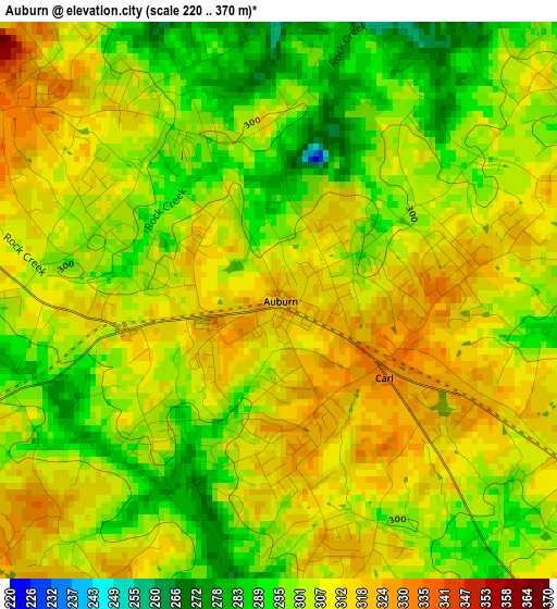
Below is the Elevation map of Auburn, which displays elevation range with different colors. Scale of the first map is from 220 to 370 m (722 to 1214 ft) with average elevation of 304.8 meters (=1000 ft) [note 1]
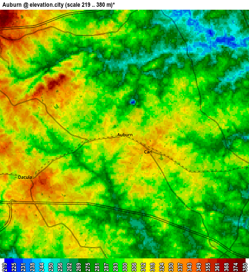
These maps also provides idea of topography and contour of this city, they are displayed at different zoom levels. More info about maps, scale and edge coordinates you can find below images.
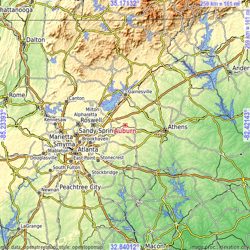
| \ | Map #1 | Map #2 | Topo.Map |
| Scale [m] | 220..370 m | 219..380 m | × |
| Scale [ft] | 722..1214 ft | 719..1247 ft | × |
| Average | 304.8 m = 1000 ft | 297.7 m = 977 ft | × |
| Width | 8.1 km = 5 mi | 16.2 km = 10.1 mi | 259.2 km = 161.1 mi |
| Height | 8.1 km = 5 mi | 16.2 km = 10.1 mi | 259.2 km = 161.1 mi |
| ↑Max Latitude | 34.050139° | 34.086542° | 35.17132° |
| Latitude at center | 34.01372° | 34.01372° | 34.01372° |
| ↓Min Latitude | 33.977286° | 33.940836° | 32.84012° |
| ← Min Longitude | -83.871625° | -83.915571° | -85.23393° |
| Longitude center | -83.82768° | -83.82768° | -83.82768° |
| →Max Longitude | -83.783735° | -83.739789° | -82.42143° |
Nearby cities:
Cities around Auburn sort by population:
• Lawrenceville elevation 326 m
16.1 km,  246°
246°
• Sugar Hill 352 m
21.6 km,  298°
298°
• Winder 303 m
10.2 km,  103°
103°
• Buford 360 m
20.2 km,  306°
306°
• Loganville 308 m
20.6 km,  199°
199°
• Braselton 282 m
12.2 km,  29°
29°
• Flowery Branch 341 m
21.1 km,  334°
334°
• Dacula 320 m
7 km, 246°
• Grayson 334 m
17.8 km,  221°
221°
• Statham 273 m
22 km, 104°
• Hoschton 282 m
11.1 km, 33°
• Russell 299 m
12.4 km,  108°
108°
Multilingual:
 En español:
Auburn elevación 321 m.
 En France:
Auburn élévation 321 m.


Sources and notes:
- [note 1] Map square and city borders are not equal. Map elevation data is calculated only from area inside that square.
- [src 1] Elevation data from geonames database provided with same terms of usage.
- [src 2] The elevation map of Auburn is generated using elevation data from NASA's 3 arcsec (90m) resolution SRTM data.
- [src 3] Base (background) map © OpenStreetMap contributors tiles are generated by Geofabrik and OpenTopoMap.
Copyright & License:
This Auburn Elevation Map is licensed under CC BY-SA. You may reuse any part from this page, if you give a proper credit by linking to this URL:
 More info on terms of use page.