Thomasville elevation
Thomasville (Alabama, Clarke County), United States elevation is 121 meters and Thomasville elevation in feet is 397 ft above sea level [src 1]. Thomasville is a populated place (feature code) with elevation that is 158 meters (518 ft) smaller than average city elevation in United States.
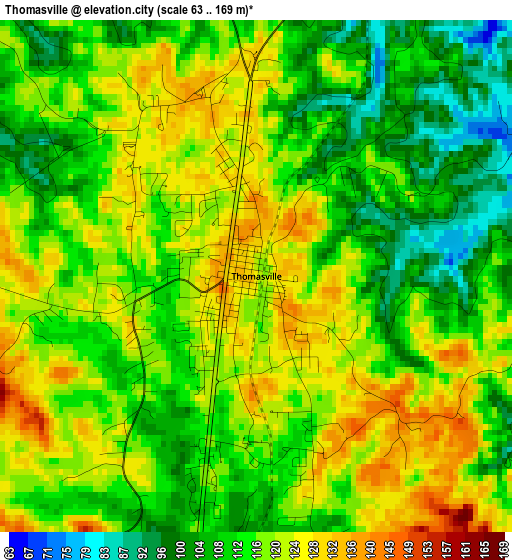
Below is the Elevation map of Thomasville, which displays elevation range with different colors. Scale of the first map is from 63 to 169 m (207 to 554 ft) with average elevation of 115.7 meters (=380 ft) [note 1]
These maps also provides idea of topography and contour of this city, they are displayed at different zoom levels. More info about maps, scale and edge coordinates you can find below images.
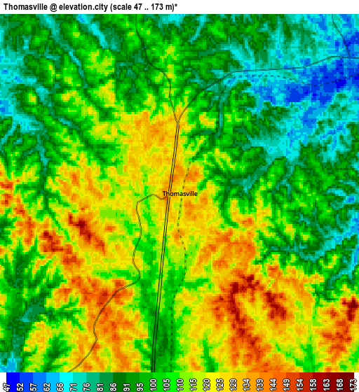
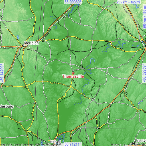
| \ | Map #1 | Map #2 | Topo.Map |
| Scale [m] | 63..169 m | 47..173 m | × |
| Scale [ft] | 207..554 ft | 154..568 ft | × |
| Average | 115.7 m = 380 ft | 105 m = 344 ft | × |
| Width | 8.3 km = 5.2 mi | 16.59 km = 10.3 mi | 265.4 km = 164.9 mi |
| Height | 8.3 km = 5.2 mi | 16.59 km = 10.3 mi | 265.4 km = 164.9 mi |
| ↑Max Latitude | 31.950785° | 31.988065° | 33.09939° |
| Latitude at center | 31.91349° | 31.91349° | 31.91349° |
| ↓Min Latitude | 31.87618° | 31.838854° | 30.71211° |
| ← Min Longitude | -87.779785° | -87.823731° | -89.14209° |
| Longitude center | -87.73584° | -87.73584° | -87.73584° |
| →Max Longitude | -87.691895° | -87.647949° | -86.32959° |
Nearby cities:
Cities around Thomasville sort by population:
• Demopolis elevation 40 m
67.8 km,  351°
351°
• Monroeville 131 m
57.9 km,  137°
137°
• Jackson 69 m
47.4 km,  198°
198°
• Uniontown 92 m
63.2 km,  19°
19°
• York 52 m
82.7 km,  320°
320°
• Linden 51 m
44.1 km, 352°
• Belmont 60 m
80.5 km,  241°
241°
• Camden 66 m
42.9 km,  78°
78°
• Butler 56 m
49.8 km,  293°
293°
• Grove Hill 155 m
23.1 km,  189°
189°
• Chatom 61 m
69.9 km,  224°
224°
• Frisco City 127 m
62 km,  149°
149°
Multilingual:
 En español:
Thomasville elevación 121 m.
 En France:
Thomasville élévation 121 m.
 Auf Deutsch:
Thomasville höhe über dem Meeresspiegel ist 121 m.

Sources and notes:
- [note 1] Map square and city borders are not equal. Map elevation data is calculated only from area inside that square.
- [src 1] Elevation data from geonames database provided with same terms of usage.
- [src 2] The elevation map of Thomasville is generated using elevation data from NASA's 3 arcsec (90m) resolution SRTM data.
- [src 3] Base (background) map © OpenStreetMap contributors tiles are generated by Geofabrik and OpenTopoMap.
Copyright & License:
This Thomasville Elevation Map is licensed under CC BY-SA. You may reuse any part from this page, if you give a proper credit by linking to this URL:
 More info on terms of use page.