Butler elevation
Butler (Alabama, Choctaw County), United States elevation is 56 meters and Butler elevation in feet is 184 ft above sea level [src 1]. Butler is a seat of a second-order administrative division (feature code) with elevation that is 223 meters (732 ft) smaller than average city elevation in United States.
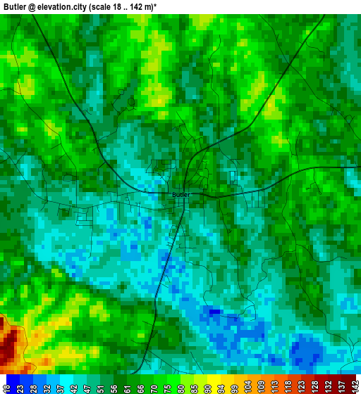
Below is the Elevation map of Butler, which displays elevation range with different colors. Scale of the first map is from 18 to 142 m (59 to 466 ft) with average elevation of 58.7 meters (=193 ft) [note 1]
These maps also provides idea of topography and contour of this city, they are displayed at different zoom levels. More info about maps, scale and edge coordinates you can find below images.
| \ | Map #1 | Topo.Map |
| Scale [m] | 18..142 m | × |
| Scale [ft] | 59..466 ft | × |
| Average | 58.7 m = 193 ft | × |
| Width | 8.28 km = 5.1 mi | 264.9 km = 164.6 mi |
| Height | 8.28 km = 5.1 mi | 264.9 km = 164.6 mi |
| ↑Max Latitude | 32.126814° | 33.27317° |
| Latitude at center | 32.08959° | 32.08959° |
| ↓Min Latitude | 32.052351° | 30.89048° |
| ← Min Longitude | -88.265915° | -89.62822° |
| Longitude center | -88.22197° | -88.22197° |
| →Max Longitude | -88.178025° | -86.81572° |
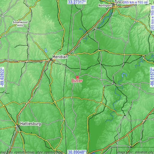
Nearby cities:
Cities around Butler sort by population:
• Meridian elevation 103 m
54.6 km,  303°
303°
• Demopolis 40 m
59.8 km,  37°
37°
• Waynesboro 60 m
61.1 km,  220°
220°
• Thomasville 121 m
49.8 km,  113°
113°
• Livingston 49 m
55.1 km,  3°
3°
• York 52 m
44.7 km,  350°
350°
• Quitman 72 m
48 km,  263°
263°
• Linden 51 m
46.6 km,  58°
58°
• Belmont 60 m
63 km,  203°
203°
• Marion 114 m
54.1 km,  312°
312°
• Grove Hill 155 m
59.6 km,  135°
135°
• Stonewall 71 m
54 km,  274°
274°
Multilingual:
 En español:
Butler elevación 56 m.
 En France:
Butler élévation 56 m.


Sources and notes:
- [note 1] Map square and city borders are not equal. Map elevation data is calculated only from area inside that square.
- [src 1] Elevation data from geonames database provided with same terms of usage.
- [src 2] The elevation map of Butler is generated using elevation data from NASA's 3 arcsec (90m) resolution SRTM data.
- [src 3] Base (background) map © OpenStreetMap contributors tiles are generated by Geofabrik and OpenTopoMap.
Copyright & License:
This Butler Elevation Map is licensed under CC BY-SA. You may reuse any part from this page, if you give a proper credit by linking to this URL:
 More info on terms of use page.