Costâna elevation
Costâna (Suceava, Comuna Todireşti), Romania elevation is 302 meters and Costâna elevation in feet is 991 ft above sea level [src 1]. Costâna is a populated place (feature code) with elevation that is 50 meters (164 ft) bigger than average city elevation in Romania.
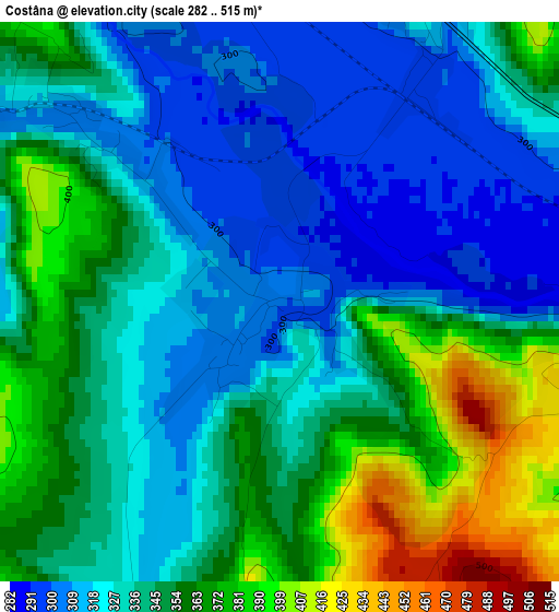
Below is the Elevation map of Costâna, which displays elevation range with different colors. Scale of the first map is from 282 to 515 m (925 to 1690 ft) with average elevation of 341.2 meters (=1119 ft) [note 1]
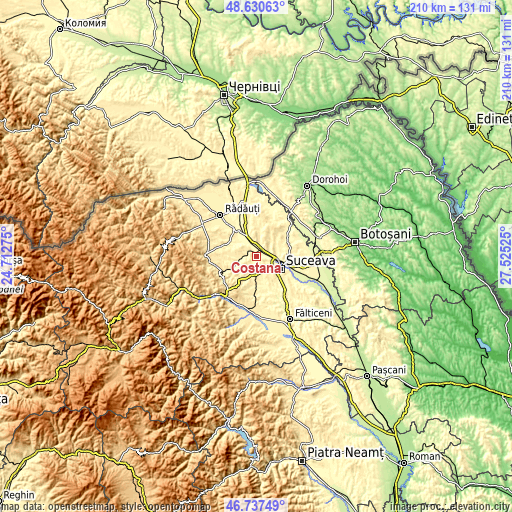
These maps also provides idea of topography and contour of this city, they are displayed at different zoom levels. More info about maps, scale and edge coordinates you can find below images.
| \ | Map #1 | Topo.Map |
| Scale [m] | 282..515 m | × |
| Scale [ft] | 925..1690 ft | × |
| Average | 341.2 m = 1119 ft | × |
| Width | 6.58 km = 4.1 mi | 210.5 km = 130.8 mi |
| Height | 6.58 km = 4.1 mi | 210.5 km = 130.8 mi |
| ↑Max Latitude | 47.722222° | 48.63063° |
| Latitude at center | 47.69265° | 47.69265° |
| ↓Min Latitude | 47.663062° | 46.73749° |
| ← Min Longitude | 26.075055° | 24.71275° |
| Longitude center | 26.119° | 26.119° |
| →Max Longitude | 26.162945° | 27.52525° |
Nearby cities:
Cities around Costâna sort by population:
• Scheia elevation 307 m
9.8 km,  118°
118°
• Dărmăneşti 340 m
5.1 km,  27°
27°
• Todireşti 365 m
6.5 km,  277°
277°
• Pătrăuţi 413 m
6.6 km,  66°
66°
• Stroiești 353 m
8.5 km,  172°
172°
• Mihoveni 374 m
4.9 km,  106°
106°
• Ilișești 399 m
10.6 km,  208°
208°
• Bălăceana 359 m
7.7 km,  224°
224°
• Măriței 402 m
7 km,  16°
16°
• Soloneț 346 m
6.5 km,  264°
264°
• Comănești 364 m
10.1 km, 255°
• Părhăuți 303 m
2.9 km,  312°
312°
Multilingual:
 En español:
Costâna elevación 302 m.
 En France:
Costâna élévation 302 m.


Sources and notes:
- [note 1] Map square and city borders are not equal. Map elevation data is calculated only from area inside that square.
- [src 1] Elevation data from geonames database provided with same terms of usage.
- [src 2] The elevation map of Costâna is generated using elevation data from NASA's 3 arcsec (90m) resolution SRTM data.
- [src 3] Base (background) map © OpenStreetMap contributors tiles are generated by Geofabrik and OpenTopoMap.
Copyright & License:
This Costâna Elevation Map is licensed under CC BY-SA. You may reuse any part from this page, if you give a proper credit by linking to this URL:
 More info on terms of use page.