Todireşti elevation
Todireşti (Suceava, Comuna Todireşti), Romania elevation is 365 meters and Todireşti elevation in feet is 1198 ft above sea level [src 1]. Todireşti is a seat of a second-order administrative division (feature code) with elevation that is 113 meters (371 ft) bigger than average city elevation in Romania.
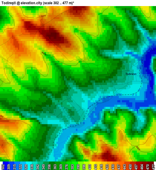
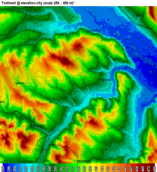
Below is the Elevation map of Todireşti, which displays elevation range with different colors. Scale of the first map is from 302 to 477 m (991 to 1565 ft) with average elevation of 377.7 meters (=1239 ft) [note 1]
These maps also provides idea of topography and contour of this city, they are displayed at different zoom levels. More info about maps, scale and edge coordinates you can find below images.
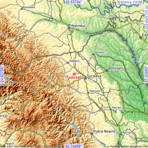
| \ | Map #1 | Map #2 | Topo.Map |
| Scale [m] | 302..477 m | 289..480 m | × |
| Scale [ft] | 991..1565 ft | 948..1575 ft | × |
| Average | 377.7 m = 1239 ft | 366.5 m = 1202 ft | × |
| Width | 6.58 km = 4.1 mi | 13.15 km = 8.2 mi | 210.5 km = 130.8 mi |
| Height | 6.58 km = 4.1 mi | 13.15 km = 8.2 mi | 210.5 km = 130.8 mi |
| ↑Max Latitude | 47.729567° | 47.759118° | 48.63784° |
| Latitude at center | 47.7° | 47.7° | 47.7° |
| ↓Min Latitude | 47.670416° | 47.640815° | 46.74498° |
| ← Min Longitude | 25.989385° | 25.945439° | 24.62708° |
| Longitude center | 26.03333° | 26.03333° | 26.03333° |
| →Max Longitude | 26.077275° | 26.121221° | 27.43958° |
Nearby cities:
Cities around Todireşti sort by population:
• Cajvana elevation 389 m
5 km,  270°
270°
• Arbore 367 m
8.3 km,  296°
296°
• Dărmăneşti 340 m
9.5 km,  66°
66°
• Botoşana 384 m
6.5 km,  253°
253°
• Iaslovăț 361 m
7.7 km,  327°
327°
• Părteştii de Jos 413 m
8.9 km,  213°
213°
• Bălăceana 359 m
6.4 km,  170°
170°
• Soloneț 346 m
1.5 km,  183°
183°
• Costâna 302 m
6.5 km,  97°
97°
• Comănești 364 m
4.8 km,  224°
224°
• Părhăuți 303 m
4.4 km, 74°
• Humoreni 356 m
5.3 km,  225°
225°
Multilingual:
 En español:
Todireşti elevación 365 m.
 En France:
Todireşti élévation 365 m.
 Auf Deutsch:
Todireşti höhe über dem Meeresspiegel ist 365 m.

Sources and notes:
- [note 1] Map square and city borders are not equal. Map elevation data is calculated only from area inside that square.
- [src 1] Elevation data from geonames database provided with same terms of usage.
- [src 2] The elevation map of Todireşti is generated using elevation data from NASA's 3 arcsec (90m) resolution SRTM data.
- [src 3] Base (background) map © OpenStreetMap contributors tiles are generated by Geofabrik and OpenTopoMap.
Copyright & License:
This Todireşti Elevation Map is licensed under CC BY-SA. You may reuse any part from this page, if you give a proper credit by linking to this URL:
 More info on terms of use page.