Măriței elevation
Măriței (Suceava, Comuna Dărmăneşti), Romania elevation is 402 meters and Măriței elevation in feet is 1319 ft above sea level [src 1]. Măriței is a populated place (feature code) with elevation that is 150 meters (492 ft) bigger than average city elevation in Romania.
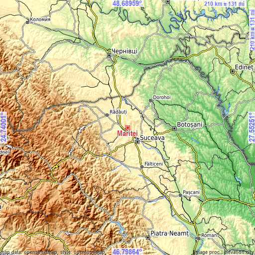
Below is the Elevation map of Măriței, which displays elevation range with different colors. Scale of the first map is from 294 to 519 m (965 to 1703 ft) with average elevation of 399.7 meters (=1311 ft) [note 1]
These maps also provides idea of topography and contour of this city, they are displayed at different zoom levels. More info about maps, scale and edge coordinates you can find below images.

| \ | Map #1 | Topo.Map |
| Scale [m] | 294..519 m | × |
| Scale [ft] | 965..1703 ft | × |
| Average | 399.7 m = 1311 ft | × |
| Width | 6.57 km = 4.1 mi | 210.3 km = 130.7 mi |
| Height | 6.57 km = 4.1 mi | 210.2 km = 130.6 mi |
| ↑Max Latitude | 47.782237° | 48.68959° |
| Latitude at center | 47.7527° | 47.7527° |
| ↓Min Latitude | 47.723146° | 46.79864° |
| ← Min Longitude | 26.102315° | 24.74001° |
| Longitude center | 26.14626° | 26.14626° |
| →Max Longitude | 26.190205° | 27.55251° |
Nearby cities:
Cities around Măriței sort by population:
• Dărmăneşti elevation 340 m
2.2 km,  172°
172°
• Calafindeşti 422 m
11 km,  348°
348°
• Todireşti 365 m
10.3 km,  235°
235°
• Grăniceşti 357 m
9.3 km,  320°
320°
• Pătrăuţi 413 m
5.7 km,  134°
134°
• Mitocu Dragomirnei 380 m
8.1 km,  105°
105°
• Mihoveni 374 m
8.5 km,  161°
161°
• Șerbăuți 392 m
8.3 km,  356°
356°
• Soloneț 346 m
11.2 km,  229°
229°
• Costâna 302 m
7 km,  196°
196°
• Călinești 369 m
5.7 km,  5°
5°
• Părhăuți 303 m
6.3 km,  221°
221°
Multilingual:
 En español:
Măriței elevación 402 m.
 En France:
Măriței élévation 402 m.


Sources and notes:
- [note 1] Map square and city borders are not equal. Map elevation data is calculated only from area inside that square.
- [src 1] Elevation data from geonames database provided with same terms of usage.
- [src 2] The elevation map of Măriței is generated using elevation data from NASA's 3 arcsec (90m) resolution SRTM data.
- [src 3] Base (background) map © OpenStreetMap contributors tiles are generated by Geofabrik and OpenTopoMap.
Copyright & License:
This Măriței Elevation Map is licensed under CC BY-SA. You may reuse any part from this page, if you give a proper credit by linking to this URL:
 More info on terms of use page.