Bolesławiec elevation
Bolesławiec (Lower Silesia, Powiat bolesławiecki), Poland elevation is 197 meters and Bolesławiec elevation in feet is 646 ft above sea level [src 1]. Bolesławiec is a seat of a third-order administrative division (feature code) with elevation that is 6 meters (20 ft) bigger than average city elevation in Poland.
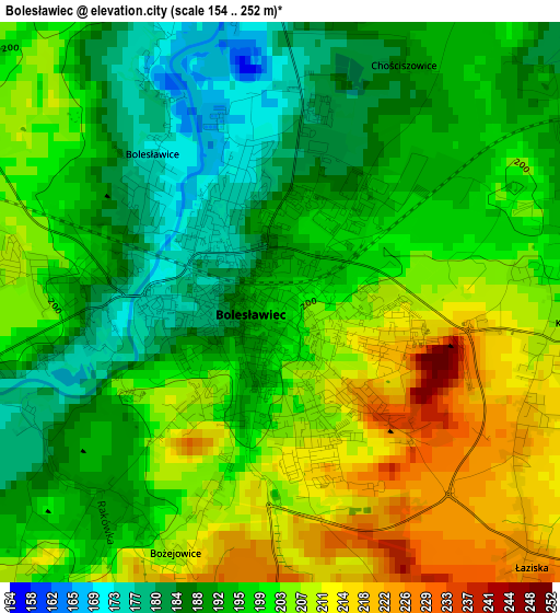
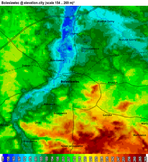
Below is the Elevation map of Bolesławiec, which displays elevation range with different colors. Scale of the first map is from 154 to 252 m (505 to 827 ft) with average elevation of 198.3 meters (=651 ft) [note 1]
These maps also provides idea of topography and contour of this city, they are displayed at different zoom levels. More info about maps, scale and edge coordinates you can find below images.
| \ | Map #1 | Map #2 | Topo.Map |
| Scale [m] | 154..252 m | 154..269 m | × |
| Scale [ft] | 505..827 ft | 505..883 ft | × |
| Average | 198.3 m = 651 ft | 205.6 m = 675 ft | × |
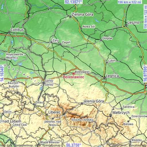
| Width | 6.11 km = 3.8 mi | 12.23 km = 7.6 mi | 195.7 km = 121.6 mi |
| Height | 6.11 km = 3.8 mi | 12.23 km = 7.6 mi | 195.7 km = 121.6 mi |
| ↑Max Latitude | 51.29167° | 51.319143° | 52.13571° |
| Latitude at center | 51.26418° | 51.26418° | 51.26418° |
| ↓Min Latitude | 51.236674° | 51.209151° | 50.3758° |
| ← Min Longitude | 15.525755° | 15.481809° | 14.16345° |
| Longitude center | 15.5697° | 15.5697° | 15.5697° |
| →Max Longitude | 15.613645° | 15.657591° | 16.97595° |
Nearby cities:
Cities around Bolesławiec sort by population:
• Lubań elevation 221 m
25.4 km,  230°
230°
• Chojnów 153 m
25.5 km,  87°
87°
• Lwówek Śląski 213 m
17.1 km,  176°
176°
• Gryfów Śląski 322 m
28 km,  201°
201°
• Olszyna 245 m
25.9 km,  212°
212°
• Nowogrodziec 207 m
14.2 km,  237°
237°
• Węgliniec 192 m
23.8 km,  276°
276°
• Gromadka 148 m
17.3 km,  51°
51°
• Lubomierz 360 m
28.3 km,  188°
188°
• Zagrodno 182 m
22.1 km,  111°
111°
• Pisarzowice 267 m
27.1 km, 240°
• Olszanica 214 m
17.3 km, 111°
Multilingual:
 En español:
Bolesławiec elevación 197 m.
 En France:
Bolesławiec élévation 197 m.


Sources and notes:
- [note 1] Map square and city borders are not equal. Map elevation data is calculated only from area inside that square.
- [src 1] Elevation data from geonames database provided with same terms of usage.
- [src 2] The elevation map of Bolesławiec is generated using elevation data from NASA's 3 arcsec (90m) resolution SRTM data.
- [src 3] Base (background) map © OpenStreetMap contributors tiles are generated by Geofabrik and OpenTopoMap.
Copyright & License:
This Bolesławiec Elevation Map is licensed under CC BY-SA. You may reuse any part from this page, if you give a proper credit by linking to this URL:
 More info on terms of use page.