Lubań elevation
Lubań (Lower Silesia, Powiat lubański), Poland elevation is 221 meters and Lubań elevation in feet is 725 ft above sea level [src 1]. Lubań is a seat of a third-order administrative division (feature code) with elevation that is 30 meters (98 ft) bigger than average city elevation in Poland.
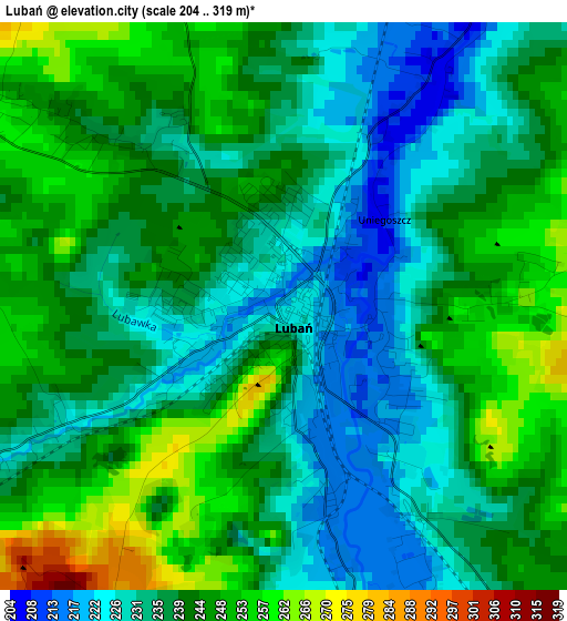
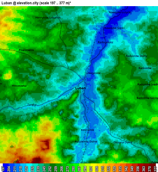
Below is the Elevation map of Lubań, which displays elevation range with different colors. Scale of the first map is from 204 to 319 m (669 to 1047 ft) with average elevation of 239.5 meters (=786 ft) [note 1]
These maps also provides idea of topography and contour of this city, they are displayed at different zoom levels. More info about maps, scale and edge coordinates you can find below images.
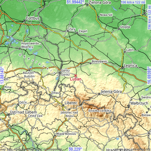
| \ | Map #1 | Map #2 | Topo.Map |
| Scale [m] | 204..319 m | 197..377 m | × |
| Scale [ft] | 669..1047 ft | 646..1237 ft | × |
| Average | 239.5 m = 786 ft | 255.1 m = 837 ft | × |
| Width | 6.13 km = 3.8 mi | 12.27 km = 7.6 mi | 196.3 km = 122 mi |
| Height | 6.13 km = 3.8 mi | 12.27 km = 7.6 mi | 196.3 km = 122 mi |
| ↑Max Latitude | 51.147716° | 51.175275° | 51.99442° |
| Latitude at center | 51.12014° | 51.12014° | 51.12014° |
| ↓Min Latitude | 51.092548° | 51.064939° | 50.229° |
| ← Min Longitude | 15.243735° | 15.199789° | 13.88143° |
| Longitude center | 15.28768° | 15.28768° | 15.28768° |
| →Max Longitude | 15.331625° | 15.375571° | 16.69393° |
Nearby cities:
Cities around Lubań sort by population:
• Gryfów Śląski elevation 322 m
13.6 km,  137°
137°
• Olszyna 245 m
8.3 km,  134°
134°
• Leśna 235 m
10.8 km,  188°
188°
• Zawidów 235 m
19 km,  236°
236°
• Mirsk 351 m
18 km,  157°
157°
• Nowogrodziec 207 m
11.4 km,  42°
42°
• Węgliniec 192 m
19.1 km,  347°
347°
• Sulików 219 m
16.1 km,  252°
252°
• Lubomierz 360 m
19.6 km, 127°
• Siekierczyn 260 m
6.6 km,  271°
271°
• Pisarzowice 267 m
4.8 km,  304°
304°
• Łagów 196 m
17.5 km,  284°
284°
Multilingual:
 En español:
Lubań elevación 221 m.
 En France:
Lubań élévation 221 m.


Sources and notes:
- [note 1] Map square and city borders are not equal. Map elevation data is calculated only from area inside that square.
- [src 1] Elevation data from geonames database provided with same terms of usage.
- [src 2] The elevation map of Lubań is generated using elevation data from NASA's 3 arcsec (90m) resolution SRTM data.
- [src 3] Base (background) map © OpenStreetMap contributors tiles are generated by Geofabrik and OpenTopoMap.
Copyright & License:
This Lubań Elevation Map is licensed under CC BY-SA. You may reuse any part from this page, if you give a proper credit by linking to this URL:
 More info on terms of use page.