Gromadka elevation
Gromadka (Lower Silesia, Powiat bolesławiecki), Poland elevation is 148 meters and Gromadka elevation in feet is 486 ft above sea level [src 1]. Gromadka is a seat of a third-order administrative division (feature code) with elevation that is 43 meters (141 ft) smaller than average city elevation in Poland.
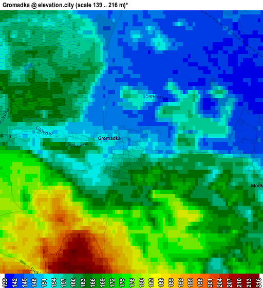
Below is the Elevation map of Gromadka, which displays elevation range with different colors. Scale of the first map is from 139 to 216 m (456 to 709 ft) with average elevation of 161.4 meters (=530 ft) [note 1]
These maps also provides idea of topography and contour of this city, they are displayed at different zoom levels. More info about maps, scale and edge coordinates you can find below images.
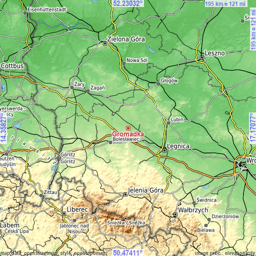
| \ | Map #1 | Topo.Map |
| Scale [m] | 139..216 m | × |
| Scale [ft] | 456..709 ft | × |
| Average | 161.4 m = 530 ft | × |
| Width | 6.1 km = 3.8 mi | 195.3 km = 121.4 mi |
| Height | 6.1 km = 3.8 mi | 195.3 km = 121.4 mi |
| ↑Max Latitude | 51.388062° | 52.23032° |
| Latitude at center | 51.36063° | 51.36063° |
| ↓Min Latitude | 51.333182° | 50.47411° |
| ← Min Longitude | 15.720575° | 14.35827° |
| Longitude center | 15.76452° | 15.76452° |
| →Max Longitude | 15.808465° | 17.17077° |
Nearby cities:
Cities around Gromadka sort by population:
• Bolesławiec elevation 197 m
17.3 km,  231°
231°
• Polkowice 179 m
26.6 km,  53°
53°
• Złotoryja 211 m
28.2 km,  157°
157°
• Chojnów 153 m
15.4 km,  128°
128°
• Szprotawa 130 m
27.7 km,  325°
325°
• Lwówek Śląski 213 m
30.4 km,  204°
204°
• Chocianów 148 m
11.5 km,  55°
55°
• Przemków 156 m
18.4 km,  6°
6°
• Radwanice 139 m
26.6 km,  28°
28°
• Miłkowice 125 m
24.4 km,  118°
118°
• Zagrodno 182 m
20.1 km, 159°
• Olszanica 214 m
17.3 km,  171°
171°
Multilingual:
 En español:
Gromadka elevación 148 m.
 En France:
Gromadka élévation 148 m.
 Auf Deutsch:
Gromadka höhe über dem Meeresspiegel ist 148 m.

Sources and notes:
- [note 1] Map square and city borders are not equal. Map elevation data is calculated only from area inside that square.
- [src 1] Elevation data from geonames database provided with same terms of usage.
- [src 2] The elevation map of Gromadka is generated using elevation data from NASA's 3 arcsec (90m) resolution SRTM data.
- [src 3] Base (background) map © OpenStreetMap contributors tiles are generated by Geofabrik and OpenTopoMap.
Copyright & License:
This Gromadka Elevation Map is licensed under CC BY-SA. You may reuse any part from this page, if you give a proper credit by linking to this URL:
 More info on terms of use page.