Rawalpindi elevation
Rawalpindi (Punjab, Rawalpindi District), Pakistan elevation is 499 meters and Rawalpindi elevation in feet is 1637 ft above sea level [src 1]. Rawalpindi is a seat of a second-order administrative division (feature code) with elevation that is 153 meters (502 ft) bigger than average city elevation in Pakistan.
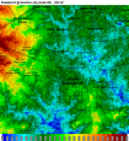
Below is the Elevation map of Rawalpindi, which displays elevation range with different colors. Scale of the first map is from 482 to 552 m (1581 to 1811 ft) with average elevation of 507.3 meters (=1664 ft) [note 1]
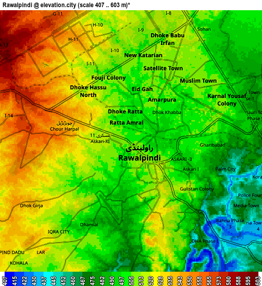
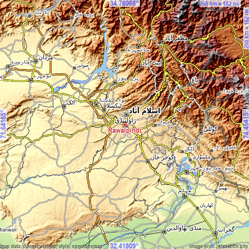
These maps also provides idea of topography and contour of this city, they are displayed at different zoom levels. More info about maps, scale and edge coordinates you can find below images.
| \ | Map #1 | Map #2 | Topo.Map |
| Scale [m] | 482..552 m | 407..603 m | × |
| Scale [ft] | 1581..1811 ft | 1335..1978 ft | × |
| Average | 507.3 m = 1664 ft | 508.7 m = 1669 ft | × |
| Width | 8.14 km = 5.1 mi | 16.28 km = 10.1 mi | 260.5 km = 161.9 mi |
| Height | 8.14 km = 5.1 mi | 16.28 km = 10.1 mi | 260.5 km = 161.9 mi |
| ↑Max Latitude | 33.633926° | 33.670507° | 34.76066° |
| Latitude at center | 33.59733° | 33.59733° | 33.59733° |
| ↓Min Latitude | 33.560718° | 33.524091° | 32.41809° |
| ← Min Longitude | 73.003955° | 72.960009° | 71.64165° |
| Longitude center | 73.0479° | 73.0479° | 73.0479° |
| →Max Longitude | 73.091845° | 73.135791° | 74.45415° |
Nearby cities:
Cities around Rawalpindi sort by population:
• Islamabad elevation 579 m
13.8 km,  358°
358°
• Gujar Khan 461 m
45 km,  148°
148°
• Haripur 537 m
45.7 km,  346°
346°
• Kamra 1006 m
46.1 km,  68°
68°
• Havelian 863 m
51.8 km,  11°
11°
• Khalabat 439 m
53.5 km,  344°
344°
• Hazro City 320 m
62.1 km,  304°
304°
• Murree 2098 m
46.9 km,  42°
42°
• Kahuta 610 m
31.4 km,  91°
91°
• Daultala 547 m
45.8 km,  169°
169°
• Sanjwal 357 m
59.7 km,  287°
287°
• Nazir Town 495 m
51.8 km,  128°
128°
Multilingual:
 En español:
Rawalpindi elevación 499 m.
 En France:
Rawalpindi élévation 499 m.
 Auf Deutsch:
Rawalpindi höhe über dem Meeresspiegel ist 499 m.

Sources and notes:
- [note 1] Map square and city borders are not equal. Map elevation data is calculated only from area inside that square.
- [src 1] Elevation data from geonames database provided with same terms of usage.
- [src 2] The elevation map of Rawalpindi is generated using elevation data from NASA's 3 arcsec (90m) resolution SRTM data.
- [src 3] Base (background) map © OpenStreetMap contributors tiles are generated by Geofabrik and OpenTopoMap.
Copyright & License:
This Rawalpindi Elevation Map is licensed under CC BY-SA. You may reuse any part from this page, if you give a proper credit by linking to this URL:
 More info on terms of use page.