Ilo elevation
Ilo (Moquegua, Provincia de Ilo), Peru elevation is 95 meters and Ilo elevation in feet is 312 ft above sea level [src 1]. Ilo is a seat of a third-order administrative division (feature code) with elevation that is 2226 meters (7303 ft) smaller than average city elevation in Peru.
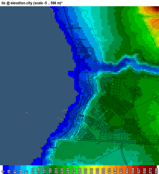
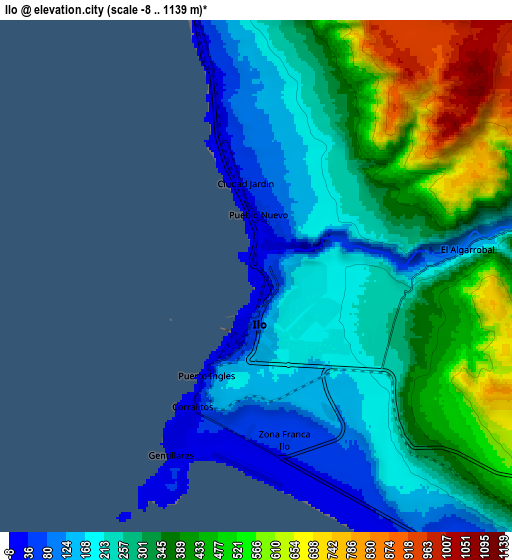
Below is the Elevation map of Ilo, which displays elevation range with different colors. Scale of the first map is from -5 to 596 m (-16 to 1955 ft) with average elevation of 148.8 meters (=488 ft) [note 1]
These maps also provides idea of topography and contour of this city, they are displayed at different zoom levels. More info about maps, scale and edge coordinates you can find below images.
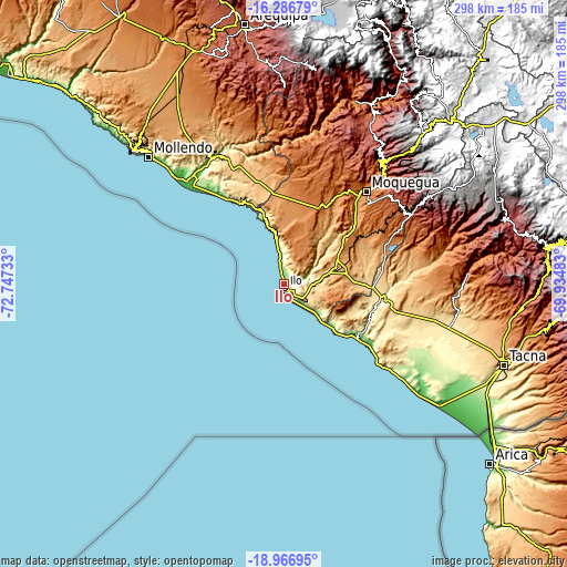
| \ | Map #1 | Map #2 | Topo.Map |
| Scale [m] | -5..596 m | -8..1139 m | × |
| Scale [ft] | -16..1955 ft | -26..3737 ft | × |
| Average | 148.8 m = 488 ft | 321 m = 1053 ft | × |
| Width | 9.31 km = 5.8 mi | 18.63 km = 11.6 mi | 298 km = 185.2 mi |
| Height | 9.31 km = 5.8 mi | 18.63 km = 11.6 mi | 298 km = 185.2 mi |
| ↑Max Latitude | -17.589964° | -17.548069° | -16.28679° |
| Latitude at center | -17.63185° | -17.63185° | -17.63185° |
| ↓Min Latitude | -17.673726° | -17.715592° | -18.96695° |
| ← Min Longitude | -71.385025° | -71.428971° | -72.74733° |
| Longitude center | -71.34108° | -71.34108° | -71.34108° |
| →Max Longitude | -71.297135° | -71.253189° | -69.93483° |
Nearby cities:
Cities around Ilo sort by population:
• Moquegua elevation 1445 m
64.6 km,  41°
41°
• Ilabaya 1386 m
90.8 km,  75°
75°
• Cocachacra 82 m
74.9 km,  323°
323°
• Pacocha 83 m
1.6 km,  194°
194°
• Torata 2213 m
81.2 km, 40°
• Punta de Bombón 25 m
70.1 km, 316°
• Las Yaras 390 m
86.4 km,  107°
107°
• La Curva 17 m
74.2 km, 316°
• Samegua 1576 m
68.8 km, 43°
• Locumba 598 m
61.3 km,  88°
88°
• El Algarrobal 125 m
7.8 km, 82°
• Pueblo Nuevo 34 m
1.9 km,  8°
8°
Multilingual:
 En español:
Ilo elevación 95 m.
 En France:
Ilo élévation 95 m.


Sources and notes:
- [note 1] Map square and city borders are not equal. Map elevation data is calculated only from area inside that square.
- [src 1] Elevation data from geonames database provided with same terms of usage.
- [src 2] The elevation map of Ilo is generated using elevation data from NASA's 3 arcsec (90m) resolution SRTM data.
- [src 3] Base (background) map © OpenStreetMap contributors tiles are generated by Geofabrik and OpenTopoMap.
Copyright & License:
This Ilo Elevation Map is licensed under CC BY-SA. You may reuse any part from this page, if you give a proper credit by linking to this URL:
 More info on terms of use page.