Torata elevation
Torata (Moquegua, Provincia de Mariscal Nieto), Peru elevation is 2213 meters and Torata elevation in feet is 7260 ft above sea level [src 1]. Torata is a seat of a third-order administrative division (feature code) with elevation that is 108 meters (354 ft) smaller than average city elevation in Peru.
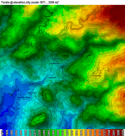
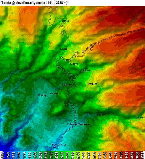
Below is the Elevation map of Torata, which displays elevation range with different colors. Scale of the first map is from 1871 to 3355 m (6138 to 11007 ft) with average elevation of 2447.8 meters (=8031 ft) [note 1]
These maps also provides idea of topography and contour of this city, they are displayed at different zoom levels. More info about maps, scale and edge coordinates you can find below images.
| \ | Map #1 | Map #2 | Topo.Map |
| Scale [m] | 1871..3355 m | 1441..3738 m | × |
| Scale [ft] | 6138..11007 ft | 4728..12264 ft | × |
| Average | 2447.8 m = 8031 ft | 2611.5 m = 8568 ft | × |
| Width | 9.34 km = 5.8 mi | 18.68 km = 11.6 mi | 298.9 km = 185.7 mi |
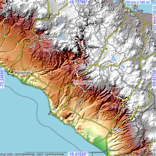
| Height | 9.34 km = 5.8 mi | 18.68 km = 11.6 mi | 298.9 km = 185.7 mi |
| ↑Max Latitude | -17.034927° | -16.992905° | -15.72796° |
| Latitude at center | -17.07694° | -17.07694° | -17.07694° |
| ↓Min Latitude | -17.118943° | -17.160937° | -18.41624° |
| ← Min Longitude | -70.887275° | -70.931221° | -72.24958° |
| Longitude center | -70.84333° | -70.84333° | -70.84333° |
| →Max Longitude | -70.799385° | -70.755439° | -69.43708° |
Nearby cities:
Cities around Torata sort by population:
• Moquegua elevation 1445 m
16.7 km,  216°
216°
• Ilabaya 1386 m
51.9 km,  137°
137°
• Pujocucho 4062 m
53 km,  99°
99°
• Camilaca 3285 m
53.8 km,  113°
113°
• Coalaque 2276 m
51.1 km,  338°
338°
• La Capilla 1842 m
50.4 km,  314°
314°
• Omate 2036 m
46.2 km, 341°
• Cuchumbaya 3125 m
40.1 km,  25°
25°
• Calacoa 2914 m
39.4 km,  22°
22°
• Quinistaquillas 1767 m
36.6 km,  353°
353°
• Carumas 3552 m
31.9 km, 24°
• Samegua 1576 m
12.8 km,  207°
207°
Multilingual:
 En español:
Torata elevación 2213 m.
 En France:
Torata élévation 2213 m.


Sources and notes:
- [note 1] Map square and city borders are not equal. Map elevation data is calculated only from area inside that square.
- [src 1] Elevation data from geonames database provided with same terms of usage.
- [src 2] The elevation map of Torata is generated using elevation data from NASA's 3 arcsec (90m) resolution SRTM data.
- [src 3] Base (background) map © OpenStreetMap contributors tiles are generated by Geofabrik and OpenTopoMap.
Copyright & License:
This Torata Elevation Map is licensed under CC BY-SA. You may reuse any part from this page, if you give a proper credit by linking to this URL:
 More info on terms of use page.