Pujocucho elevation
Pujocucho (Tacna, Candarave), Peru elevation is 4062 meters and Pujocucho elevation in feet is 13327 ft above sea level [src 1]. Pujocucho is a populated place (feature code) with elevation that is 1741 meters (5712 ft) bigger than average city elevation in Peru.
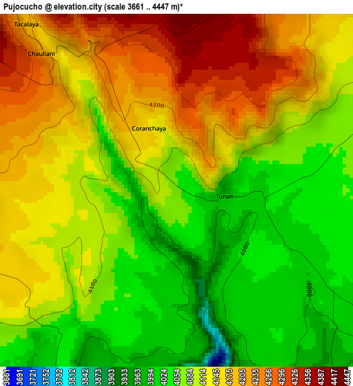
Below is the Elevation map of Pujocucho, which displays elevation range with different colors. Scale of the first map is from 3661 to 4447 m (12011 to 14590 ft) with average elevation of 4115.4 meters (=13502 ft) [note 1]
These maps also provides idea of topography and contour of this city, they are displayed at different zoom levels. More info about maps, scale and edge coordinates you can find below images.
| \ | Map #1 | Map #2 | Topo.Map |
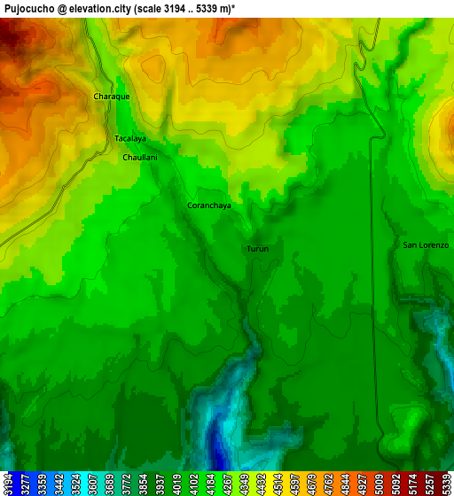
| Scale [m] | 3661..4447 m | 3194..5339 m | × |
| Scale [ft] | 12011..14590 ft | 10479..17516 ft | × |
| Average | 4115.4 m = 13502 ft | 4173.9 m = 13694 ft | × |
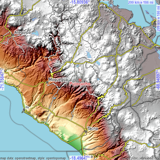
| Width | 9.34 km = 5.8 mi | 18.68 km = 11.6 mi | 298.8 km = 185.7 mi |
| Height | 9.34 km = 5.8 mi | 18.68 km = 11.6 mi | 298.8 km = 185.7 mi |
| ↑Max Latitude | -17.115786° | -17.073782° | -15.80936° |
| Latitude at center | -17.15778° | -17.15778° | -17.15778° |
| ↓Min Latitude | -17.199765° | -17.24174° | -18.49647° |
| ← Min Longitude | -70.396165° | -70.440111° | -71.75847° |
| Longitude center | -70.35222° | -70.35222° | -70.35222° |
| →Max Longitude | -70.308275° | -70.264329° | -68.94597° |
Nearby cities:
Cities around Pujocucho sort by population:
• Ilabaya elevation 1386 m
33.9 km,  210°
210°
• Chuquitira 4266 m
35.9 km,  113°
113°
• Candarave 3445 m
16.4 km,  138°
138°
• Quilahuani 3215 m
20.4 km,  150°
150°
• Totoral 1979 m
27.7 km,  182°
182°
• Chipispaya 1940 m
40.4 km,  159°
159°
• Sitajara 3167 m
33.6 km, 136°
• Susapaya 3386 m
31.9 km,  132°
132°
• Curibaya 2402 m
25.1 km, 175°
• Huanuara 3244 m
17.7 km,  169°
169°
• Cairani 3394 m
14.3 km, 184°
• Camilaca 3285 m
12.6 km,  192°
192°
Multilingual:
 En español:
Pujocucho elevación 4062 m.
 En France:
Pujocucho élévation 4062 m.
 Auf Deutsch:
Pujocucho höhe über dem Meeresspiegel ist 4062 m.

Sources and notes:
- [note 1] Map square and city borders are not equal. Map elevation data is calculated only from area inside that square.
- [src 1] Elevation data from geonames database provided with same terms of usage.
- [src 2] The elevation map of Pujocucho is generated using elevation data from NASA's 3 arcsec (90m) resolution SRTM data.
- [src 3] Base (background) map © OpenStreetMap contributors tiles are generated by Geofabrik and OpenTopoMap.
Copyright & License:
This Pujocucho Elevation Map is licensed under CC BY-SA. You may reuse any part from this page, if you give a proper credit by linking to this URL:
 More info on terms of use page.