Oyotún elevation
Oyotún (Lambayeque, Provincia de Chiclayo), Peru elevation is 207 meters and Oyotún elevation in feet is 679 ft above sea level [src 1]. Oyotún is a populated place (feature code) with elevation that is 2114 meters (6936 ft) smaller than average city elevation in Peru.
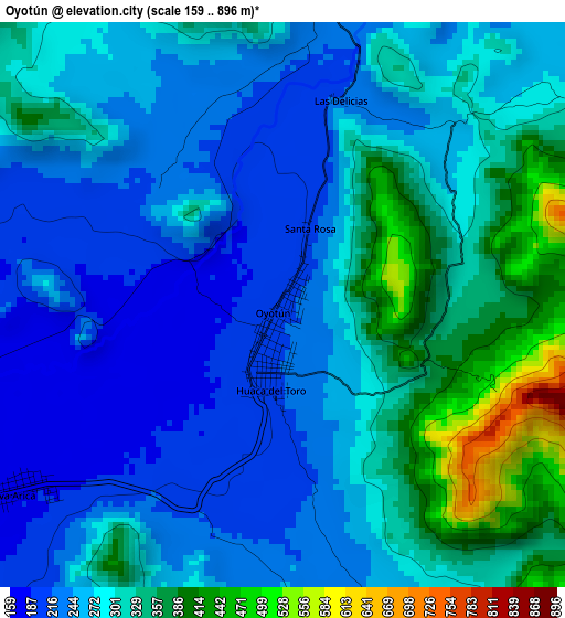
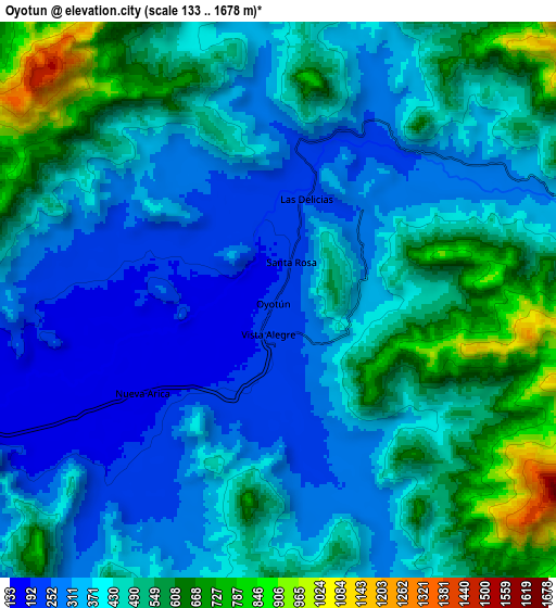
Below is the Elevation map of Oyotún, which displays elevation range with different colors. Scale of the first map is from 159 to 896 m (522 to 2940 ft) with average elevation of 284.3 meters (=933 ft) [note 1]
These maps also provides idea of topography and contour of this city, they are displayed at different zoom levels. More info about maps, scale and edge coordinates you can find below images.
| \ | Map #1 | Map #2 | Topo.Map |
| Scale [m] | 159..896 m | 133..1678 m | × |
| Scale [ft] | 522..2940 ft | 436..5505 ft | × |
| Average | 284.3 m = 933 ft | 430.9 m = 1414 ft | × |
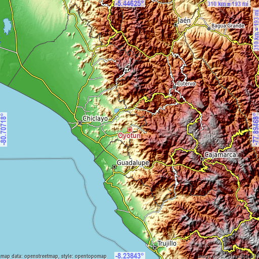
| Width | 9.7 km = 6 mi | 19.41 km = 12.1 mi | 310.5 km = 192.9 mi |
| Height | 9.7 km = 6 mi | 19.41 km = 12.1 mi | 310.5 km = 192.9 mi |
| ↑Max Latitude | -6.800746° | -6.757108° | -5.44625° |
| Latitude at center | -6.84438° | -6.84438° | -6.84438° |
| ↓Min Latitude | -6.88801° | -6.931636° | -8.23843° |
| ← Min Longitude | -79.344875° | -79.388821° | -80.70718° |
| Longitude center | -79.30093° | -79.30093° | -79.30093° |
| →Max Longitude | -79.256985° | -79.213039° | -77.89468° |
Nearby cities:
Cities around Oyotún sort by population:
• Saña elevation 65 m
32.1 km,  255°
255°
• Chongoyape 214 m
24.7 km,  336°
336°
• Llama 2096 m
41.8 km,  28°
28°
• Sexi 2474 m
41.6 km,  41°
41°
• El Prado 2897 m
39.3 km,  122°
122°
• Mocupe 34 m
38.7 km,  245°
245°
• Catache 1343 m
35 km,  57°
57°
• San Gregorio 1574 m
31.9 km,  135°
135°
• Niepos 2452 m
21.1 km, 115°
• La Florida 1041 m
20.1 km,  98°
98°
• Nanchoc 395 m
14.4 km,  153°
153°
• Nueva Arica 174 m
5.6 km,  235°
235°
Multilingual:
 En español:
Oyotún elevación 207 m.
 En France:
Oyotún élévation 207 m.


Sources and notes:
- [note 1] Map square and city borders are not equal. Map elevation data is calculated only from area inside that square.
- [src 1] Elevation data from geonames database provided with same terms of usage.
- [src 2] The elevation map of Oyotún is generated using elevation data from NASA's 3 arcsec (90m) resolution SRTM data.
- [src 3] Base (background) map © OpenStreetMap contributors tiles are generated by Geofabrik and OpenTopoMap.
Copyright & License:
This Oyotún Elevation Map is licensed under CC BY-SA. You may reuse any part from this page, if you give a proper credit by linking to this URL:
 More info on terms of use page.