Aku elevation
Aku (Enugu, Igbo-Etiti), Nigeria elevation is 299 meters and Aku elevation in feet is 981 ft above sea level [src 1]. Aku is a populated place (feature code) with elevation that is 2 meters (7 ft) bigger than average city elevation in Nigeria.
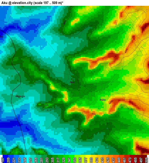
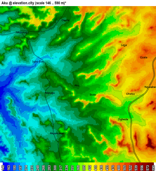
Below is the Elevation map of Aku, which displays elevation range with different colors. Scale of the first map is from 197 to 509 m (646 to 1670 ft) with average elevation of 308.1 meters (=1011 ft) [note 1]
These maps also provides idea of topography and contour of this city, they are displayed at different zoom levels. More info about maps, scale and edge coordinates you can find below images.
| \ | Map #1 | Map #2 | Topo.Map |
| Scale [m] | 197..509 m | 146..590 m | × |
| Scale [ft] | 646..1670 ft | 479..1936 ft | × |
| Average | 308.1 m = 1011 ft | 329.4 m = 1081 ft | × |
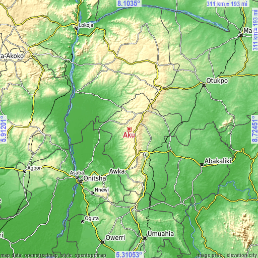
| Width | 9.71 km = 6 mi | 19.41 km = 12.1 mi | 310.5 km = 192.9 mi |
| Height | 9.71 km = 6 mi | 19.41 km = 12.1 mi | 310.6 km = 193 mi |
| ↑Max Latitude | 6.752662° | 6.796301° | 8.1035° |
| Latitude at center | 6.70902° | 6.70902° | 6.70902° |
| ↓Min Latitude | 6.665374° | 6.621723° | 5.31053° |
| ← Min Longitude | 7.274315° | 7.230369° | 5.91201° |
| Longitude center | 7.31826° | 7.31826° | 7.31826° |
| →Max Longitude | 7.362205° | 7.406151° | 8.72451° |
Nearby cities:
Cities around Aku sort by population:
• Enugu elevation 192 m
35.8 km,  146°
146°
• Nsukka 423 m
18.6 km,  27°
27°
• Enugu-Ezike 376 m
34 km, 26°
• Opi 496 m
15.1 km,  57°
57°
• Adoru 90 m
34.4 km,  330°
330°
• Adani 59 m
34.1 km,  275°
275°
• Aguobu-Owa 200 m
37.8 km,  187°
187°
• Umulona 71 m
33.1 km,  227°
227°
• Obollo-Afor 484 m
31.9 km,  43°
43°
• Nkwo Nike 173 m
30.7 km,  136°
136°
• Ibagwa-Aka 337 m
24.9 km,  20°
20°
• Ogbede 361 m
7.4 km,  122°
122°
Multilingual:
 En español:
Aku elevación 299 m.
 En France:
Aku élévation 299 m.


Sources and notes:
- [note 1] Map square and city borders are not equal. Map elevation data is calculated only from area inside that square.
- [src 1] Elevation data from geonames database provided with same terms of usage.
- [src 2] The elevation map of Aku is generated using elevation data from NASA's 3 arcsec (90m) resolution SRTM data.
- [src 3] Base (background) map © OpenStreetMap contributors tiles are generated by Geofabrik and OpenTopoMap.
Copyright & License:
This Aku Elevation Map is licensed under CC BY-SA. You may reuse any part from this page, if you give a proper credit by linking to this URL:
 More info on terms of use page.