Adani elevation
Adani (Enugu, Uzo-Uwani), Nigeria elevation is 59 meters and Adani elevation in feet is 194 ft above sea level [src 1]. Adani is a populated place (feature code) with elevation that is 238 meters (781 ft) smaller than average city elevation in Nigeria.
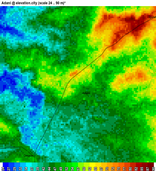
Below is the Elevation map of Adani, which displays elevation range with different colors. Scale of the first map is from 24 to 90 m (79 to 295 ft) with average elevation of 49.1 meters (=161 ft) [note 1]
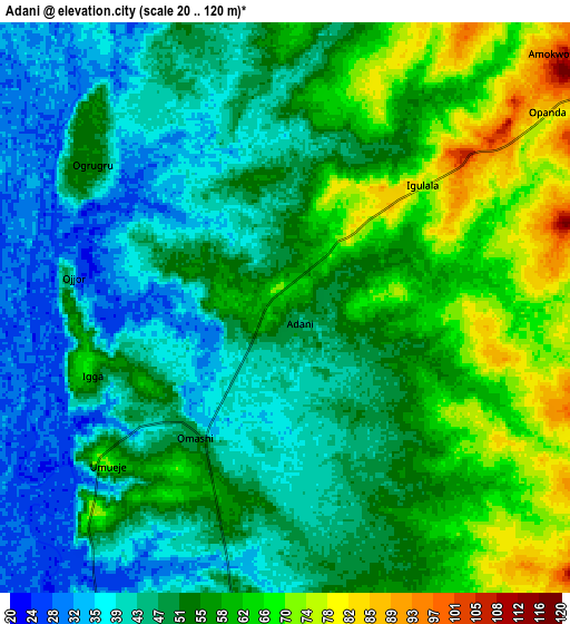
These maps also provides idea of topography and contour of this city, they are displayed at different zoom levels. More info about maps, scale and edge coordinates you can find below images.
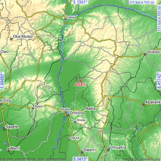
| \ | Map #1 | Map #2 | Topo.Map |
| Scale [m] | 24..90 m | 20..120 m | × |
| Scale [ft] | 79..295 ft | 66..394 ft | × |
| Average | 49.1 m = 161 ft | 51.9 m = 170 ft | × |
| Width | 9.7 km = 6 mi | 19.41 km = 12.1 mi | 310.5 km = 192.9 mi |
| Height | 9.71 km = 6 mi | 19.41 km = 12.1 mi | 310.6 km = 193 mi |
| ↑Max Latitude | 6.78335° | 6.826985° | 8.1341° |
| Latitude at center | 6.73971° | 6.73971° | 6.73971° |
| ↓Min Latitude | 6.696066° | 6.652419° | 5.3413° |
| ← Min Longitude | 6.967225° | 6.923279° | 5.60492° |
| Longitude center | 7.01117° | 7.01117° | 7.01117° |
| →Max Longitude | 7.055115° | 7.099061° | 8.41742° |
Nearby cities:
Cities around Adani sort by population:
• Nsukka elevation 423 m
44.4 km,  72°
72°
• Aku 299 m
34.1 km,  95°
95°
• Opi 496 m
46.8 km,  84°
84°
• Ogurugu 54 m
8.5 km,  307°
307°
• Adoru 90 m
31.2 km,  32°
32°
• Illushi 32 m
42.9 km,  259°
259°
• Achalla 84 m
45.1 km,  183°
183°
• Nzam 27 m
44.6 km,  224°
224°
• Ogbede 361 m
40.8 km, 100°
• Onyedega 32 m
40.3 km,  293°
293°
• Anaku 68 m
31.5 km,  196°
196°
• Umulona 71 m
27.5 km,  159°
159°
Multilingual:
 En español:
Adani elevación 59 m.
 En France:
Adani élévation 59 m.


Sources and notes:
- [note 1] Map square and city borders are not equal. Map elevation data is calculated only from area inside that square.
- [src 1] Elevation data from geonames database provided with same terms of usage.
- [src 2] The elevation map of Adani is generated using elevation data from NASA's 3 arcsec (90m) resolution SRTM data.
- [src 3] Base (background) map © OpenStreetMap contributors tiles are generated by Geofabrik and OpenTopoMap.
Copyright & License:
This Adani Elevation Map is licensed under CC BY-SA. You may reuse any part from this page, if you give a proper credit by linking to this URL:
 More info on terms of use page.