Adoru elevation
Adoru (Kogi, Igalamela-Odolu), Nigeria elevation is 90 meters and Adoru elevation in feet is 295 ft above sea level [src 1]. Adoru is a populated place (feature code) with elevation that is 207 meters (679 ft) smaller than average city elevation in Nigeria.
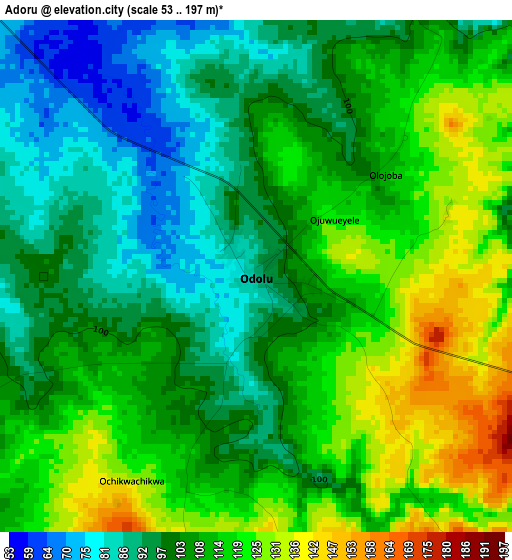
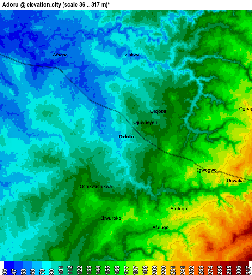
Below is the Elevation map of Adoru, which displays elevation range with different colors. Scale of the first map is from 53 to 197 m (174 to 646 ft) with average elevation of 107.4 meters (=352 ft) [note 1]
These maps also provides idea of topography and contour of this city, they are displayed at different zoom levels. More info about maps, scale and edge coordinates you can find below images.
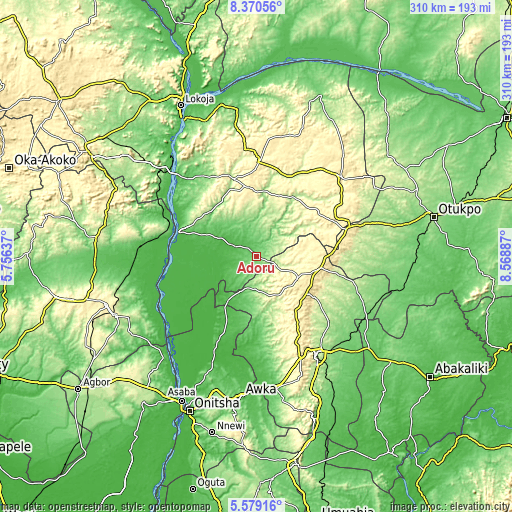
| \ | Map #1 | Map #2 | Topo.Map |
| Scale [m] | 53..197 m | 36..317 m | × |
| Scale [ft] | 174..646 ft | 118..1040 ft | × |
| Average | 107.4 m = 352 ft | 121.7 m = 399 ft | × |
| Width | 9.7 km = 6 mi | 19.4 km = 12.1 mi | 310.4 km = 192.9 mi |
| Height | 9.7 km = 6 mi | 19.4 km = 12.1 mi | 310.4 km = 192.9 mi |
| ↑Max Latitude | 7.020558° | 7.064172° | 8.37056° |
| Latitude at center | 6.97694° | 6.97694° | 6.97694° |
| ↓Min Latitude | 6.933318° | 6.889692° | 5.57916° |
| ← Min Longitude | 7.118675° | 7.074729° | 5.75637° |
| Longitude center | 7.16262° | 7.16262° | 7.16262° |
| →Max Longitude | 7.206565° | 7.250511° | 8.56887° |
Nearby cities:
Cities around Adoru sort by population:
• Nsukka elevation 423 m
28.9 km,  117°
117°
• Aku 299 m
34.4 km,  150°
150°
• Enugu-Ezike 376 m
32.3 km,  88°
88°
• Opi 496 m
36.9 km,  125°
125°
• Ete 338 m
34.4 km,  68°
68°
• Ogurugu 54 m
31.6 km,  227°
227°
• Adani 59 m
31.2 km,  212°
212°
• Ajaka 210 m
43.2 km,  300°
300°
• Ogbede 361 m
41.1 km, 145°
• Obollo-Afor 484 m
39.9 km,  99°
99°
• Ugwolawo 114 m
39.2 km,  317°
317°
• Ibagwa-Aka 337 m
26.9 km, 103°
Multilingual:
 En español:
Adoru elevación 90 m.
 En France:
Adoru élévation 90 m.


Sources and notes:
- [note 1] Map square and city borders are not equal. Map elevation data is calculated only from area inside that square.
- [src 1] Elevation data from geonames database provided with same terms of usage.
- [src 2] The elevation map of Adoru is generated using elevation data from NASA's 3 arcsec (90m) resolution SRTM data.
- [src 3] Base (background) map © OpenStreetMap contributors tiles are generated by Geofabrik and OpenTopoMap.
Copyright & License:
This Adoru Elevation Map is licensed under CC BY-SA. You may reuse any part from this page, if you give a proper credit by linking to this URL:
 More info on terms of use page.