Lapai elevation
Lapai (Niger), Nigeria elevation is 169 meters and Lapai elevation in feet is 554 ft above sea level [src 1]. Lapai is a seat of a second-order administrative division (feature code) with elevation that is 128 meters (420 ft) smaller than average city elevation in Nigeria.
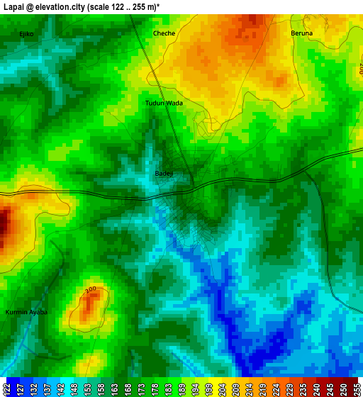
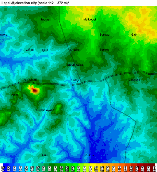
Below is the Elevation map of Lapai, which displays elevation range with different colors. Scale of the first map is from 122 to 255 m (400 to 837 ft) with average elevation of 172.9 meters (=567 ft) [note 1]
These maps also provides idea of topography and contour of this city, they are displayed at different zoom levels. More info about maps, scale and edge coordinates you can find below images.
| \ | Map #1 | Map #2 | Topo.Map |
| Scale [m] | 122..255 m | 112..372 m | × |
| Scale [ft] | 400..837 ft | 367..1220 ft | × |
| Average | 172.9 m = 567 ft | 181.2 m = 594 ft | × |
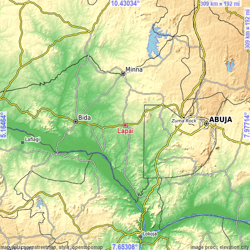
| Width | 9.65 km = 6 mi | 19.3 km = 12 mi | 308.8 km = 191.9 mi |
| Height | 9.65 km = 6 mi | 19.3 km = 12 mi | 308.8 km = 191.9 mi |
| ↑Max Latitude | 9.087786° | 9.131177° | 10.43034° |
| Latitude at center | 9.04439° | 9.04439° | 9.04439° |
| ↓Min Latitude | 9.000988° | 8.957582° | 7.65308° |
| ← Min Longitude | 6.526945° | 6.482999° | 5.16464° |
| Longitude center | 6.57089° | 6.57089° | 6.57089° |
| →Max Longitude | 6.614835° | 6.658781° | 7.97714° |
Nearby cities:
Cities around Lapai sort by population:
• Minna elevation 243 m
63.5 km,  357°
357°
• Bida 118 m
61.7 km,  273°
273°
• Suleja 421 m
68.5 km,  77°
77°
• Baro 94 m
50.5 km,  199°
199°
• Madala 416 m
70.9 km, 84°
• Agaie 120 m
28 km,  261°
261°
• Badeggi 82 m
47 km, 271°
• Kwali 197 m
52.3 km,  109°
109°
• Gwagwalada 186 m
57.2 km,  101°
101°
• Gawu Babangida 290 m
53.2 km,  60°
60°
• Paiko 312 m
44.2 km,  8°
8°
• Katcha 71 m
42.5 km,  222°
222°
Multilingual:
 En español:
Lapai elevación 169 m.
 En France:
Lapai élévation 169 m.


Sources and notes:
- [note 1] Map square and city borders are not equal. Map elevation data is calculated only from area inside that square.
- [src 1] Elevation data from geonames database provided with same terms of usage.
- [src 2] The elevation map of Lapai is generated using elevation data from NASA's 3 arcsec (90m) resolution SRTM data.
- [src 3] Base (background) map © OpenStreetMap contributors tiles are generated by Geofabrik and OpenTopoMap.
Copyright & License:
This Lapai Elevation Map is licensed under CC BY-SA. You may reuse any part from this page, if you give a proper credit by linking to this URL:
 More info on terms of use page.