Minna elevation
Minna (Niger, Chanchaga), Nigeria elevation is 243 meters and Minna elevation in feet is 797 ft above sea level [src 1]. Minna is a seat of a first-order administrative division (feature code) with elevation that is 54 meters (177 ft) smaller than average city elevation in Nigeria.
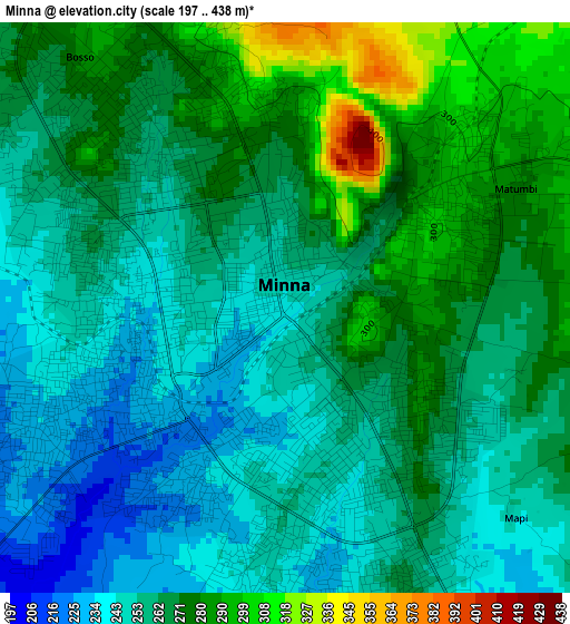
Below is the Elevation map of Minna, which displays elevation range with different colors. Scale of the first map is from 197 to 438 m (646 to 1437 ft) with average elevation of 262.6 meters (=862 ft) [note 1]
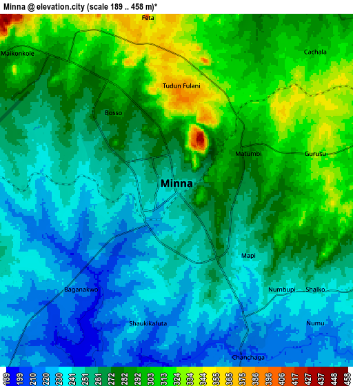
These maps also provides idea of topography and contour of this city, they are displayed at different zoom levels. More info about maps, scale and edge coordinates you can find below images.
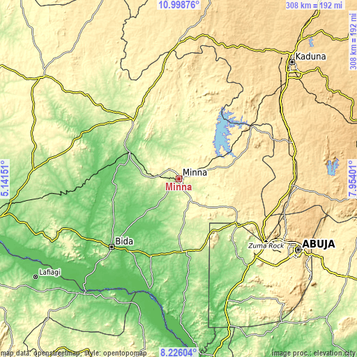
| \ | Map #1 | Map #2 | Topo.Map |
| Scale [m] | 197..438 m | 189..458 m | × |
| Scale [ft] | 646..1437 ft | 620..1503 ft | × |
| Average | 262.6 m = 862 ft | 267.8 m = 879 ft | × |
| Width | 9.64 km = 6 mi | 19.27 km = 12 mi | 308.3 km = 191.6 mi |
| Height | 9.64 km = 6 mi | 19.27 km = 12 mi | 308.3 km = 191.6 mi |
| ↑Max Latitude | 9.658565° | 9.701885° | 10.99876° |
| Latitude at center | 9.61524° | 9.61524° | 9.61524° |
| ↓Min Latitude | 9.571909° | 9.528573° | 8.22604° |
| ← Min Longitude | 6.503815° | 6.459869° | 5.14151° |
| Longitude center | 6.54776° | 6.54776° | 6.54776° |
| →Max Longitude | 6.591705° | 6.635651° | 7.95401° |
Nearby cities:
Cities around Minna sort by population:
• Zungeru elevation 125 m
48.3 km,  296°
296°
• Tegina 270 m
64 km,  322°
322°
• Lapai 169 m
63.5 km,  177°
177°
• Agaie 120 m
72 km,  200°
200°
• Badeggi 82 m
76.4 km,  215°
215°
• Kuta 318 m
33.3 km,  32°
32°
• Kagara 287 m
71.2 km,  333°
333°
• Lemu 139 m
62 km,  246°
246°
• Gawu Babangida 290 m
61.6 km,  127°
127°
• Wushishi 119 m
53.6 km,  283°
283°
• Paiko 312 m
22 km,  154°
154°
• Maikunkele 303 m
10.8 km, 315°
Multilingual:
 En español:
Minna elevación 243 m.
 En France:
Minna élévation 243 m.


Sources and notes:
- [note 1] Map square and city borders are not equal. Map elevation data is calculated only from area inside that square.
- [src 1] Elevation data from geonames database provided with same terms of usage.
- [src 2] The elevation map of Minna is generated using elevation data from NASA's 3 arcsec (90m) resolution SRTM data.
- [src 3] Base (background) map © OpenStreetMap contributors tiles are generated by Geofabrik and OpenTopoMap.
Copyright & License:
This Minna Elevation Map is licensed under CC BY-SA. You may reuse any part from this page, if you give a proper credit by linking to this URL:
 More info on terms of use page.