El Campanario y Oradel elevation
El Campanario y Oradel (Tamaulipas, Nuevo Laredo), Mexico elevation is 144 meters and El Campanario y Oradel elevation in feet is 472 ft above sea level [src 1]. El Campanario y Oradel is a populated place (feature code) with elevation that is 1170 meters (3839 ft) smaller than average city elevation in Mexico.
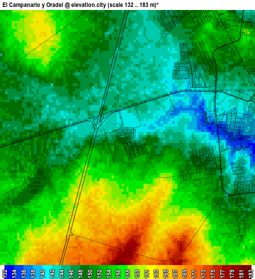
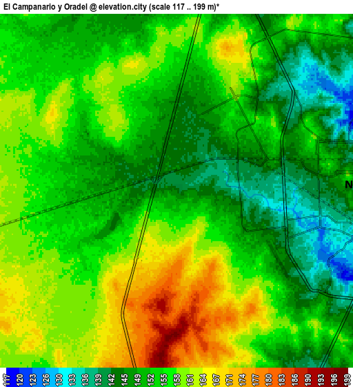
Below is the Elevation map of El Campanario y Oradel, which displays elevation range with different colors. Scale of the first map is from 132 to 183 m (433 to 600 ft) with average elevation of 151.7 meters (=498 ft) [note 1]
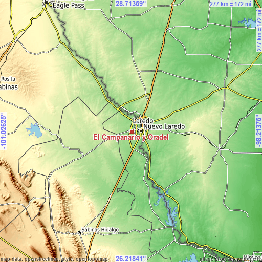
These maps also provides idea of topography and contour of this city, they are displayed at different zoom levels. More info about maps, scale and edge coordinates you can find below images.
| \ | Map #1 | Map #2 | Topo.Map |
| Scale [m] | 132..183 m | 117..199 m | × |
| Scale [ft] | 433..600 ft | 384..653 ft | × |
| Average | 151.7 m = 498 ft | 154.1 m = 506 ft | × |
| Width | 8.67 km = 5.4 mi | 17.34 km = 10.8 mi | 277.4 km = 172.4 mi |
| Height | 8.67 km = 5.4 mi | 17.34 km = 10.8 mi | 277.4 km = 172.4 mi |
| ↑Max Latitude | 27.512043° | 27.551011° | 28.71359° |
| Latitude at center | 27.47306° | 27.47306° | 27.47306° |
| ↓Min Latitude | 27.434064° | 27.395053° | 26.21841° |
| ← Min Longitude | -99.663945° | -99.707891° | -101.02625° |
| Longitude center | -99.62° | -99.62° | -99.62° |
| →Max Longitude | -99.576055° | -99.532109° | -98.21375° |
Nearby cities:
Cities around El Campanario y Oradel sort by population:
• Nuevo Laredo elevation 130 m
10.2 km,  87°
87°
• Ciudad Sabinas Hidalgo 308 m
121.3 km,  207°
207°
• Anáhuac 197 m
56.6 km,  243°
243°
• Lampazos de Naranjo 326 m
100.7 km, 240°
• Mier 75 m
124.9 km,  158°
158°
• Nueva Ciudad Guerrero 108 m
108.4 km, 159°
• Hidalgo 156 m
43.4 km,  324°
324°
• Candela 428 m
125.3 km, 235°
• Guerrero 222 m
119.3 km, 321°
• Juárez 278 m
110.1 km,  277°
277°
• Parás 148 m
108.6 km,  174°
174°
• Vallecillo 268 m
97.4 km,  201°
201°
Multilingual:
 En español:
El Campanario y Oradel elevación 144 m.
 En France:
El Campanario y Oradel élévation 144 m.
 Auf Deutsch:
El Campanario y Oradel höhe über dem Meeresspiegel ist 144 m.
 На русском:
El Campanario y Oradel высота над уровнем моря 144 м
Sources and notes:
- [note 1] Map square and city borders are not equal. Map elevation data is calculated only from area inside that square.
- [src 1] Elevation data from geonames database provided with same terms of usage.
- [src 2] The elevation map of El Campanario y Oradel is generated using elevation data from NASA's 3 arcsec (90m) resolution SRTM data.
- [src 3] Base (background) map © OpenStreetMap contributors tiles are generated by Geofabrik and OpenTopoMap.
Copyright & License:
This El Campanario y Oradel Elevation Map is licensed under CC BY-SA. You may reuse any part from this page, if you give a proper credit by linking to this URL:
 More info on terms of use page.