Mier elevation
Mier (Tamaulipas), Mexico elevation is 75 meters and Mier elevation in feet is 246 ft above sea level [src 1]. Mier is a seat of a second-order administrative division (feature code) with elevation that is 1239 meters (4065 ft) smaller than average city elevation in Mexico.
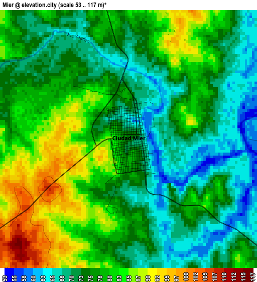
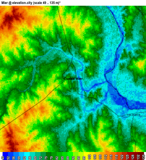
Below is the Elevation map of Mier, which displays elevation range with different colors. Scale of the first map is from 53 to 117 m (174 to 384 ft) with average elevation of 76.6 meters (=251 ft) [note 1]
These maps also provides idea of topography and contour of this city, they are displayed at different zoom levels. More info about maps, scale and edge coordinates you can find below images.
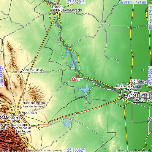
| \ | Map #1 | Map #2 | Topo.Map |
| Scale [m] | 53..117 m | 49..135 m | × |
| Scale [ft] | 174..384 ft | 161..443 ft | × |
| Average | 76.6 m = 251 ft | 82.6 m = 271 ft | × |
| Width | 8.75 km = 5.4 mi | 17.5 km = 10.9 mi | 280 km = 174 mi |
| Height | 8.75 km = 5.4 mi | 17.5 km = 10.9 mi | 280 km = 174 mi |
| ↑Max Latitude | 26.469035° | 26.508368° | 27.68201° |
| Latitude at center | 26.42969° | 26.42969° | 26.42969° |
| ↓Min Latitude | 26.390331° | 26.350959° | 25.16362° |
| ← Min Longitude | -99.196065° | -99.240011° | -100.55837° |
| Longitude center | -99.15212° | -99.15212° | -99.15212° |
| →Max Longitude | -99.108175° | -99.064229° | -97.74587° |
Nearby cities:
Cities around Mier sort by population:
• Ciudad Miguel Alemán elevation 59 m
12.8 km,  105°
105°
• Camargo 59 m
36.4 km,  122°
122°
• Ciudad Camargo 54 m
34.2 km, 112°
• Los Guerra 63 m
8.2 km, 118°
• Nueva Ciudad Guerrero 108 m
16.6 km,  332°
332°
• Comales 86 m
36 km,  140°
140°
• Valadeces 48 m
52.2 km, 114°
• Agualeguas 185 m
40.5 km,  251°
251°
• General Treviño 158 m
40.3 km,  235°
235°
• Doctor Coss 115 m
56.2 km,  183°
183°
• Parás 148 m
37.6 km,  282°
282°
• Los Aldamas 104 m
41.1 km,  186°
186°
Multilingual:
 En español:
Mier elevación 75 m.
 En France:
Mier élévation 75 m.


Sources and notes:
- [note 1] Map square and city borders are not equal. Map elevation data is calculated only from area inside that square.
- [src 1] Elevation data from geonames database provided with same terms of usage.
- [src 2] The elevation map of Mier is generated using elevation data from NASA's 3 arcsec (90m) resolution SRTM data.
- [src 3] Base (background) map © OpenStreetMap contributors tiles are generated by Geofabrik and OpenTopoMap.
Copyright & License:
This Mier Elevation Map is licensed under CC BY-SA. You may reuse any part from this page, if you give a proper credit by linking to this URL:
 More info on terms of use page.