Tafetán elevation
Tafetán (Michoacán, Tzitzio), Mexico elevation is 928 meters and Tafetán elevation in feet is 3045 ft above sea level [src 1]. Tafetán is a populated place (feature code) with elevation that is 386 meters (1266 ft) smaller than average city elevation in Mexico.
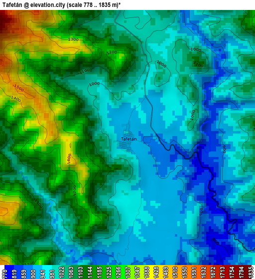
Below is the Elevation map of Tafetán, which displays elevation range with different colors. Scale of the first map is from 778 to 1835 m (2552 to 6020 ft) with average elevation of 1060.6 meters (=3480 ft) [note 1]
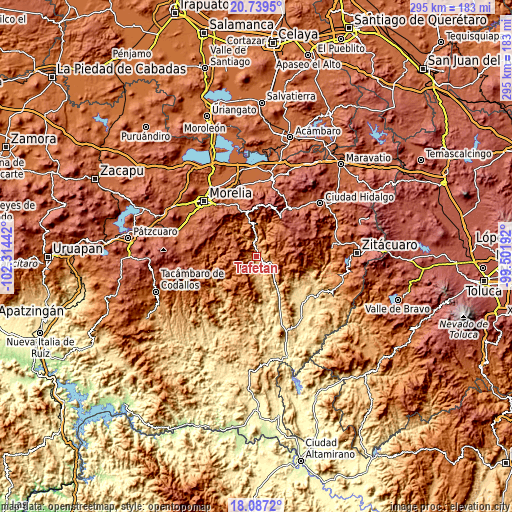
These maps also provides idea of topography and contour of this city, they are displayed at different zoom levels. More info about maps, scale and edge coordinates you can find below images.
| \ | Map #1 | Topo.Map |
| Scale [m] | 778..1835 m | × |
| Scale [ft] | 2552..6020 ft | × |
| Average | 1060.6 m = 3480 ft | × |
| Width | 9.22 km = 5.7 mi | 294.9 km = 183.2 mi |
| Height | 9.22 km = 5.7 mi | 294.9 km = 183.2 mi |
| ↑Max Latitude | 19.4602° | 20.7395° |
| Latitude at center | 19.41876° | 19.41876° |
| ↓Min Latitude | 19.377309° | 18.0872° |
| ← Min Longitude | -100.952115° | -102.31442° |
| Longitude center | -100.90817° | -100.90817° |
| →Max Longitude | -100.864225° | -99.50192° |
Nearby cities:
Cities around Tafetán sort by population:
• Jesús del Monte elevation 2154 m
36.4 km,  315°
315°
• Agostitlán 2535 m
33.1 km,  66°
66°
• Zurumbeneo 1985 m
33.1 km,  340°
340°
• Puerto de Buenavista (Lázaro Cárdenas) 2037 m
37.7 km, 322°
• San Antonio Villalongín 2189 m
20.8 km,  51°
51°
• Huajúmbaro 2297 m
34.1 km,  30°
30°
• Irapeo 1973 m
34.4 km,  332°
332°
• El Durazno 2134 m
37.9 km,  313°
313°
• Jaripeo 2062 m
34.5 km, 327°
• Etúcuaro 1579 m
32.2 km,  270°
270°
• Montaña Monarca (Punta Altozano) 2127 m
38.1 km, 314°
• Tzitzio 1543 m
18.7 km,  354°
354°
Multilingual:
 En español:
Tafetán elevación 928 m.
 En France:
Tafetán élévation 928 m.


Sources and notes:
- [note 1] Map square and city borders are not equal. Map elevation data is calculated only from area inside that square.
- [src 1] Elevation data from geonames database provided with same terms of usage.
- [src 2] The elevation map of Tafetán is generated using elevation data from NASA's 3 arcsec (90m) resolution SRTM data.
- [src 3] Base (background) map © OpenStreetMap contributors tiles are generated by Geofabrik and OpenTopoMap.
Copyright & License:
This Tafetán Elevation Map is licensed under CC BY-SA. You may reuse any part from this page, if you give a proper credit by linking to this URL:
 More info on terms of use page.