San Antonio Villalongín elevation
San Antonio Villalongín (Michoacán, Hidalgo), Mexico elevation is 2189 meters and San Antonio Villalongín elevation in feet is 7182 ft above sea level [src 1]. San Antonio Villalongín is a populated place (feature code) with elevation that is 875 meters (2871 ft) bigger than average city elevation in Mexico.
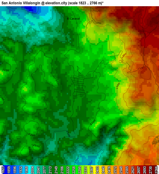
Below is the Elevation map of San Antonio Villalongín, which displays elevation range with different colors. Scale of the first map is from 1823 to 2766 m (5981 to 9075 ft) with average elevation of 2254.9 meters (=7398 ft) [note 1]
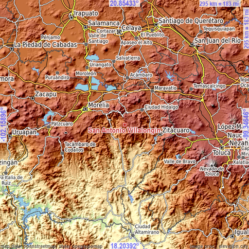
These maps also provides idea of topography and contour of this city, they are displayed at different zoom levels. More info about maps, scale and edge coordinates you can find below images.
| \ | Map #1 | Topo.Map |
| Scale [m] | 1823..2766 m | × |
| Scale [ft] | 5981..9075 ft | × |
| Average | 2254.9 m = 7398 ft | × |
| Width | 9.21 km = 5.7 mi | 294.7 km = 183.1 mi |
| Height | 9.21 km = 5.7 mi | 294.7 km = 183.1 mi |
| ↑Max Latitude | 19.575971° | 20.85433° |
| Latitude at center | 19.53456° | 19.53456° |
| ↓Min Latitude | 19.493139° | 18.20392° |
| ← Min Longitude | -100.796655° | -102.15896° |
| Longitude center | -100.75271° | -100.75271° |
| →Max Longitude | -100.708765° | -99.34646° |
Nearby cities:
Cities around San Antonio Villalongín sort by population:
• San Bartolo Cuitareo elevation 2158 m
20.5 km,  50°
50°
• Agostitlán 2535 m
14.1 km,  88°
88°
• Huajúmbaro 2297 m
16.5 km,  4°
4°
• San Pedro Jácuaro 2168 m
23 km,  29°
29°
• Tafetán 928 m
20.8 km,  231°
231°
• San Isidro Alta Huerta 2190 m
24.3 km, 29°
• Rincón de Cedeños (Rincón de Dolores) 2116 m
24.4 km, 49°
• Colonia Ecológica Asociación de Lucha Social (Lucha Social) 2103 m
22.8 km,  41°
41°
• San Lucas Huarirapeo (La Mesa de San Lucas) 2138 m
20.9 km, 40°
• Tierras Coloradas (San Pedro) 2186 m
23.3 km, 28°
• Tzitzio 1543 m
18.9 km,  287°
287°
• Colonia el Mirador (Llano del Ejido) 2067 m
26.1 km, 53°
Multilingual:
 En español:
San Antonio Villalongín elevación 2189 m.
 En France:
San Antonio Villalongín élévation 2189 m.
 Auf Deutsch:
San Antonio Villalongín höhe über dem Meeresspiegel ist 2189 m.
 На русском:
San Antonio Villalongín высота над уровнем моря 2189 м
Sources and notes:
- [note 1] Map square and city borders are not equal. Map elevation data is calculated only from area inside that square.
- [src 1] Elevation data from geonames database provided with same terms of usage.
- [src 2] The elevation map of San Antonio Villalongín is generated using elevation data from NASA's 3 arcsec (90m) resolution SRTM data.
- [src 3] Base (background) map © OpenStreetMap contributors tiles are generated by Geofabrik and OpenTopoMap.
Copyright & License:
This San Antonio Villalongín Elevation Map is licensed under CC BY-SA. You may reuse any part from this page, if you give a proper credit by linking to this URL:
 More info on terms of use page.