Tecolotlán elevation
Tecolotlán (Jalisco), Mexico elevation is 1207 meters and Tecolotlán elevation in feet is 3960 ft above sea level [src 1]. Tecolotlán is a seat of a second-order administrative division (feature code) with elevation that is 107 meters (351 ft) smaller than average city elevation in Mexico.
Below is the Elevation map of Tecolotlán, which displays elevation range with different colors. Scale of the first map is from 1129 to 1676 m (3704 to 5499 ft) with average elevation of 1235.8 meters (=4054 ft) [note 1]
These maps also provides idea of topography and contour of this city, they are displayed at different zoom levels. More info about maps, scale and edge coordinates you can find below images.
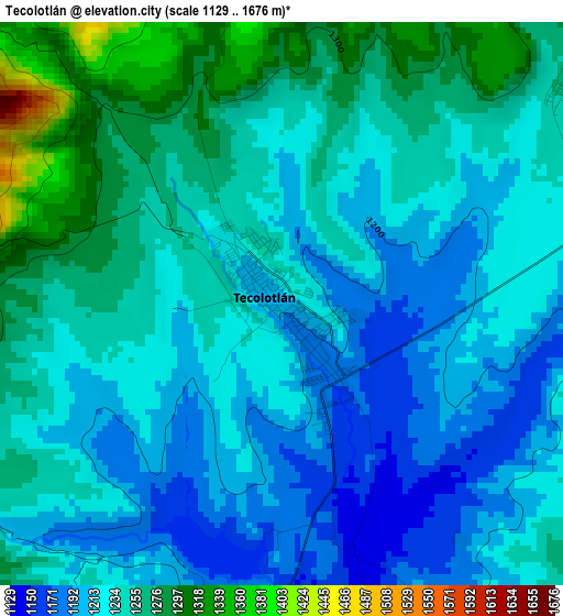
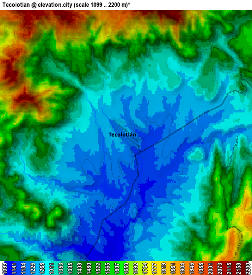
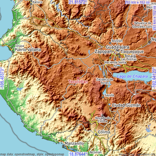
| \ | Map #1 | Map #2 | Topo.Map |
| Scale [m] | 1129..1676 m | 1099..2200 m | × |
| Scale [ft] | 3704..5499 ft | 3606..7218 ft | × |
| Average | 1235.8 m = 4054 ft | 1413.7 m = 4638 ft | × |
| Width | 9.17 km = 5.7 mi | 18.34 km = 11.4 mi | 293.5 km = 182.4 mi |
| Height | 9.17 km = 5.7 mi | 18.34 km = 11.4 mi | 293.5 km = 182.4 mi |
| ↑Max Latitude | 20.242906° | 20.284132° | 21.51572° |
| Latitude at center | 20.20167° | 20.20167° | 20.20167° |
| ↓Min Latitude | 20.160423° | 20.119164° | 18.87644° |
| ← Min Longitude | -104.091425° | -104.135371° | -105.45373° |
| Longitude center | -104.04748° | -104.04748° | -104.04748° |
| →Max Longitude | -104.003535° | -103.959589° | -102.64123° |
Nearby cities:
Cities around Tecolotlán sort by population:
• San Martín Hidalgo elevation 1308 m
28.8 km,  25°
25°
• Tenamaxtlán 1476 m
12.3 km,  278°
278°
• Chiquilistlán 1730 m
23.2 km,  123°
123°
• Chiquilistlán 1665 m
24.1 km,  90°
90°
• Juchitlán 1250 m
14 km,  202°
202°
• El Crucero de Santa María 1320 m
28 km,  43°
43°
• Soyatlán del Oro 1599 m
26.7 km,  294°
294°
• Atengo 1410 m
21.4 km, 292°
• Santa Cruz de las Flores 1363 m
23.8 km, 25°
• Tamazulita 1221 m
8.2 km, 87°
• Ayotitlán 1273 m
11 km,  79°
79°
• San Clemente 1341 m
25 km,  238°
238°
Multilingual:
 En español:
Tecolotlán elevación 1207 m.
 En France:
Tecolotlán élévation 1207 m.
 Auf Deutsch:
Tecolotlán höhe über dem Meeresspiegel ist 1207 m.

Sources and notes:
- [note 1] Map square and city borders are not equal. Map elevation data is calculated only from area inside that square.
- [src 1] Elevation data from geonames database provided with same terms of usage.
- [src 2] The elevation map of Tecolotlán is generated using elevation data from NASA's 3 arcsec (90m) resolution SRTM data.
- [src 3] Base (background) map © OpenStreetMap contributors tiles are generated by Geofabrik and OpenTopoMap.
Copyright & License:
This Tecolotlán Elevation Map is licensed under CC BY-SA. You may reuse any part from this page, if you give a proper credit by linking to this URL:
 More info on terms of use page.