Villa Morelos elevation
Villa Morelos (State of Mexico), Mexico elevation is 2290 meters and Villa Morelos elevation in feet is 7513 ft above sea level [src 1]. Villa Morelos is a populated place (feature code) with elevation that is 976 meters (3202 ft) bigger than average city elevation in Mexico.
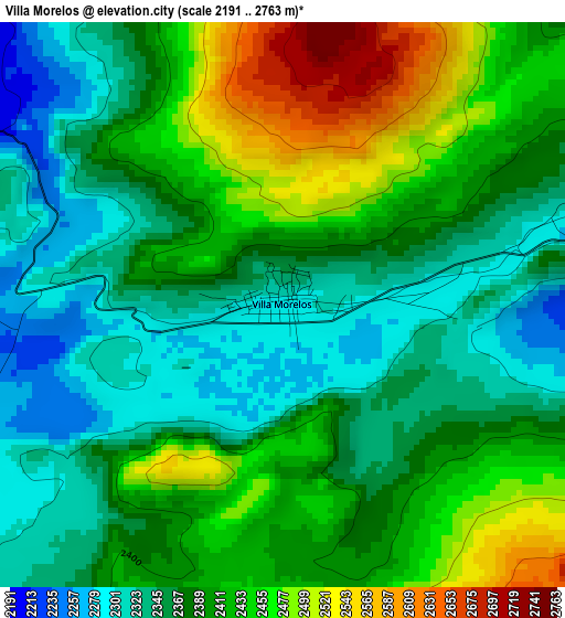
Below is the Elevation map of Villa Morelos, which displays elevation range with different colors. Scale of the first map is from 2191 to 2763 m (7188 to 9065 ft) with average elevation of 2393 meters (=7851 ft) [note 1]
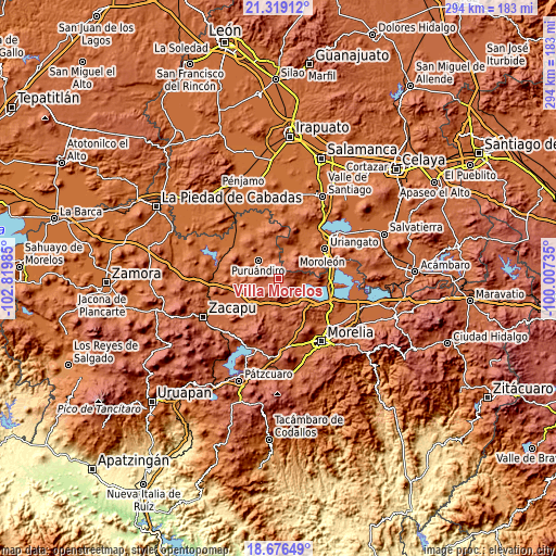
These maps also provides idea of topography and contour of this city, they are displayed at different zoom levels. More info about maps, scale and edge coordinates you can find below images.
| \ | Map #1 | Topo.Map |
| Scale [m] | 2191..2763 m | × |
| Scale [ft] | 7188..9065 ft | × |
| Average | 2393 m = 7851 ft | × |
| Width | 9.18 km = 5.7 mi | 293.8 km = 182.6 mi |
| Height | 9.18 km = 5.7 mi | 293.9 km = 182.6 mi |
| ↑Max Latitude | 20.044639° | 21.31912° |
| Latitude at center | 20.00335° | 20.00335° |
| ↓Min Latitude | 19.96205° | 18.67649° |
| ← Min Longitude | -101.457545° | -102.81985° |
| Longitude center | -101.4136° | -101.4136° |
| →Max Longitude | -101.369655° | -100.00735° |
Nearby cities:
Cities around Villa Morelos sort by population:
• Puruándiro elevation 1891 m
14.3 km,  311°
311°
• Huandacareo 1855 m
14.4 km,  95°
95°
• Cerano 1882 m
12 km,  13°
13°
• Galeana 1939 m
16.9 km,  282°
282°
• Huaniqueo de Morales 2049 m
15.2 km,  218°
218°
• Capacho 1847 m
19.5 km, 102°
• La Calera 1871 m
18.8 km,  24°
24°
• Chucándiro 1861 m
14.2 km,  144°
144°
• San José Cuaro 1861 m
17 km, 95°
• El Moral 1830 m
19.2 km,  42°
42°
• El Canario 1874 m
18.9 km,  25°
25°
• Piñícuaro 2109 m
18.7 km,  74°
74°
Multilingual:
 En español:
Villa Morelos elevación 2290 m.
 En France:
Villa Morelos élévation 2290 m.
 Auf Deutsch:
Villa Morelos höhe über dem Meeresspiegel ist 2290 m.

Sources and notes:
- [note 1] Map square and city borders are not equal. Map elevation data is calculated only from area inside that square.
- [src 1] Elevation data from geonames database provided with same terms of usage.
- [src 2] The elevation map of Villa Morelos is generated using elevation data from NASA's 3 arcsec (90m) resolution SRTM data.
- [src 3] Base (background) map © OpenStreetMap contributors tiles are generated by Geofabrik and OpenTopoMap.
Copyright & License:
This Villa Morelos Elevation Map is licensed under CC BY-SA. You may reuse any part from this page, if you give a proper credit by linking to this URL:
 More info on terms of use page.