Cerano elevation
Cerano (Guanajuato, Yuriria), Mexico elevation is 1882 meters and Cerano elevation in feet is 6175 ft above sea level [src 1]. Cerano is a populated place (feature code) with elevation that is 568 meters (1864 ft) bigger than average city elevation in Mexico.
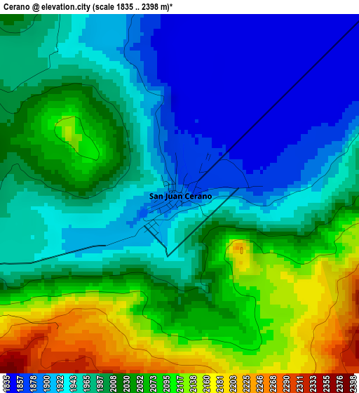
Below is the Elevation map of Cerano, which displays elevation range with different colors. Scale of the first map is from 1835 to 2398 m (6020 to 7867 ft) with average elevation of 1999.4 meters (=6560 ft) [note 1]
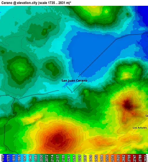
These maps also provides idea of topography and contour of this city, they are displayed at different zoom levels. More info about maps, scale and edge coordinates you can find below images.
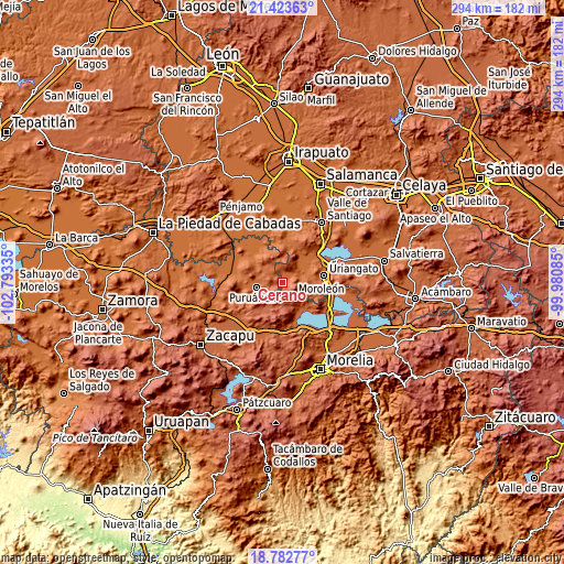
| \ | Map #1 | Map #2 | Topo.Map |
| Scale [m] | 1835..2398 m | 1735..2831 m | × |
| Scale [ft] | 6020..7867 ft | 5692..9288 ft | × |
| Average | 1999.4 m = 6560 ft | 2122.3 m = 6963 ft | × |
| Width | 9.18 km = 5.7 mi | 18.35 km = 11.4 mi | 293.6 km = 182.4 mi |
| Height | 9.18 km = 5.7 mi | 18.35 km = 11.4 mi | 293.7 km = 182.5 mi |
| ↑Max Latitude | 20.150031° | 20.191281° | 21.42363° |
| Latitude at center | 20.10877° | 20.10877° | 20.10877° |
| ↓Min Latitude | 20.067498° | 20.026215° | 18.78277° |
| ← Min Longitude | -101.431045° | -101.474991° | -102.79335° |
| Longitude center | -101.3871° | -101.3871° | -101.3871° |
| →Max Longitude | -101.343155° | -101.299209° | -99.98085° |
Nearby cities:
Cities around Cerano sort by population:
• Puruándiro elevation 1891 m
13.6 km,  260°
260°
• Huandacareo 1855 m
17.5 km,  138°
138°
• Santa Clara 1998 m
9.2 km,  328°
328°
• Villa Morelos 2290 m
12 km,  193°
193°
• La Calera 1871 m
7.4 km,  43°
43°
• Tejocote de Calera 1985 m
7.9 km,  352°
352°
• El Moral 1830 m
10.6 km,  76°
76°
• Las Letras 2132 m
14.4 km,  340°
340°
• El Canario 1874 m
7.6 km,  45°
45°
• El Pilar 2269 m
14.9 km, 353°
• Las Ranas 2088 m
14.6 km,  319°
319°
• Piñícuaro 2109 m
16.7 km,  114°
114°
Multilingual:
 En español:
Cerano elevación 1882 m.
 En France:
Cerano élévation 1882 m.


Sources and notes:
- [note 1] Map square and city borders are not equal. Map elevation data is calculated only from area inside that square.
- [src 1] Elevation data from geonames database provided with same terms of usage.
- [src 2] The elevation map of Cerano is generated using elevation data from NASA's 3 arcsec (90m) resolution SRTM data.
- [src 3] Base (background) map © OpenStreetMap contributors tiles are generated by Geofabrik and OpenTopoMap.
Copyright & License:
This Cerano Elevation Map is licensed under CC BY-SA. You may reuse any part from this page, if you give a proper credit by linking to this URL:
 More info on terms of use page.