Zacualpan elevation
Zacualpan (Nayarit, Compostela), Mexico elevation is 29 meters and Zacualpan elevation in feet is 95 ft above sea level [src 1]. Zacualpan is a populated place (feature code) with elevation that is 1285 meters (4216 ft) smaller than average city elevation in Mexico.
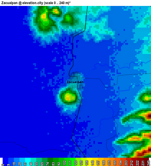
Below is the Elevation map of Zacualpan, which displays elevation range with different colors. Scale of the first map is from 0 to 240 m (0 to 787 ft) with average elevation of 23.4 meters (=77 ft) [note 1]
These maps also provides idea of topography and contour of this city, they are displayed at different zoom levels. More info about maps, scale and edge coordinates you can find below images.
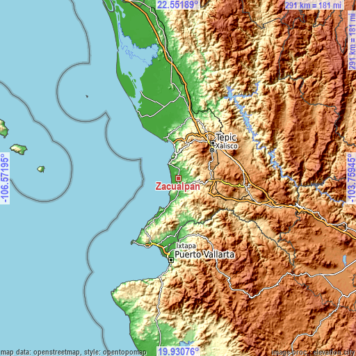
| \ | Map #1 | Map #2 | Topo.Map |
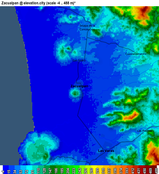
| Scale [m] | 0..240 m | -4..488 m | × |
| Scale [ft] | 0..787 ft | -13..1601 ft | × |
| Average | 23.4 m = 77 ft | 60.1 m = 197 ft | × |
| Width | 9.11 km = 5.7 mi | 18.22 km = 11.3 mi | 291.4 km = 181.1 mi |
| Height | 9.11 km = 5.7 mi | 18.22 km = 11.3 mi | 291.5 km = 181.1 mi |
| ↑Max Latitude | 21.288102° | 21.329044° | 22.55189° |
| Latitude at center | 21.24715° | 21.24715° | 21.24715° |
| ↓Min Latitude | 21.206186° | 21.165211° | 19.93076° |
| ← Min Longitude | -105.209645° | -105.253591° | -106.57195° |
| Longitude center | -105.1657° | -105.1657° | -105.1657° |
| →Max Longitude | -105.121755° | -105.077809° | -103.75945° |
Nearby cities:
Cities around Zacualpan sort by population:
• Compostela elevation 855 m
27.5 km,  92°
92°
• Las Varas 27 m
8.1 km,  157°
157°
• La Peñita de Jaltomba 8 m
24.7 km,  200°
200°
• Jalcocotán 437 m
26.9 km,  14°
14°
• Colonia Paraíso Escondido 8 m
22.8 km, 199°
• Rincón de Guayabitos 9 m
27.2 km, 203°
• Monteón 15 m
31.7 km,  206°
206°
• Emiliano Zapata 1062 m
29.3 km,  63°
63°
• Ixtapan de la Concepción 46 m
6.8 km, 6°
• Aticama 13 m
26.5 km,  352°
352°
• El Llano 50 m
19.1 km,  355°
355°
• La Palma 47 m
27.2 km, 357°
Multilingual:
 En español:
Zacualpan elevación 29 m.
 En France:
Zacualpan élévation 29 m.
 Auf Deutsch:
Zacualpan höhe über dem Meeresspiegel ist 29 m.

Sources and notes:
- [note 1] Map square and city borders are not equal. Map elevation data is calculated only from area inside that square.
- [src 1] Elevation data from geonames database provided with same terms of usage.
- [src 2] The elevation map of Zacualpan is generated using elevation data from NASA's 3 arcsec (90m) resolution SRTM data.
- [src 3] Base (background) map © OpenStreetMap contributors tiles are generated by Geofabrik and OpenTopoMap.
Copyright & License:
This Zacualpan Elevation Map is licensed under CC BY-SA. You may reuse any part from this page, if you give a proper credit by linking to this URL:
 More info on terms of use page.