Compostela elevation
Compostela (Nayarit), Mexico elevation is 855 meters and Compostela elevation in feet is 2805 ft above sea level [src 1]. Compostela is a seat of a second-order administrative division (feature code) with elevation that is 459 meters (1506 ft) smaller than average city elevation in Mexico.
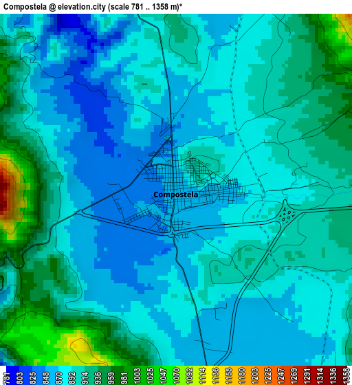
Below is the Elevation map of Compostela, which displays elevation range with different colors. Scale of the first map is from 781 to 1358 m (2562 to 4455 ft) with average elevation of 896.8 meters (=2942 ft) [note 1]
These maps also provides idea of topography and contour of this city, they are displayed at different zoom levels. More info about maps, scale and edge coordinates you can find below images.
| \ | Map #1 | Map #2 | Topo.Map |
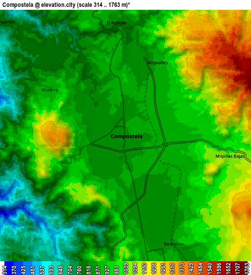
| Scale [m] | 781..1358 m | 314..1763 m | × |
| Scale [ft] | 2562..4455 ft | 1030..5784 ft | × |
| Average | 896.8 m = 2942 ft | 933.5 m = 3063 ft | × |
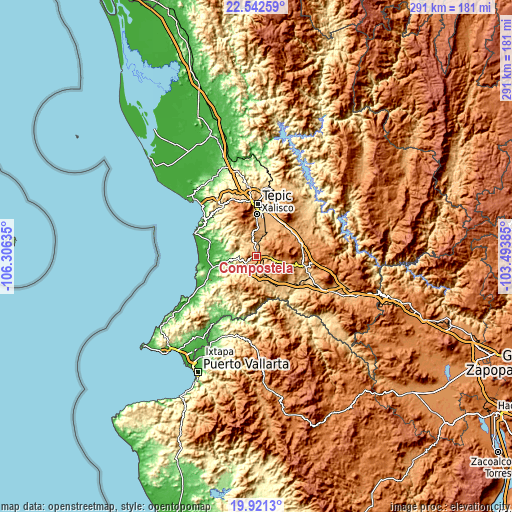
| Width | 9.11 km = 5.7 mi | 18.22 km = 11.3 mi | 291.5 km = 181.1 mi |
| Height | 9.11 km = 5.7 mi | 18.22 km = 11.3 mi | 291.5 km = 181.1 mi |
| ↑Max Latitude | 21.278725° | 21.319669° | 22.54259° |
| Latitude at center | 21.23777° | 21.23777° | 21.23777° |
| ↓Min Latitude | 21.196804° | 21.155826° | 19.9213° |
| ← Min Longitude | -104.944045° | -104.987991° | -106.30635° |
| Longitude center | -104.9001° | -104.9001° | -104.9001° |
| →Max Longitude | -104.856155° | -104.812209° | -103.49385° |
Nearby cities:
Cities around Compostela sort by population:
• Xalisco elevation 997 m
23.7 km,  0°
0°
• San Cayetano 948 m
25.1 km,  20°
20°
• San Pedro Lagunillas 1293 m
15.5 km,  97°
97°
• Pantanal 952 m
21.6 km,  10°
10°
• La Labor 1058 m
24 km,  51°
51°
• Testerazo 1029 m
18.3 km, 1°
• Emiliano Zapata 1062 m
14.2 km,  354°
354°
• Felipe Carrillo Puerto 855 m
12.5 km,  160°
160°
• Zapotán 815 m
17 km,  166°
166°
• La Corregidora 959 m
24.7 km, 21°
• Aquiles Serdán 984 m
16.1 km, 4°
• Juan Escutia (Borbollón) 863 m
8.5 km, 156°
Multilingual:
 En español:
Compostela elevación 855 m.
 En France:
Compostela élévation 855 m.
 Auf Deutsch:
Compostela höhe über dem Meeresspiegel ist 855 m.

Sources and notes:
- [note 1] Map square and city borders are not equal. Map elevation data is calculated only from area inside that square.
- [src 1] Elevation data from geonames database provided with same terms of usage.
- [src 2] The elevation map of Compostela is generated using elevation data from NASA's 3 arcsec (90m) resolution SRTM data.
- [src 3] Base (background) map © OpenStreetMap contributors tiles are generated by Geofabrik and OpenTopoMap.
Copyright & License:
This Compostela Elevation Map is licensed under CC BY-SA. You may reuse any part from this page, if you give a proper credit by linking to this URL:
 More info on terms of use page.