Concepción elevation
Concepción (Chiapas, Ixtapa), Mexico elevation is 1284 meters and Concepción elevation in feet is 4213 ft above sea level [src 1]. Concepción is a populated place (feature code) with elevation that is 30 meters (98 ft) smaller than average city elevation in Mexico.
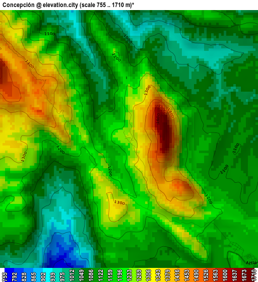
Below is the Elevation map of Concepción, which displays elevation range with different colors. Scale of the first map is from 755 to 1710 m (2477 to 5610 ft) with average elevation of 1160.6 meters (=3808 ft) [note 1]
These maps also provides idea of topography and contour of this city, they are displayed at different zoom levels. More info about maps, scale and edge coordinates you can find below images.
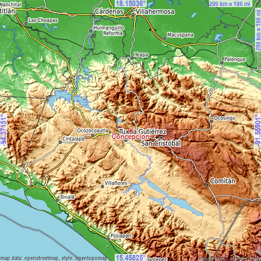
| \ | Map #1 | Topo.Map |
| Scale [m] | 755..1710 m | × |
| Scale [ft] | 2477..5610 ft | × |
| Average | 1160.6 m = 3808 ft | × |
| Width | 9.35 km = 5.8 mi | 299.3 km = 186 mi |
| Height | 9.35 km = 5.8 mi | 299.4 km = 186 mi |
| ↑Max Latitude | 16.851143° | 18.15036° |
| Latitude at center | 16.80908° | 16.80908° |
| ↓Min Latitude | 16.767008° | 15.45825° |
| ← Min Longitude | -93.009205° | -94.37151° |
| Longitude center | -92.96526° | -92.96526° |
| →Max Longitude | -92.921315° | -91.55901° |
Nearby cities:
Cities around Concepción sort by population:
• Chiapa de Corzo elevation 429 m
12.3 km,  203°
203°
• Ixtapa 1116 m
6.4 km,  95°
95°
• Soyaló 1172 m
10.1 km,  25°
25°
• Jardínes del Grijalva 414 m
11.6 km,  219°
219°
• Las Flechas 401 m
13.7 km,  208°
208°
• El Palmar (San Gabriel) 1348 m
6.8 km,  306°
306°
• Juan del Grijalva 509 m
9.1 km,  188°
188°
• Venustiano Carranza 1323 m
10.6 km,  336°
336°
• Cacaté 1476 m
14.5 km,  73°
73°
• Aztlán 1143 m
6.3 km,  134°
134°
• El Zapotillo 1012 m
3.4 km, 25°
• Nuevo Carmen Tonapac 550 m
12.5 km,  175°
175°
Multilingual:
 En español:
Concepción elevación 1284 m.
 En France:
Concepción élévation 1284 m.
 Auf Deutsch:
Concepción höhe über dem Meeresspiegel ist 1284 m.

Sources and notes:
- [note 1] Map square and city borders are not equal. Map elevation data is calculated only from area inside that square.
- [src 1] Elevation data from geonames database provided with same terms of usage.
- [src 2] The elevation map of Concepción is generated using elevation data from NASA's 3 arcsec (90m) resolution SRTM data.
- [src 3] Base (background) map © OpenStreetMap contributors tiles are generated by Geofabrik and OpenTopoMap.
Copyright & License:
This Concepción Elevation Map is licensed under CC BY-SA. You may reuse any part from this page, if you give a proper credit by linking to this URL:
 More info on terms of use page.