Perote elevation
Perote (Veracruz), Mexico elevation is 2416 meters and Perote elevation in feet is 7927 ft above sea level [src 1]. Perote is a seat of a second-order administrative division (feature code) with elevation that is 1102 meters (3615 ft) bigger than average city elevation in Mexico.
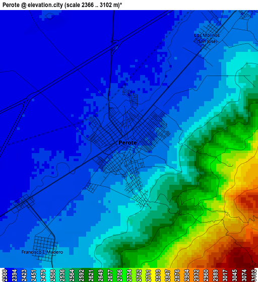
Below is the Elevation map of Perote, which displays elevation range with different colors. Scale of the first map is from 2366 to 3102 m (7762 to 10177 ft) with average elevation of 2491.4 meters (=8174 ft) [note 1]
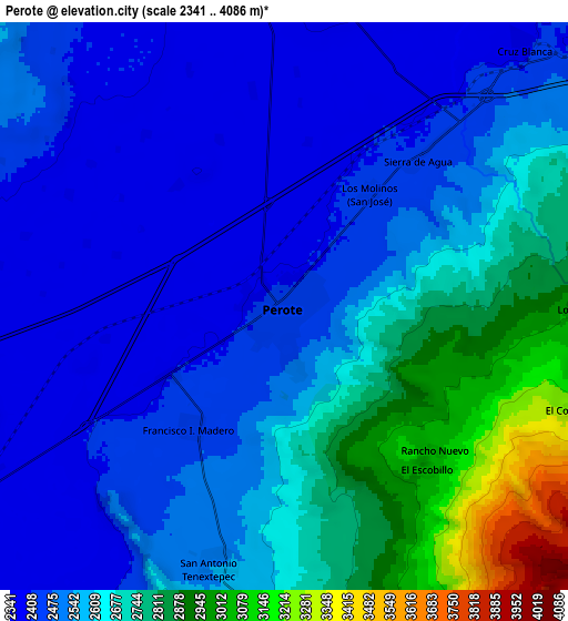
These maps also provides idea of topography and contour of this city, they are displayed at different zoom levels. More info about maps, scale and edge coordinates you can find below images.
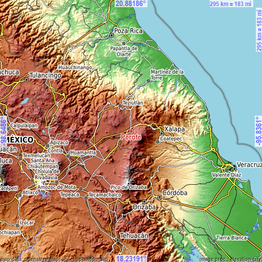
| \ | Map #1 | Map #2 | Topo.Map |
| Scale [m] | 2366..3102 m | 2341..4086 m | × |
| Scale [ft] | 7762..10177 ft | 7680..13406 ft | × |
| Average | 2491.4 m = 8174 ft | 2591.3 m = 8502 ft | × |
| Width | 9.21 km = 5.7 mi | 18.42 km = 11.4 mi | 294.6 km = 183.1 mi |
| Height | 9.21 km = 5.7 mi | 18.42 km = 11.4 mi | 294.7 km = 183.1 mi |
| ↑Max Latitude | 19.603733° | 19.645126° | 20.88186° |
| Latitude at center | 19.56233° | 19.56233° | 19.56233° |
| ↓Min Latitude | 19.520916° | 19.479491° | 18.23191° |
| ← Min Longitude | -97.286295° | -97.330241° | -98.6486° |
| Longitude center | -97.24235° | -97.24235° | -97.24235° |
| →Max Longitude | -97.198405° | -97.154459° | -95.8361° |
Nearby cities:
Cities around Perote sort by population:
• Villa Aldama elevation 2409 m
9.8 km,  11°
11°
• Los Molinos 2428 m
4.7 km,  37°
37°
• Orilla del Monte 2402 m
12.2 km,  334°
334°
• Centro de Readaptación Social 2378 m
7.3 km,  18°
18°
• Francisco I. Madero 2446 m
4.9 km,  217°
217°
• Sierra de Agua 2419 m
6.5 km, 42°
• Cruz Blanca 2394 m
11.5 km, 43°
• Los Pescados 2988 m
9.8 km,  90°
90°
• Tlalconteno 2724 m
12.6 km,  181°
181°
• El Escobillo 3046 m
7.1 km,  138°
138°
• El Conejo 3257 m
9.9 km,  110°
110°
• Guadalupe Victoria 2406 m
4.4 km,  238°
238°
Multilingual:
 En español:
Perote elevación 2416 m.
 En France:
Perote élévation 2416 m.


Sources and notes:
- [note 1] Map square and city borders are not equal. Map elevation data is calculated only from area inside that square.
- [src 1] Elevation data from geonames database provided with same terms of usage.
- [src 2] The elevation map of Perote is generated using elevation data from NASA's 3 arcsec (90m) resolution SRTM data.
- [src 3] Base (background) map © OpenStreetMap contributors tiles are generated by Geofabrik and OpenTopoMap.
Copyright & License:
This Perote Elevation Map is licensed under CC BY-SA. You may reuse any part from this page, if you give a proper credit by linking to this URL:
 More info on terms of use page.