San Miguel Oxtotilpan elevation
San Miguel Oxtotilpan (State of Mexico, Temascaltepec), Mexico elevation is 2743 meters and San Miguel Oxtotilpan elevation in feet is 8999 ft above sea level [src 1]. San Miguel Oxtotilpan is a populated place (feature code) with elevation that is 1429 meters (4688 ft) bigger than average city elevation in Mexico.
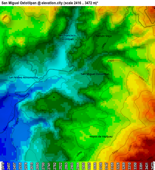
Below is the Elevation map of San Miguel Oxtotilpan, which displays elevation range with different colors. Scale of the first map is from 2416 to 3472 m (7927 to 11391 ft) with average elevation of 2840.8 meters (=9320 ft) [note 1]
These maps also provides idea of topography and contour of this city, they are displayed at different zoom levels. More info about maps, scale and edge coordinates you can find below images.
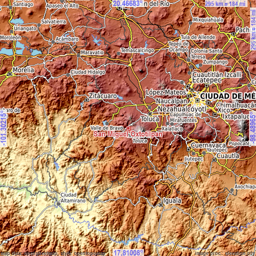
| \ | Map #1 | Topo.Map |
| Scale [m] | 2416..3472 m | × |
| Scale [ft] | 7927..11391 ft | × |
| Average | 2840.8 m = 9320 ft | × |
| Width | 9.23 km = 5.7 mi | 295.4 km = 183.6 mi |
| Height | 9.23 km = 5.7 mi | 295.4 km = 183.6 mi |
| ↑Max Latitude | 19.18531° | 20.46683° |
| Latitude at center | 19.1438° | 19.1438° |
| ↓Min Latitude | 19.10228° | 17.81008° |
| ← Min Longitude | -99.939845° | -101.30215° |
| Longitude center | -99.8959° | -99.8959° |
| →Max Longitude | -99.851955° | -98.48965° |
Nearby cities:
Cities around San Miguel Oxtotilpan sort by population:
• El Cóporo elevation 2995 m
16.7 km,  22°
22°
• Cerro La Calera 3387 m
9.4 km,  62°
62°
• Ojo de Agua 3020 m
15.4 km, 58°
• El Contadero de Matamoros 3049 m
13.8 km,  40°
40°
• San Pedro Tejalpa 2869 m
16.7 km, 40°
• San Mateo Almomoloha 2598 m
4.1 km,  273°
273°
• Colonia Cuauhtémoc 2891 m
15.8 km, 40°
• San Lucas del Pulque 2169 m
14.7 km,  251°
251°
• Los Saucos 2549 m
11.1 km,  282°
282°
• San Francisco Oxtotilpan 2642 m
2.9 km,  345°
345°
• San Andrés de los Gama 2090 m
14.4 km,  214°
214°
• San Martín Tequesquipan (Tequesquipan) 2352 m
10.9 km, 209°
Multilingual:
 En español:
San Miguel Oxtotilpan elevación 2743 m.
 En France:
San Miguel Oxtotilpan élévation 2743 m.
 Auf Deutsch:
San Miguel Oxtotilpan höhe über dem Meeresspiegel ist 2743 m.
 На русском:
San Miguel Oxtotilpan высота над уровнем моря 2743 м
Sources and notes:
- [note 1] Map square and city borders are not equal. Map elevation data is calculated only from area inside that square.
- [src 1] Elevation data from geonames database provided with same terms of usage.
- [src 2] The elevation map of San Miguel Oxtotilpan is generated using elevation data from NASA's 3 arcsec (90m) resolution SRTM data.
- [src 3] Base (background) map © OpenStreetMap contributors tiles are generated by Geofabrik and OpenTopoMap.
Copyright & License:
This San Miguel Oxtotilpan Elevation Map is licensed under CC BY-SA. You may reuse any part from this page, if you give a proper credit by linking to this URL:
 More info on terms of use page.