El Cóporo elevation
El Cóporo (State of Mexico, Zinacantepec), Mexico elevation is 2995 meters and El Cóporo elevation in feet is 9826 ft above sea level [src 1]. El Cóporo is a populated place (feature code) with elevation that is 1681 meters (5515 ft) bigger than average city elevation in Mexico.
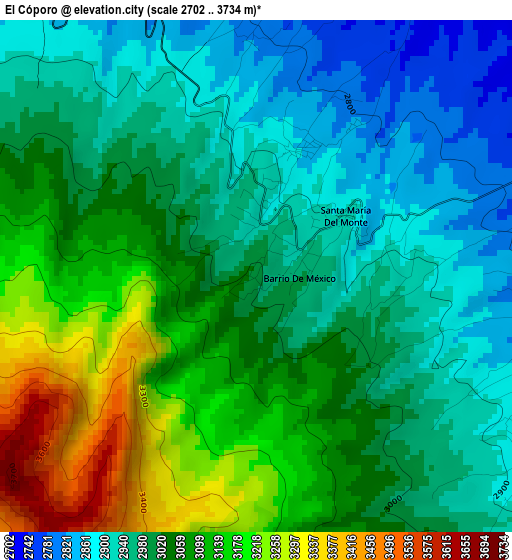
Below is the Elevation map of El Cóporo, which displays elevation range with different colors. Scale of the first map is from 2702 to 3734 m (8865 to 12251 ft) with average elevation of 3030.5 meters (=9943 ft) [note 1]
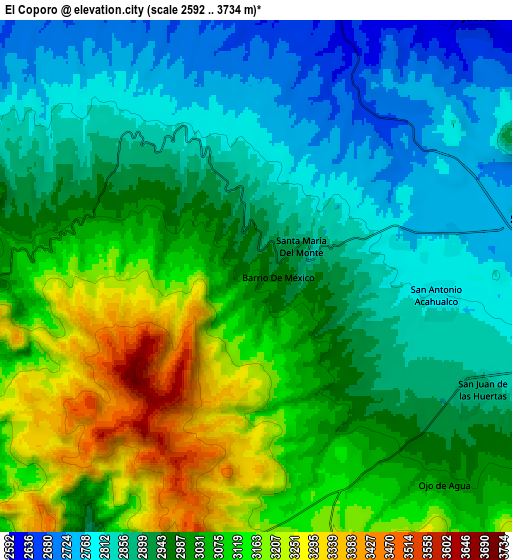
These maps also provides idea of topography and contour of this city, they are displayed at different zoom levels. More info about maps, scale and edge coordinates you can find below images.
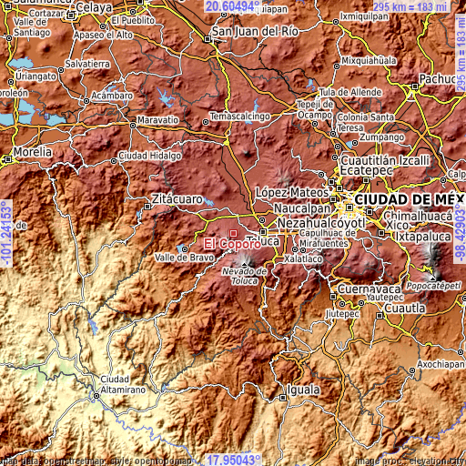
| \ | Map #1 | Map #2 | Topo.Map |
| Scale [m] | 2702..3734 m | 2592..3734 m | × |
| Scale [ft] | 8865..12251 ft | 8504..12251 ft | × |
| Average | 3030.5 m = 9943 ft | 2980.4 m = 9778 ft | × |
| Width | 9.22 km = 5.7 mi | 18.45 km = 11.5 mi | 295.2 km = 183.4 mi |
| Height | 9.22 km = 5.7 mi | 18.45 km = 11.5 mi | 295.2 km = 183.4 mi |
| ↑Max Latitude | 19.324535° | 19.365999° | 20.60494° |
| Latitude at center | 19.28306° | 19.28306° | 19.28306° |
| ↓Min Latitude | 19.241575° | 19.200079° | 17.95043° |
| ← Min Longitude | -99.879225° | -99.923171° | -101.24153° |
| Longitude center | -99.83528° | -99.83528° | -99.83528° |
| →Max Longitude | -99.791335° | -99.747389° | -98.42903° |
Nearby cities:
Cities around El Cóporo sort by population:
• Barrio de México elevation 2979 m
0.7 km,  94°
94°
• Santa María del Monte 2930 m
1.4 km,  58°
58°
• San Bartolo el Viejo 2890 m
2.1 km,  34°
34°
• San Bartolo del Llano (San Isidro) 2858 m
2.6 km,  18°
18°
• El Curtidor 2903 m
1 km,  1°
1°
• El Contadero de Matamoros 3049 m
5.7 km,  152°
152°
• San Pedro Tejalpa 2869 m
5.3 km,  121°
121°
• Colonia Cuauhtémoc 2891 m
5.3 km,  131°
131°
• Cañada de Guadarrama 2727 m
5.8 km, 55°
• Colonia Bellavista 2826 m
3.3 km, 58°
• Loma de San Francisco 2927 m
2.7 km, 89°
• San Nicolás Amealco 2851 m
6.1 km,  321°
321°
Multilingual:
 En español:
El Cóporo elevación 2995 m.
 En France:
El Cóporo élévation 2995 m.
 Auf Deutsch:
El Cóporo höhe über dem Meeresspiegel ist 2995 m.

Sources and notes:
- [note 1] Map square and city borders are not equal. Map elevation data is calculated only from area inside that square.
- [src 1] Elevation data from geonames database provided with same terms of usage.
- [src 2] The elevation map of El Cóporo is generated using elevation data from NASA's 3 arcsec (90m) resolution SRTM data.
- [src 3] Base (background) map © OpenStreetMap contributors tiles are generated by Geofabrik and OpenTopoMap.
Copyright & License:
This El Cóporo Elevation Map is licensed under CC BY-SA. You may reuse any part from this page, if you give a proper credit by linking to this URL:
 More info on terms of use page.