Mizunami elevation
Mizunami (Gifu, Mizunami-shi), Japan elevation is 157 meters and Mizunami elevation in feet is 515 ft above sea level [src 1]. Mizunami is a seat of a second-order administrative division (feature code) with elevation that is 72 meters (236 ft) bigger than average city elevation in Japan.
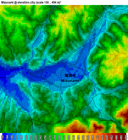
Below is the Elevation map of Mizunami, which displays elevation range with different colors. Scale of the first map is from 130 to 494 m (427 to 1621 ft) with average elevation of 245.2 meters (=804 ft) [note 1]
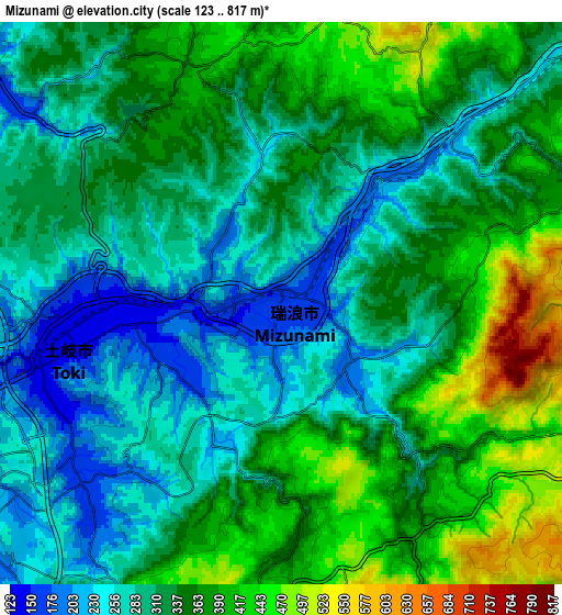
These maps also provides idea of topography and contour of this city, they are displayed at different zoom levels. More info about maps, scale and edge coordinates you can find below images.
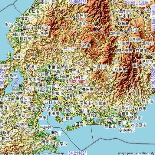
| \ | Map #1 | Map #2 | Topo.Map |
| Scale [m] | 130..494 m | 123..817 m | × |
| Scale [ft] | 427..1621 ft | 404..2680 ft | × |
| Average | 245.2 m = 804 ft | 329.7 m = 1082 ft | × |
| Width | 7.97 km = 5 mi | 15.94 km = 9.9 mi | 255 km = 158.4 mi |
| Height | 7.97 km = 5 mi | 15.94 km = 9.9 mi | 255 km = 158.4 mi |
| ↑Max Latitude | 35.402498° | 35.43831° | 36.50523° |
| Latitude at center | 35.36667° | 35.36667° | 35.36667° |
| ↓Min Latitude | 35.330826° | 35.294966° | 34.21182° |
| ← Min Longitude | 137.206055° | 137.162109° | 135.84375° |
| Longitude center | 137.25° | 137.25° | 137.25° |
| →Max Longitude | 137.293945° | 137.337891° | 138.65625° |
Nearby cities:
Cities around Mizunami sort by population:
• Kasugai elevation 30 m
28.5 km,  242°
242°
• Seto 111 m
20.1 km,  222°
222°
• Tajimi 138 m
12 km, 242°
• Inuyama 56 m
27.9 km,  273°
273°
• Toki 159 m
6.3 km,  252°
252°
• Nakatsugawa 338 m
26.1 km,  60°
60°
• Minokamo 175 m
24.3 km,  301°
301°
• Mitake 232 m
11.9 km, 297°
• Nisshin 45 m
31.2 km, 215°
• Nagakute 85 m
27.8 km, 219°
• Kani 123 m
18.1 km,  283°
283°
• Ena 358 m
15 km,  53°
53°
Multilingual:
 En español:
Mizunami elevación 157 m.
 En France:
Mizunami élévation 157 m.
 Auf Deutsch:
Mizunami höhe über dem Meeresspiegel ist 157 m.

Sources and notes:
- [note 1] Map square and city borders are not equal. Map elevation data is calculated only from area inside that square.
- [src 1] Elevation data from geonames database provided with same terms of usage.
- [src 2] The elevation map of Mizunami is generated using elevation data from NASA's 3 arcsec (90m) resolution SRTM data.
- [src 3] Base (background) map © OpenStreetMap contributors tiles are generated by Geofabrik and OpenTopoMap.
Copyright & License:
This Mizunami Elevation Map is licensed under CC BY-SA. You may reuse any part from this page, if you give a proper credit by linking to this URL:
 More info on terms of use page.