Seto elevation
Seto (Aichi, Seto-shi), Japan elevation is 111 meters and Seto elevation in feet is 364 ft above sea level [src 1]. Seto is a seat of a second-order administrative division (feature code) with elevation that is 26 meters (85 ft) bigger than average city elevation in Japan.
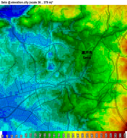
Below is the Elevation map of Seto, which displays elevation range with different colors. Scale of the first map is from 36 to 379 m (118 to 1243 ft) with average elevation of 148.3 meters (=487 ft) [note 1]
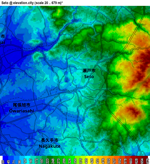
These maps also provides idea of topography and contour of this city, they are displayed at different zoom levels. More info about maps, scale and edge coordinates you can find below images.
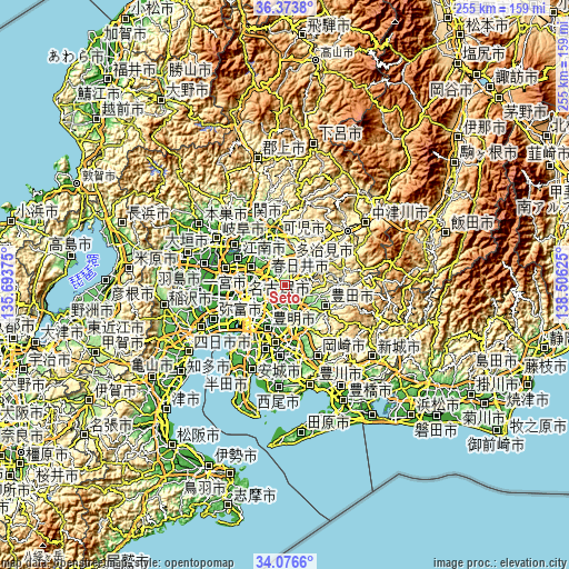
| \ | Map #1 | Map #2 | Topo.Map |
| Scale [m] | 36..379 m | 20..679 m | × |
| Scale [ft] | 118..1243 ft | 66..2228 ft | × |
| Average | 148.3 m = 487 ft | 185.8 m = 610 ft | × |
| Width | 7.98 km = 5 mi | 15.96 km = 9.9 mi | 255.4 km = 158.7 mi |
| Height | 7.98 km = 5 mi | 15.96 km = 9.9 mi | 255.4 km = 158.7 mi |
| ↑Max Latitude | 35.269217° | 35.305088° | 36.3738° |
| Latitude at center | 35.23333° | 35.23333° | 35.23333° |
| ↓Min Latitude | 35.197427° | 35.161508° | 34.0766° |
| ← Min Longitude | 137.056055° | 137.012109° | 135.69375° |
| Longitude center | 137.1° | 137.1° | 137.1° |
| →Max Longitude | 137.143945° | 137.187891° | 138.50625° |
Nearby cities:
Cities around Seto sort by population:
• Nagoya elevation 23 m
18.5 km,  251°
251°
• Toyota 55 m
17.3 km,  164°
164°
• Kasugai 30 m
11.7 km,  277°
277°
• Komaki 17 m
17.5 km,  288°
288°
• Tajimi 138 m
9.7 km,  18°
18°
• Toki 159 m
15 km,  30°
30°
• Mizunami 157 m
20.1 km,  42°
42°
• Kitanagoya 15 m
20.2 km,  274°
274°
• Kani 123 m
19.4 km,  348°
348°
• Miyoshi 59 m
16 km,  183°
183°
• Nisshin 45 m
11.6 km,  201°
201°
• Nagakute 85 m
7.8 km,  210°
210°
Multilingual:
 En español:
Seto elevación 111 m.
 En France:
Seto élévation 111 m.


Sources and notes:
- [note 1] Map square and city borders are not equal. Map elevation data is calculated only from area inside that square.
- [src 1] Elevation data from geonames database provided with same terms of usage.
- [src 2] The elevation map of Seto is generated using elevation data from NASA's 3 arcsec (90m) resolution SRTM data.
- [src 3] Base (background) map © OpenStreetMap contributors tiles are generated by Geofabrik and OpenTopoMap.
Copyright & License:
This Seto Elevation Map is licensed under CC BY-SA. You may reuse any part from this page, if you give a proper credit by linking to this URL:
 More info on terms of use page.